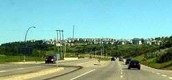
Sarcee Trail
Sarcee Trail is a major limited-access road in Calgary, Alberta. It is divided into two portions, one in the south end of the city, and one in the north end of the city.[2] Originally planned as one continuous route, plans to connect the two halves have been shelved as it would involve the demolition of homes in Bowness and the disruption of the Bowmont Natural Area park. The urban arterial road is named for the Tsuu T'ina, who were also known as the Sarcee.
| Location | Calgary, Alberta |
|---|---|
| ----
Southern section | |
| Length | 8.9 km (5.5 mi)[1] |
| South end | Glenmore Trail (Hwy 8) |
| Major junctions | Richmond Road 17 Avenue SW Bow Trail 16 Avenue NW (Hwy 1) |
| North end | 34 Avenue NW |
| ----
Northern section | |
| Length | 9.1 km (5.7 mi)[1] |
| South end | Crowchild Trail (Hwy 1A) |
| Major junctions | John Laurie Boulevard Country Hills Boulevard Stoney Trail (Hwy 201) |
| North end | 144 Avenue NW |
Southern section
| Neighborhoods | |
|---|---|
| Southern section | Northern section
|
The 8.9-kilometre-long (5.5 mi) southern half of Sarcee Trail acts as a major connector between Glenmore Trail to the south and 16 Avenue NW in the west end of the city, though the road continues north into the community of Bowness at 34 Avenue NW. Sarcee Trail is signed as bypass route which connects Highway 1 west and Highway 2 south. Sarcee Trail crosses the divide between the southwest and northwest quadrants of the city at 16 Avenue NW.
Early plans for the city's southwest ring road called for Sarcee Trail to continue south from Glenmore, connecting eventually with Alberta Highway 22X. Although the extension is still planned, with some construction having begun in 2016, it will now carry the name Tsuut'ina Trail. As part of the Tsuut'ina Trail project, the City of Calgary will be constructing an interchange at Richmond Road.[3]
Northern section
The 9.1-kilometre-long (5.7 mi) northern half of Sarcee Trail travels between the communities of Silver Springs in the south and Nolan Hill in the north. It starts at the intersection of Crowchild Trail and Silver Springs Gate. Heading northbound, Sarcee Trail continues along until it reaches 144 Avenue NW, acting as the divider between several communities along the way.
Silver Springs Gate, a short road leading into the Silver Springs community, was formerly part of Sarcee Trail until the mid-1990s when plans to extend the northern leg of Sarcee southward through the Bowmont Natural Area and Bowness community to connect with the south leg were abandoned. The renaming of this stretch of road was reported by local media as being intended to reassure residents that the extension plans would not be revived.
Major intersections
From south to north. The entire route is in Calgary.
| km[1] | mi | Destinations | Notes | ||||
|---|---|---|---|---|---|---|---|
| 0.0 | 0.0 | T-intersection; through traffic follows Glenmore Trail east. | |||||
| Future | Future Cloverstack interchange[4] | ||||||
| 0.9 | 0.56 | Richmond Road | Split intersection; interchange proposed[3] | ||||
| 1.4 | 0.87 | Signal Hill Centre | Southbound right-in/right-out | ||||
| 3.4 | 2.1 | 17 Avenue SW | Partial cloverleaf interchange | ||||
| 4.8 | 3.0 | Bow Trail – City Centre | |||||
| 7.9– 8.7 | 4.9– 5.4 | Bowdale Crescent / Trinity Hills | Hybrid diamond interchange | ||||
| Bowdale Crescent | Northbound right-in/right-out | ||||||
| Partial cloverleaf interchange | |||||||
| 8.9 | 5.5 | 34 Avenue NW | |||||
| Gap in Sarcee Trail | |||||||
| 11.1 | 6.9 | Silver Springs Boulevard / Silver Springs Drive | South end of Silver Springs Gate; former Sarcee Trail | ||||
| 12.4 | 7.7 | Partial cloverleaf interchange; north end of Silver Springs Gate | |||||
| 13.8 | 8.6 | John Laurie Boulevard | |||||
| 15.9 | 9.9 | Country Hills Boulevard | |||||
| 16.7 | 10.4 | Citadel Boulevard / Citadel Green | |||||
| 17.5 | 10.9 | Partial cloverleaf interchange (Hwy 201 Exit 46) | |||||
| 18.2 | 11.3 | Access road – Beacon Hill Centre | |||||
| 18.5 | 11.5 | 112 Avenue NW – Beacon Hill Centre | |||||
| 19.3 | 12.0 | Symons Valley Parkway | |||||
| 20.7 | 12.9 | Nolan Hill Avenue | |||||
| 21.5 | 13.4 | 144 Avenue NW | |||||
1.000 mi = 1.609 km; 1.000 km = 0.621 mi
| |||||||
See also
References
- Google (December 13, 2016). "Sarcee Trail in Calgary, Alberta" (Map). Google Maps. Google. Retrieved December 13, 2016.
- Sherlock Publishing (2014). Sherlock's Map of Calgary (Map) (16th ed.). Langdon, AB: Sherlock Publishing. pp. 3, 9, 16, 25, and 33. ISBN 1-895229-80-4.
- "Sarcee Trail / Richmond Road S.W. interchange functional planning study". Transportation Planning. City of Calgary. September 26, 2016. Retrieved March 26, 2018.
- "Glenmore Trail SW / Westhills Way SW / Sarcee Trail SW / 37 Street SW Interchanges" (PDF). Southwest Calgary Ring Road. Alberta Transportation. October 2015. Retrieved August 25, 2016.