Sandwich Township, DeKalb County, Illinois
Sandwich Township is one of nineteen townships in DeKalb County, Illinois, USA. As of the 2010 census, its population was 7,709 and it contained 3,005 housing units.[2] Sandwich Township was formed from a portion of Somonauk Township on July 14, 1896.
Sandwich Township | |
|---|---|
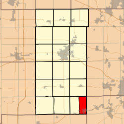 Location in DeKalb County | |
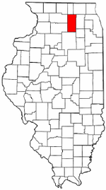 DeKalb County's location in Illinois | |
| Coordinates: 41°40′20″N 88°37′48″W | |
| Country | |
| State | |
| County | DeKalb |
| Established | July 14, 1896 |
| Area | |
| • Total | 15.39 sq mi (39.9 km2) |
| • Land | 15.33 sq mi (39.7 km2) |
| • Water | 0.06 sq mi (0.2 km2) 0.39% |
| Elevation | 692 ft (211 m) |
| Population (2010) | |
| • Total | 7,709 |
| • Estimate (2016)[1] | 7,645 |
| • Density | 502.9/sq mi (194.2/km2) |
| Time zone | UTC-6 (CST) |
| • Summer (DST) | UTC-5 (CDT) |
| ZIP codes | 60511, 60548, 60552 |
| FIPS code | 17-037-67561 |
Geography
According to the 2010 census, the township has a total area of 15.39 square miles (39.9 km2), of which 15.33 square miles (39.7 km2) (or 99.61%) is land and 0.06 square miles (0.16 km2) (or 0.39%) is water.[2]
Cities, towns, villages
- Sandwich (west three-quarters)
Cemeteries
- Oaklawn
- Saint Paul's Catholic
Airports and landing strips
- Gord Airport
- Hospital Heliport
- Sandwich Airport
- Woodlake Landing Airport
School districts
- Sandwich Community Unit School District 430
- Somonauk Community Unit School District 432
Political districts
- Illinois's 14th congressional district
- State House District 70
- State Senate District 35
References
- "Sandwich Township, DeKalb County, Illinois". Geographic Names Information System. United States Geological Survey. Retrieved 4 July 2010.
- US Census Bureau 2009 TIGER/Line Shapefiles
- US National Atlas
- "Population and Housing Unit Estimates". Retrieved June 9, 2017.
- "Population, Housing Units, Area, and Density: 2010 - County". US Census Bureau. Archived from the original on 12 February 2020. Retrieved 28 May 2013.
- "Census of Population and Housing". Census.gov. Retrieved June 4, 2016.
External links
Places adjacent to Sandwich Township, DeKalb County, Illinois | |
|---|---|
Municipalities and communities of DeKalb County, Illinois, United States | ||
|---|---|---|
| Cities | Map of Illinois highlighting DeKalb County | |
| Town | ||
| Villages | ||
| Townships | ||
| Unincorporated communities | ||
| Ghost towns | ||
| Footnotes | ‡This populated place also has portions in an adjacent county or counties | |
This article is issued from Wikipedia. The text is licensed under Creative Commons - Attribution - Sharealike. Additional terms may apply for the media files.