San Bellino
San Bellino is a comune (municipality) in the Province of Rovigo in the Italian region Veneto, located about 73 kilometres (45 mi) southwest of Venice and about 15 kilometres (9 mi) west of Rovigo.
San Bellino | |
|---|---|
| Comune di San Bellino | |
Location of San Bellino 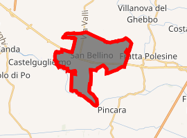
| |
 San Bellino Location of San Bellino in Italy 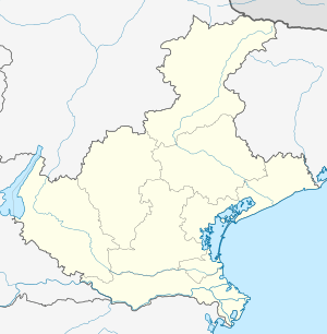 San Bellino San Bellino (Veneto) | |
| Coordinates: 45°2′N 11°35′E | |
| Country | Italy |
| Region | Veneto |
| Province | Province of Rovigo (RO) |
| Frazioni | Borgo di Mezzo, Borgo Due Spade, Borgo Vespara, Ca'moro-Dona, Ca'Peretto, Case Nuove, Passarara, Presciane, Treponti |
| Area | |
| • Total | 15.8 km2 (6.1 sq mi) |
| Elevation | 7 m (23 ft) |
| Population (Dec. 2006)[2] | |
| • Total | 1,340 |
| • Density | 85/km2 (220/sq mi) |
| Time zone | UTC+1 (CET) |
| • Summer (DST) | UTC+2 (CEST) |
| Postal code | 45020 |
| Dialing code | 04505 |
| Website | Official website |
Its Basilica di S. Bellino is a minor basilica by immemorial decree and its parish church in the Roman Catholic Diocese of Adria-Rovigo.
Shares with Castelguglielmo, to being the home of the second largest solar park in Italy: the 70 MWp San Bellino Photovoltaic Power Plant.
Geography
The municipality of San Bellino contains the frazioni (subdivisions, mainly villages and hamlets) Borgo di Mezzo, Borgo Due Spade, Borgo Vespara, Ca'moro-Dona, Ca'Peretto, Case Nuove, Passarara, Presciane and Treponti.
San Bellino borders the following municipalities: Castelguglielmo, Fratta Polesine, Lendinara and Pincara.
Statistics
As of 31 December 2004, it had a population of 1,198 and an area of 15.8 square kilometres (6.1 sq mi).[3]
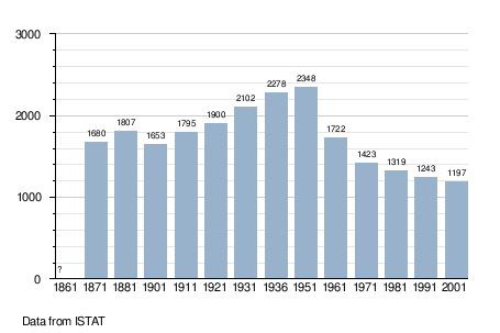
Demographic evolution
References
- "Superficie di Comuni Province e Regioni italiane al 9 ottobre 2011". Istat. Retrieved 16 March 2019.
- "Popolazione Residente al 1° Gennaio 2018". Istat. Retrieved 16 March 2019.
- All demographics and other statistics: Italian statistical institute Istat.