Sale City, Georgia
Sale City is a town in Mitchell County, Georgia, United States. The population was 380 at the 2010 census.
Sale City, Georgia | |
|---|---|
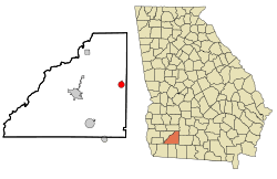 Location in Mitchell County and the state of Georgia | |
| Coordinates: 31°15′47″N 84°1′20″W | |
| Country | United States |
| State | Georgia |
| County | Mitchell |
| Area | |
| • Total | 1.84 sq mi (4.75 km2) |
| • Land | 1.83 sq mi (4.75 km2) |
| • Water | 0.00 sq mi (0.00 km2) |
| Elevation | 358 ft (109 m) |
| Population (2010) | |
| • Total | 380 |
| • Estimate (2018)[2] | 346 |
| • Density | 188.66/sq mi (72.85/km2) |
| Time zone | UTC-5 (Eastern (EST)) |
| • Summer (DST) | UTC-4 (EDT) |
| ZIP code | 31784 |
| Area code(s) | 229 |
| FIPS code | 13-68096[3] |
| GNIS feature ID | 0322327[4] |
History
A post office called Sale City was established in 1904.[5] The community was named after founder T.D. Sale.[6] The Georgia General Assembly incorporated Sale City as a town in 1910.[7]
Geography
Sale City is located at 31°15′47″N 84°1′20″W (31.262970, -84.022182).[8]
According to the United States Census Bureau, the town has a total area of 1.8 square miles (4.7 km2), of which 1.8 square miles (4.7 km2) is land and 0.54% is water.
Demographics
| Historical population | |||
|---|---|---|---|
| Census | Pop. | %± | |
| 1910 | 402 | — | |
| 1920 | 537 | 33.6% | |
| 1930 | 506 | −5.8% | |
| 1940 | 329 | −35.0% | |
| 1950 | 289 | −12.2% | |
| 1960 | 275 | −4.8% | |
| 1970 | 323 | 17.5% | |
| 1980 | 336 | 4.0% | |
| 1990 | 324 | −3.6% | |
| 2000 | 319 | −1.5% | |
| 2010 | 380 | 19.1% | |
| Est. 2018 | 346 | [2] | −8.9% |
| U.S. Decennial Census[9] | |||
As of the census[3] of 2000, there were 319 people, 125 households, and 98 families residing in the town. The population density was 174.8 people per square mile (67.3/km²). There were 144 housing units at an average density of 78.9 per square mile (30.4/km²). The racial makeup of the town was 89.97% White and 10.03% African American. Hispanic or Latino of any race were 0.94% of the population.
There were 125 households out of which 32.8% had children under the age of 18 living with them, 61.6% were married couples living together, 12.0% had a female householder with no husband present, and 21.6% were non-families. 20.0% of all households were made up of individuals and 8.8% had someone living alone who was 65 years of age or older. The average household size was 2.55 and the average family size was 2.86.
In the town, the population was spread out with 24.8% under the age of 18, 9.7% from 18 to 24, 28.8% from 25 to 44, 21.0% from 45 to 64, and 15.7% who were 65 years of age or older. The median age was 36 years. For every 100 females, there were 101.9 males. For every 100 females age 18 and over, there were 93.5 males.
The median income for a household in the town was $33,542, and the median income for a family was $37,778. Males had a median income of $30,625 versus $19,306 for females. The per capita income for the town was $16,971. About 10.8% of families and 10.7% of the population were below the poverty line, including 12.2% of those under age 18 and 12.3% of those age 65 or over.
References
- "2018 U.S. Gazetteer Files". United States Census Bureau. Retrieved Feb 12, 2020.
- "Population and Housing Unit Estimates". Retrieved June 4, 2019.
- "U.S. Census website". United States Census Bureau. Retrieved 2008-01-31.
- "US Board on Geographic Names". United States Geological Survey. 2007-10-25. Retrieved 2008-01-31.
- "Post Offices". Jim Forte Postal History. Retrieved 28 May 2019.
- Krakow, Kenneth K. (1975). Georgia Place-Names: Their History and Origins (PDF). Macon, GA: Winship Press. p. 197. ISBN 0-915430-00-2.
- Acts and Resolutions of the General Assembly of the State of Georgia. Clark & Hines, State Printers. 1910. p. 1117.
- "US Gazetteer files: 2010, 2000, and 1990". United States Census Bureau. 2011-02-12. Retrieved 2011-04-23.
- "Census of Population and Housing". Census.gov. Retrieved June 4, 2015.
Municipalities and communities of Mitchell County, Georgia, United States | ||
|---|---|---|
| Cities | 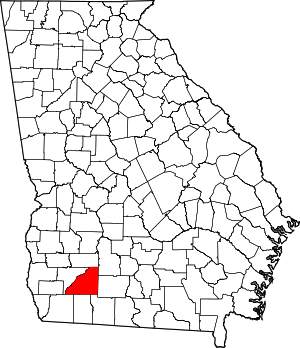 Map of Georgia highlighting Mitchell County | |
| Town | ||
| Unincorporated communities | ||
| Footnotes | ‡This populated place also has portions in an adjacent county or counties | |