Sainte-Eulalie, Quebec
Sainte-Eulalie is a municipality in the Nicolet-Yamaska RCM in the Centre-du-Québec region of Quebec, Canada, situated at the crossroads of Autoroutes 55, 20 and 955. The population as of the Canada 2011 Census was 871.
Sainte-Eulalie | |
|---|---|
Municipality | |
.svg.png) Coat of arms | |
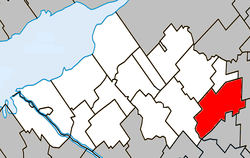 Location within Nicolet-Yamaska RCM. | |
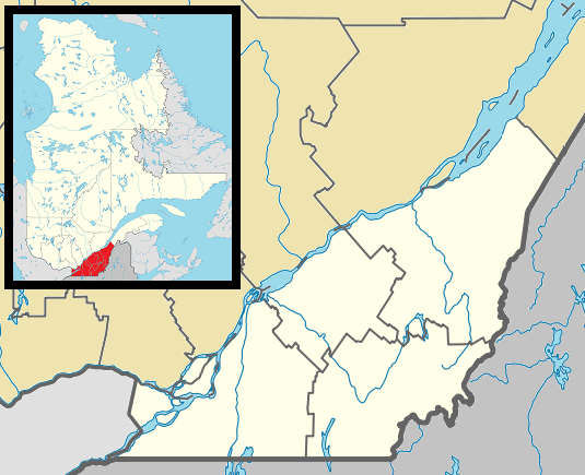 Sainte-Eulalie Location in southern Quebec. | |
| Coordinates: 46°06′N 72°15′W[1] | |
| Country | |
| Province | |
| Region | Centre-du-Québec |
| RCM | Nicolet-Yamaska |
| Constituted | July 1, 1864 |
| Government | |
| • Mayor | André DeMers |
| • Federal riding | Bas-Richelieu— Nicolet—Bécancour |
| • Prov. riding | Nicolet-Bécancour |
| Area | |
| • Total | 86.00 km2 (33.20 sq mi) |
| • Land | 86.38 km2 (33.35 sq mi) |
| There is an apparent contradiction between two authoritative sources | |
| Population (2011)[4] | |
| • Total | 871 |
| • Density | 10.1/km2 (26/sq mi) |
| • Pop 2006-2011 | |
| • Dwellings | 429 |
| Time zone | UTC−5 (EST) |
| • Summer (DST) | UTC−4 (EDT) |
| Postal code(s) | G0Z 1E0 |
| Area code(s) | 819 |
| Highways | |
| Website | www.municipalite. sainte-eulalie.qc.ca |
Sainte-Eulalie is also the home of Hydro-Québec's Nicolet static inverter station along Autoroute 20, west of its junction with Autoroute 55, as part of its HVDC Quebec - New England Transmission circuit.
Demographics
Population
Population trend:[5]
| Census | Population | Change (%) |
|---|---|---|
| 2011 | 871 | |
| 2006 | 894 | |
| 2001 | 884 | |
| 1996 | 879 | |
| 1991 | 815 | N/A |
Language
Mother tongue language (2006)[6]
| Language | Population | Pct (%) |
|---|---|---|
| French only | 875 | 98.31% |
| English only | 0 | 0.00% |
| Both English and French | 0 | 0.00% |
| Other languages | 15 | 1.69% |
See also
References
- Reference number 56158 of the Commission de toponymie du Québec (in French)
- Ministère des Affaires municipales, des Régions et de l'Occupation du territoire: Sainte-Eulalie
- Parliament of Canada Federal Riding History: BAS-RICHELIEU--NICOLET--BÉCANCOUR (Quebec)
- "(Code 2450005) Census Profile". 2011 census. Statistics Canada. 2012.
- Statistics Canada: 1996, 2001, 2006, 2011 census
- 2006 Statistics Canada Community Profile: Sainte-Eulalie, Quebec
Adjacent Municipal Subdivisions | ||||||||||
|---|---|---|---|---|---|---|---|---|---|---|
| ||||||||||
| Cities | |
|---|---|
| Municipalities | |
| Parishes | |
| Villages | |
| |
This article is issued from Wikipedia. The text is licensed under Creative Commons - Attribution - Sharealike. Additional terms may apply for the media files.