Sainte-Clotilde-de-Horton, Quebec
Sainte-Clotilde-de-Horton is a municipality located in the Centre-du-Québec region of Quebec, Canada.
Sainte-Clotilde-de-Horton | |
|---|---|
Municipality | |
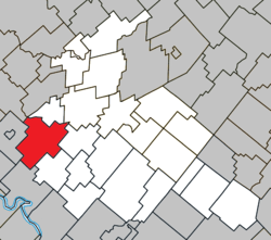 Location within Arthabaska RCM. | |
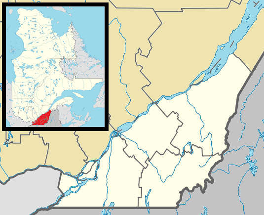 Sainte-Clotilde-de-Horton Location in southern Quebec. | |
| Coordinates: 45°59′N 72°14′W[1] | |
| Country | |
| Province | |
| Region | Centre-du-Québec |
| RCM | Arthabaska |
| Constituted | March 26, 1997 |
| Government | |
| • Mayor | Marie Désilets |
| • Federal riding | Richmond—Arthabaska |
| • Prov. riding | Drummond–Bois-Francs |
| Area | |
| • Total | 117.10 km2 (45.21 sq mi) |
| • Land | 114.08 km2 (44.05 sq mi) |
| Population (2011)[3] | |
| • Total | 1,616 |
| • Density | 14.2/km2 (37/sq mi) |
| • Pop 2006-2011 | |
| Time zone | UTC−5 (EST) |
| • Summer (DST) | UTC−4 (EDT) |
| Postal code(s) | J0A 1H0 |
| Area code(s) | 819 |
| Highways | |
| Website | www |
It was formed on March 26, 1997 by the merger of the village of Sainte-Clotilde-de-Horton, the parish municipality of Sainte-Clothilde-de-Horton (note spelling), and the municipality of Saint-Jacques-de-Horton. Prior to February 9, 1991, the name of the village was also spelled Sainte-Clothilde-de-Horton.
References
- Reference number 329754 of the Commission de toponymie du Québec (in French)
- Geographic code 39117 in the official Répertoire des municipalités (in French)
- "(Code 2439117) Census Profile". 2011 census. Statistics Canada. 2012.
Places adjacent to Sainte-Clotilde-de-Horton, Quebec | ||||||||||
|---|---|---|---|---|---|---|---|---|---|---|
| ||||||||||
| Cities |
|
|---|---|
| Municipalities | |
| Parishes |
|
| Townships | |
| |
| Authority control |
|
|---|
This article is issued from Wikipedia. The text is licensed under Creative Commons - Attribution - Sharealike. Additional terms may apply for the media files.