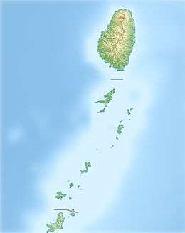
Saint Vincent (Antilles)
Saint Vincent is a volcanic island in the Caribbean. It is the largest island of the country Saint Vincent and the Grenadines island chain. It is located in the Caribbean Sea, between Saint Lucia and Grenada. It is composed of partially submerged volcanic mountains. Its largest volcano and the country's highest peak, La Soufrière, is active, having last erupted in 1979.[1]
| Native name: Yurumei or Hairouna | |||||||||||
|---|---|---|---|---|---|---|---|---|---|---|---|
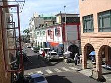
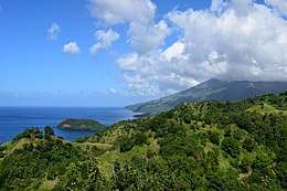 View of Saint Vincent. | |||||||||||
 Saint Vincent 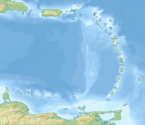 Saint Vincent 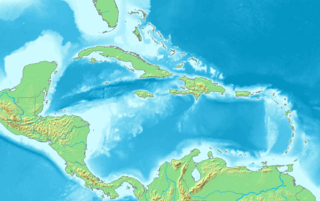 Saint Vincent | |||||||||||
| Geography | |||||||||||
| Location | Caribbean Sea on the West Coast Atlantic Ocean on the East Coast. | ||||||||||
| Coordinates | 13°15′N 61°12′W | ||||||||||
| Archipelago | Windward Islands | ||||||||||
| Area | 345 km2 (133 sq mi) | ||||||||||
| Length | 18 mi (29 km) | ||||||||||
| Width | 11 mi (18 km) | ||||||||||
| Highest point | La Soufrière 4,048 ft (1,234 m) | ||||||||||
| Administration | |||||||||||
| Parishes | 6 | ||||||||||
| Constituencies | 15 | ||||||||||
| Largest settlement | Kingstown (pop. 25,418) | ||||||||||
| Demographics | |||||||||||
| Population | 100,000 (2012) | ||||||||||
| Pop. density | 347.83/km2 (900.88/sq mi) | ||||||||||
| Ethnic groups | Black 66%, East Indian 6%, people 2%, Mixed Race 19%, White 4%, Other 3%. | ||||||||||
| Additional information | |||||||||||
| |||||||||||
There were major territory wars between the indigenous population of the Black Caribs, also called the garifuna, the United Kingdom in the 18th century, before the island was ceded to the British in 1763 and again in 1783. Saint Vincent and the Grenadines gained independence from the British on October 27, 1979 and became part of the British Commonwealth of Nations thereafter. Approximately 130,000 people currently live on the island, and the population saw significant migration to the United Kingdom in the early 1900s and between the 1940s & 1980s. There has also been significant migration to Canada and other larger neighbouring Anglo-Caribbean islands. The main island consists of Kingstown the capital, with the rest of the island divided into the five main coastal strip towns of Layou, Barrouallie, Chateaubelair, Georgetown, and Calliaqua.
People
The people of Saint Vincent and the Grenadines are formally called Vincentians, colloquially they are known as Vincies or Vincys. The majority of the island's population is of Afro-Vincentian descent. However, a sizable portion of the population consists of black charibe descendants, white descendants of English colonists, Portuguese descendants of indentured servants and a significant number of Indo-Vincentians, descendants of indentured workers with Indian heritage. There is also a sizable mixed-race minority (19%).
In 2012, the population of the island was approximately 130,000. The main religions are Anglican (47%), Methodist (10%), Roman Catholic (13%), and other Protestant denominations such as Seventh-day Adventism, Spiritual baptism and Hinduism.
Adult literacy was 88.1% in 2004. Infant mortality in 2006 was 17 per 1,000 live births and life expectancy for men stood at 69 years, 74 years for women. The active workforce in 2006 was 57,695 and unemployment in 2004 was 12%.
History
Before 1498, the island was called Hairouna by its indigenous inhabitants.[2] Columbus named the island Saint Vincent, since it is said to have been discovered on 22 January, the feast day of the patron saint of Lisbon and Valencia, Vincent of Saragossa.
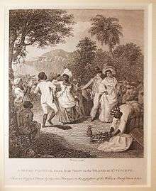
Columbus and the Spanish conquistadors embarked on slaving expeditions in and around St. Vincent following royal sanction in 1511, driving the inhabitants to the rugged interior, but the Spanish were not able to settle the island.[3] In the 1500s Columbus and the conquistadors noted there was a significantly large African population living amongst the native population, whom they assumed had come from shipwrecked slave ships or escaped from St. Lucia or Grenada to seek refuge in St. Vincent. They were called "Black Caribs," but are now known as Garifuna.
The large population aggressively prevented European settlement on St. Vincent until the 18th century.
French colony
The first Europeans to occupy St. Vincent were the French. However, following a series of wars and peace treaties, these islands were eventually ceded to the British. While the English were the first to lay claim to St. Vincent in 1627, the French, centered on the island of Martinique, became the first Europeans to invade the island, establishing their first colony at Barrouallie on the Leeward side of St. Vincent in 1719.[4] African slaves were made to cultivate coffee, tobacco, indigo, corn, and sugar on plantations operated by the French colonizers. Under French dominion, Saint Vincent was known as Ile Saint Marcouf.[5]
St. Vincent was ceded to Britain by the Treaty of Paris (1763), after which friction between the British and the natives led to the First Carib War. Upon taking control of the island in 1763, the British laid the foundations of Fort Charlotte which was completed in 1806. The island was reverted to French rule in 1779, then regained by the British under the Treaty of Versailles (1783). Between 1793 and 1796, the Black Caribs, led by their chief, Joseph Chatoyer, fought a series of battles against the British. The combat ultimately ended in a treaty, after which 5,000 Garifuna were exiled to the smaller island of Baliceaux off the coast of Bequia. Conflict between the British and the indigenous peoples continued until 1796, when General Ralph Abercromby ended a revolt fomented by the radical Victor Hugues. The British deported more than 5,000 Black Caribs to Roatán, an island off the coast of Honduras.
Like the French before them, the British also made African slaves work plantations of sugar, coffee, indigo, tobacco, cotton and cocoa until full emancipation in 1838. The economy then went into a period of decline, with many landowners abandoning their estates and leaving the land to be cultivated by liberated slaves. Life was made even harder following two eruptions of the La Soufriere volcano in 1812 and 1902 when much of the island was destroyed and many people were killed. The volcano erupted once more in 1979, with no fatalities. In the same year, St Vincent & The Grenadines gained full independence from Britain, though it remains a member of the Commonwealth of Nations.
British colony
From 1763 until independence, St. Vincent passed through various stages of colonial status under the British. A representative assembly was authorized in 1776. The British abolished slavery in 1834. The resulting labour shortages on the plantations attracted Portuguese immigrants in the 1840s and East Indians in the 1860s as laborers. Conditions remained harsh for both former slaves and immigrant agricultural workers, as depressed world sugar prices kept the economy stagnant until the turn of the 20th century. The Opobo king Jaja was exiled to St. Vincent after his 1887 arrest by the British for shipping cargoes of palm oil directly to Liverpool without the intermediation of the National African Company.
A Crown Colony government was installed in 1877, a Legislative Council created in 1925, and universal adult suffrage granted in 1951. During this period, the British made several unsuccessful attempts to affiliate St. Vincent with other Windward Islands in order to govern the region through a unified administration. The most notable was the West Indies Federation, which collapsed in 1962.
Self-rule and independence
St. Vincent was granted associate statehood status by Britain on 27 October 1969, giving it complete control over its internal affairs. Following a referendum in 1979, St. Vincent and the Grenadines became the last of the Windward Islands to gain independence. It celebrates independence every year on 27 October.
Geography
The island of Saint Vincent is 29 kilometres (18 mi) long and 18 kilometres (11 mi) wide and is located 160 kilometres (99 mi) west of Barbados.
On the island of Saint Vincent, there is a 1,234-metre (4,049 ft) active volcano, La Soufriere, that erupted violently in 1812 and 1902. The most recent eruption was on April 13, 1979, falling on Good Friday.
The island is very mountainous and well-forested.
Saint Vincent island belongs to the Lesser Antilles chain.
The island has a total surface area of 344 square kilometres (133 sq mi), or about 88% of the total country area, 19 times that of the country's second largest island Bequia. The coastline measures about 84 kilometres (52 mi).
The island's climate is tropical and humid, with an average of between 18 and 31 °C (64 and 88 °F) depending on the altitude.
More than 95% of the beaches on the mainland have black sand, while most of the beaches in the Grenadines have white sand.
For many years, the black sand was used in the building industry. During recent times, because of destruction to the coastal areas, the government has restricted the amount of sand that may be removed from beaches, as well as the specific beaches from which sand may be removed. The sand is still used in construction of pitched roads, as it blends in with the colour of the asphalt used for road construction.
Biodiversity
Saint Vincent is home to endemic birds like the Lesser Antillean Tanager, the Whistling Warbler, and the Saint Vincent Amazon. Some pockets of tropical rainforest are left on the volcanic hills.
Popular culture events
In 2002, Saint Vincent was one of the filming locations for the American adventure fantasy film Pirates of the Caribbean: The Curse of the Black Pearl. Filming took place from October 2002 through to March 2003, and several hundreds of the local inhabitants were hired as cast members.[6]
Educational Institutions
Saint Vincent is home to a number of International accrediting Medical Schools:
- All Saints University School of Medicine
- Saint James School of Medicine
- Trinity School of Medicine
- American University of St. Vincent School of Medicine
In addition to the international schools, Saint Vincent is also home to local educational schools.
See also
- 1898 Windward Islands Hurricane
References
| Wikimedia Commons has media related to Saint Vincent (island). |
- Rogozinski, Jan (1999). A Brief History of the Caribbean (Revised ed.). New York: Facts on File, Inc. pp. 358–359. ISBN 0-8160-3811-2.
- "Review of the Indigenous Caribbean". indigenousreview.blogspot.com.au. Retrieved 26 March 2018.
- Rogozinski, January 2000. A Brief History of the Caribbean: From the Arawak to the Present. Plume, New York, New York.
- "Attention * St. Vincent Genealogy Resources". St. Vincent Genealogy Resources. Archived from the original on 21 March 2012. Retrieved 26 March 2018.
- Roche, Jean-Michel (2005). Dictionnaire des bâtiments de la flotte de guerre française de Colbert à nos jours, 1671 - 1870. Group Retozel-Maury Millau. p. 269. ISBN 978-2-9525917-0-6. OCLC 165892922. (see entry for the frigate Junon)
- "The Making of Pirates of the Caribbean: The Curse of the Black Pearl (1/4)". redmorgankidd. Retrieved 2012-12-19.