Saint-Zénon, Quebec
Saint-Zénon is a municipality in the Lanaudière region of Quebec, part of the Matawinie Regional County Municipality.
- Not to be confused with Saint-Zénon-du-Lac-Humqui, Quebec, in the Bas-Saint-Laurent region
Saint-Zénon | |
|---|---|
Municipality | |
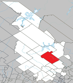 Location within Matawinie RCM. | |
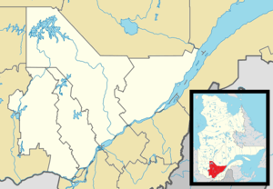 Saint-Zénon Location in central Quebec. | |
| Coordinates: 46°33′N 73°49′W[1] | |
| Country | |
| Province | |
| Region | Lanaudière |
| RCM | Matawinie |
| Constituted | October 7, 1895 |
| Government | |
| • Mayor | Eddy St-Georges |
| • Federal riding | Joliette |
| • Prov. riding | Berthier |
| Area | |
| • Total | 492.20 km2 (190.04 sq mi) |
| • Land | 465.07 km2 (179.56 sq mi) |
| Population (2011)[4] | |
| • Total | 1,250 |
| • Density | 2.7/km2 (7/sq mi) |
| • Pop 2006-2011 | |
| • Dwellings | 1,229 |
| Time zone | UTC−5 (EST) |
| • Summer (DST) | UTC−4 (EDT) |
| Postal code(s) | J0K 3N0 |
| Area code(s) | 450 and 579 |
| Highways | |
| Website | www |
Demographics
Population
In the 2011 Census, Statistics Canada originally reported that Saint-Zénon had a population of 1,115 living in 551 of its 180 total dwellings, an 8.2% change from its 2006 population of 1,379.[5] Statistics Canada subsequently amended the 2011 census results to a population of 1,250 living in 619 of its 1,229 total dwellings, a -9.4% change from 2006.[4] With a land area of 465.07 km2 (179.56 sq mi), it had a population density of 2.688/km2 (6.961/sq mi) in 2011.[4][5]
| Historical Census Data - Saint-Zénon, Quebec[6] | ||||||||||||||||||||||||||
|---|---|---|---|---|---|---|---|---|---|---|---|---|---|---|---|---|---|---|---|---|---|---|---|---|---|---|
|
|
| ||||||||||||||||||||||||
Language
Mother tongue:[7]
- English as first language: 0.7%
- French as first language: 96.0%
- English and French as first language: 2.6%
- Other as first language: 0.7%
Education
Commission scolaire des Samares operates francophone public schools:
- École Bérard[8]
The Sir Wilfrid Laurier School Board operates anglophone public schools serving the community at the secondary level, including:
- Joliette High School in Joliette[9]
See also
References
- Reference number 349159 of the Commission de toponymie du Québec (in French)
- Geographic code 62080 in the official Répertoire des municipalités (in French)
- Statistics Canada 2011 Census - Saint-Zénon census profile
- "Corrections and updates". Statistics Canada. 2012-10-24. Retrieved 2012-11-11.
- "Population and dwelling counts, for Canada, provinces and territories, and census subdivisions (municipalities), 2011 and 2006 censuses (Quebec)". Statistics Canada. 2012-02-08. Retrieved 2012-11-11.
- Statistics Canada: 1996, 2001, 2006, 2011 census
- Statistics Canada 2006 Census - Saint-Zénon community profile
- "Bérard." Commission scolaire des Samares. Retrieved on September 23, 2017.
- "Joliette High School Zone Sec 1-5." Sir Wilfrid Laurier School Board. Retrieved on September 5, 2017.
Adjacent Municipal Subdivisions | ||||||||||
|---|---|---|---|---|---|---|---|---|---|---|
| ||||||||||
| Municipalities |
|
|---|---|
| Parishes | |
| Unorganized Territories | |
| |
| Authority control |
|
|---|