Sagbama
Sagbama is a Local Government Area in Bayelsa State, Nigeria. Its headquarters are in the town of Sagbama. Part of the area of the LGA lies within the Bayelsa National Forest.
Sagbama | |
|---|---|
LGA and town | |
 Sagbama Location in Nigeria | |
| Coordinates: 5°10′N 6°12′E | |
| Country | |
| State | Bayelsa State |
| Headquarters | Sagbama |
| Area | |
| • Total | 945 km2 (365 sq mi) |
| Population (2006 census) | |
| • Total | 187,146 |
| Time zone | UTC+1 (WAT) |
| 3-digit postal code prefix | 561 |
| ISO 3166 code | NG.BY.SA |
It has an area of 945 km² and a population of 187,146 at the 2006 census. Sagbama LGA is in the town of Sagbama and consists of the districts of Ofoni, Aduku, Sagbama, Ossiama, Adagbariri, Adoni, Agbere, Asamabiri, Angalabiri, Ebedebiri, Osekwenike, Agoro, Toru Ebeni and Trofani, and the LGA is under Bayelsa West Senatorial District
The postal code of the area is 561.[1]
References
- "Post Offices- with map of LGA". NIPOST. Archived from the original on 2012-11-26. Retrieved 2009-10-20.
- Finelib.com. "Sagbama Local Government Area".
State capital: Yenagoa | ||
| Local Government Areas | 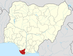 | |
This article is issued from Wikipedia. The text is licensed under Creative Commons - Attribution - Sharealike. Additional terms may apply for the media files.