Ogbia
Ogbia is a Local Government Area of Bayelsa State in the Niger Delta region of Nigeria. Its headquarters is in the town of Ogbia in the south of the area at 4°39′00″N 6°16′00″E.
Ogbia | |
|---|---|
LGA and town | |
 Ogbia Location in Nigeria | |
| Coordinates: 4°47′N 6°20′E | |
| Country | |
| State | Bayelsa State |
| Headquarters | Ogbia |
| Government | |
| • [Obanobhan] | HRM Dumaro Charles Owaba |
| Area | |
| • Total | 1,698 km2 (656 sq mi) |
| Population (2006 census) | |
| • Total | 266,008 |
| Time zone | UTC+1 (WAT) |
| 3-digit postal code prefix | 560 |
| ISO 3166 code | NG.BY.OG |
It has an area of 695 km² and a population of 179,926. It is well known for its historic value to the today Nigerian state economy mainstay, i.e., its oil industry, being the local government area encompassing Oloibiri the first place oil was discovered on Sunday 15 January 1956.
The postal code of the area is 562.[1] Ogbia is also the name of a subgroup of the Ijaw nation. The Ogbia people, speak the Ogbia language, a unique Ijaw dialect. The Ogbia people who inhabit the Ogbia local government of Bayelsa, have close kinship and language ties with the Okoroma people of Nembe local government of Bayelsa; the Odual people of Abua/Odual local government of Rivers state; the Ogbogolo people of Ahoada in Rivers state. The present political headquarters of the Ogbia people, is Ogbia town; a town conceptualized and founded in 1972 by the Ogbia brotherhood. It also serves as the local government headquarters. The inhabitants of Ogbia land are mainly fishermen and farmers. Former Nigerian president Goodluck Ebele Jonathan was born in Otueke, Ogbia. The first civilian governor of the old Rivers state, Chief Milford Obiene Okilo was also from Emakalakala in Ogbia. King Amakiri, the first king of modern Kalabari kingdom (1669-1757) is also said to come from Emakalakala in Ogbia.
Ogbia Communities/Town'
- Ogbia
- Imiringi
- Elebele
- Kolo 1
- Kolo 2
- Emeyal 1
- Emeyal 2
- Otuosega
- Oruema
- Emakalakala
- Eboh
- Obeduma
- Akipelai
- Otuagbagi
- Otuoke
- Otakeme
- Oloibiri
- Abobiri
- Opume
- Otuogbodi
- Idema
- Otuokpoti
- Anyama
- Onuebum
- Ewema
- Otuabulla 1
- Otuabulla 2
- Ologi
- Otuedu
References
- "Post Offices- with map of LGA". Nigerian Postal Service. Archived from the original on 26 November 2012. Retrieved 20 October 2009.
State capital: Yenagoa | ||
| Local Government Areas | 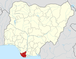 | |