Rotella
Rotella is a comune (municipality) in the Province of Ascoli Piceno in the Italian region Marche, located about 70 km (43 mi) south of Ancona and about 11 km (6.8 mi) north of Ascoli Piceno. As of 31 December 2005, it has a population of 985 and an area of 27.2 km2 (10.5 sq mi).[3]
Rotella | |
|---|---|
| Comune di Rotella | |
 Clock Tower | |
Location of Rotella 
| |
 Rotella Location of Rotella in Italy 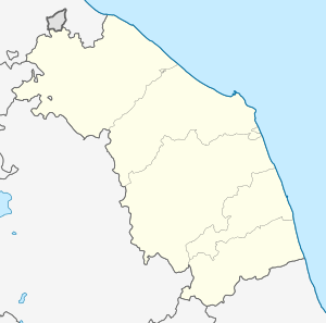 Rotella Rotella (Marche) | |
| Coordinates: 42°57′N 13°34′E | |
| Country | Italy |
| Region | Marche |
| Province | Province of Ascoli Piceno (AP) |
| Frazioni | Casteltel di Croce, Capradosso, Poggio Canoso |
| Government | |
| • Mayor | Domenico Gentili |
| Area | |
| • Total | 27.2 km2 (10.5 sq mi) |
| Elevation | 395 m (1,296 ft) |
| Population (2005)[2] | |
| • Total | 985 |
| • Density | 36/km2 (94/sq mi) |
| Demonym(s) | Rotellesi |
| Time zone | UTC+1 (CET) |
| • Summer (DST) | UTC+2 (CEST) |
| Postal code | 63030 |
| Dialing code | 0736 |
| Patron saint | Lawrence of Rome |
| Saint day | 10 August |
| Website | Official website |
The municipality of Rotella contains the frazioni (subdivisions, mainly villages and hamlets) Castel di Croce, Capradosso, and Poggio Canoso.
Rotella borders the following municipalities: Ascoli Piceno, Castignano, Force, Montedinove, Montelparo, Venarotta.
Among the prominent public buildings in Rotella are:
- Torre Civica dell'Orologio
- Museo Piccolomini, Rotella
- Santi Maria e Lorenzo
- Sanctuary of the Madonna della Consolazione, Montemisio
- Santa Lucia di Capradosso
- Santa Lucia di Poggio Canoso
- San Severino
- Santa Viviana or Chiesa delle Icone
Demographic evolution

References
- "Superficie di Comuni Province e Regioni italiane al 9 ottobre 2011". Istat. Retrieved 16 March 2019.
- "Popolazione Residente al 1° Gennaio 2018". Istat. Retrieved 16 March 2019.
- All demographics and other statistics: Italian statistical institute Istat.
This article is issued from Wikipedia. The text is licensed under Creative Commons - Attribution - Sharealike. Additional terms may apply for the media files.