Rockdale, Wisconsin
Rockdale is a village in Dane County, Wisconsin, United States. The population was 214 at the 2010 census. The village is split in half by the Koshkonong Creek. It is part of the Madison Metropolitan Statistical Area.
Rockdale, Wisconsin | |
|---|---|
 | |
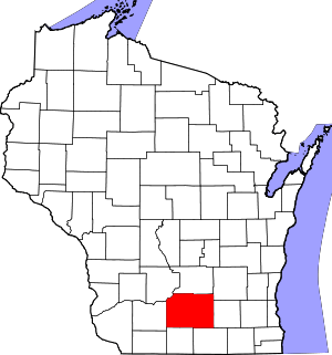
 Location of Rockdale in Dane County, Wisconsin. | |
| Coordinates: 42°58′21″N 89°2′2″W | |
| Country | |
| State | |
| County | Dane |
| Area | |
| • Total | 0.30 sq mi (0.77 km2) |
| • Land | 0.28 sq mi (0.73 km2) |
| • Water | 0.02 sq mi (0.04 km2) |
| Elevation | 833 ft (254 m) |
| Population | |
| • Total | 214 |
| • Estimate (2018)[4] | 220 |
| • Density | 782.92/sq mi (302.40/km2) |
| Time zone | UTC-6 (Central (CST)) |
| • Summer (DST) | UTC-5 (CDT) |
| Area code(s) | 608 |
| FIPS code | 55-68725[5] |
| GNIS feature ID | 1572479[2] |
| Website | http://www.villageofrockdale.com/ |
Geography
Rockdale is located in Christiana Township at 42°58′21″N 89°2′2″W (42.972476, -89.033886).[6]
According to the United States Census Bureau, the village has a total area of 0.24 square miles (0.62 km2), of which, 0.23 square miles (0.60 km2) of it is land and 0.01 square miles (0.03 km2) is water.[7]
Demographics
| Historical population | |||
|---|---|---|---|
| Census | Pop. | %± | |
| 1920 | 139 | — | |
| 1930 | 135 | −2.9% | |
| 1940 | 136 | 0.7% | |
| 1950 | 161 | 18.4% | |
| 1960 | 191 | 18.6% | |
| 1970 | 172 | −9.9% | |
| 1980 | 200 | 16.3% | |
| 1990 | 235 | 17.5% | |
| 2000 | 214 | −8.9% | |
| 2010 | 214 | 0.0% | |
| Est. 2018 | 220 | [4] | 2.8% |
| U.S. Decennial Census[8] | |||
2010 census
As of the census[3] of 2010, there were 214 people, 89 households, and 60 families living in the village. The population density was 930.4 inhabitants per square mile (359.2/km2). There were 94 housing units at an average density of 408.7 per square mile (157.8/km2). The racial makeup of the village was 99.1% White, 0.5% Asian, and 0.5% from two or more races. Hispanic or Latino of any race were 1.9% of the population.
There were 89 households of which 29.2% had children under the age of 18 living with them, 55.1% were married couples living together, 9.0% had a female householder with no husband present, 3.4% had a male householder with no wife present, and 32.6% were non-families. 23.6% of all households were made up of individuals and 3.3% had someone living alone who was 65 years of age or older. The average household size was 2.40 and the average family size was 2.92.
The median age in the village was 39 years. 24.3% of residents were under the age of 18; 7.9% were between the ages of 18 and 24; 29.4% were from 25 to 44; 26.5% were from 45 to 64; and 11.7% were 65 years of age or older. The gender makeup of the village was 53.7% male and 46.3% female.
2000 census
As of the census[5] of 2000, there were 214 people, 89 households, and 60 families living in the village. The population density was 914.7 people per square mile (359.2/km²). There were 91 housing units at an average density of 388.9 per square mile (152.8/km²). The racial makeup of the village was 99.07% White, 0.47% African American, and 0.47% from two or more races. Hispanic or Latino of any race were 0.47% of the population.
Ancestries: German (59.3%), Norwegian (38.8%), English (15.9%), Irish (15.0%), French (10.3%), Scots-Irish (4.7%).
There were 89 households out of which 32.6% had children under the age of 18 living with them, 51.7% were married couples living together, 7.9% had a female householder with no husband present, and 31.5% were non-families. 21.3% of all households were made up of individuals and 5.6% had someone living alone who was 65 years of age or older. The average household size was 2.40 and the average family size was 2.84.
In the village, the population was spread out with 26.2% under the age of 18, 4.7% from 18 to 24, 30.4% from 25 to 44, 28.0% from 45 to 64, and 10.7% who were 65 years of age or older. The median age was 38 years. For every 100 females, there were 105.8 males. For every 100 females age 18 and over, there were 90.4 males.
The median income for a household in the village was $37,500, and the median income for a family was $48,281. Males had a median income of $36,667 versus $23,250 for females. The per capita income for the village was $19,416. About 9.5% of families and 8.8% of the population were below the poverty line, including 14.5% of those under the age of eighteen and 13.0% of those sixty five or over.
References
- "2018 U.S. Gazetteer Files". United States Census Bureau. Retrieved Feb 15, 2020.
- "US Board on Geographic Names". United States Geological Survey. 2007-10-25. Retrieved 2008-01-31.
- "U.S. Census website". United States Census Bureau. Retrieved 2012-11-18.
- "Population and Housing Unit Estimates". Retrieved June 4, 2019.
- "U.S. Census website". United States Census Bureau. Retrieved 2008-01-31.
- "US Gazetteer files: 2010, 2000, and 1990". United States Census Bureau. 2011-02-12. Retrieved 2011-04-23.
- "US Gazetteer files 2010". United States Census Bureau. Archived from the original on 2012-01-25. Retrieved 2012-11-18.
- "Census of Population and Housing". Census.gov. Retrieved June 4, 2015.