Road signs in Greece
Road signs in Greece,are regulated by the Ministry of Transport and the Hellenic Traffic Police, according to the Greek Highway Code.
Signs follow the general European conventions concerning the use of shape and colour to indicate function. Thus signs indicating dangers are triangular with a red border, those giving orders are almost all circular (white on blue for mandatory instructions, black on white with a red border for prohibitions), and those providing information are rectangular. Most signs use pictograms to convey their particular meaning.
As is customary in European countries, all signs are partly or fully reflectorized or are provided with their own night-time illumination. Signs used for temporary regulations may have a yellow background colour.
Greek road signs depict people with realistic (as opposed to stylized) silhouettes. Also, all signs are identified by a Greece capital letter (for each category) and a number. Signs that indicate the same meaning but in a different direction have the same letter and number but are separated by a lowercase (eg, α, β, γ, δ, ... or α for left and δ for right)
History
_from_the_Roman_road_that_ran_through_Boeotia._2nd_cent._B.C.jpg)
The history of road singaling in Greece dates back to Antiquity. The first road signaling included marble columns with the head of Hermes, protector of the wayfarers. Those signs were known known as "ἑρμαῖ" ("Hermai").[1] There were also milestones for measuring street length in stadions.[2] Similar columns were also used in Roman times, but had miles as a unit of measurement. Shortly after Greece's independence in 1836, a decree was issued to place the first road signs in Greece. They were stone carved signs with distances between cities according to the metric system that was in force at the time.[3]
The first road signage on Greek roads was made in 1924 by ELPA (Elliniki Leschi Periigiseon kai Aftokinitou, lit. translated: Hellenic Club of Tours and Car), [4] which took over the road network's signage until 1957, when it was taken over by the state. [5] The signs were subject to the provisions of the Geneva Protocol on Road Signs and Signals.
On July 25, 1962, and with Government Gazette A '110/62, it was announced in paragraph 1 of Article 14 that "by joint decisions, issued by the Ministers of Transport, Public Works and Interior, all matters relating to the road signs, roadmarkings, the type of signals, the characteristics of the road signage and the manner of its application shall be defined. ", while in paragraph 2 of the same article that "the provisions of the International Geneva Protocol on Road Signs and Signals of September 1949, with its supplements, is temporarily valid and up-to the apply of the referenced of the paragraph 1 of this Article. "
Finally, on July 6, 1974, 12 years after the initial announcements and with the Government Gazette B '676/74, the first serious signaling standards were prepared, which are still valid today.[6] It was the first time that sign diagrams were included in a Government Gazette. Since the publication of the relevant Government Gazette, the provisions of Article 14 of Article 14 of Law 4332/62 "on the ratification of the Road Trafffic Code" have been abolished. However, within five years of its publication, six (6) of the old signs from the Geneva Protocol were still valid, as "temporarily preserved signs".
Design
Fonts
The font on the signs since 1974 is Transport, which also appears on the signs of other European countries. On motorways, the DIN 1451 font is used.
Language
The signs in Greece are in two languages: Greek (Greek Alphabet) and English (Latin Alphabet). Previously, the signs were in Katharevousa and used the Polytonic system, until 1976 and 1981, which were replaced by the Demotic and Monotonic systems respectively.
Retroreflection
Signs during the night are either:
- Internally illuminated: that is, of suitable translucent materials, illuminated by internal illumination systems. The application of these signs is restricted mainly to urban areas and to specific high-risk interurban networks.
- Externally illuminated: that is, they are illuminated by lamps facing them. These signs are applied at places where the light beam of cars is difficult to reach, such as the road sign gantries.
- With reflective materials: that is, part or all of which is of a suitable reflective film. They may not be reflective (at roads that are lighted at night.), semi-reflective (Only symbols are reflective) or fully reflective (except symbols)
Finally, there are fluorescent reflective membranes, used in special circumstances, as a backdrop for school signs or signs indicating significant hazards.
Post-1974 signs
Categorization
They are divided into certain categories based on their meaning, shape and coloring.[7]
- Danger Notice (K Series).
- Traffic Regulatory (Ρ Series).
- Informatory (Π Series).
- Οδοδείκτες (Road-pointers), these are signs with text that guide drivers to the directions they at intersections between roads or warn before they confirm the correctness of the route they follow and inform them of the distances from their destination.
- Other informatory signs, are signs that contain pictograms that inform drivers of the existence of a specific installation or service in the course of their journey.
The color of the letters is yellow, in Greek and white in Latin. Background color indicates the kind of direction. These colors are:
- Green for Motorways
- Blue for expressways, etc.
- Brown for tourist routes
- White (with black letters) inside populated areas or facilities in them.
- Additional (Πρ series). These signs are rectangular with a black border on a white background with a black pictogram and are always combined with other road signs. They are designed to:
- Make the message displayed clearer
- Specify the displayed message
Additional signs are never used by themselves.
Danger notice signs (Warning)
These signs have mostly triangular shape. Their borders are red and their background is yellow. (Usually in other European countries it is white) They are intended to alert drivers early on of risks, which they can find their course.[8]
- Warning signs
 Dangerous left turn
 Dangerous right turn
 Dangerous two opposing or continuous turns, first to left
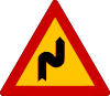 Dangerous two opposing or continuous turns, first to right
 Steep descent (With slope as indicated on the sign)
 Steep ascent (With slope as indicated on the sign)
 Road narrows dangerously on both sides
 Road narrows dangerously from the left side
 Road narrows dangerously from the right side
 Swing bridge
 Road leads to ferry berth or river bank
 Dangerous bumpy road in poor condition, with potholes etc.
 Dangerously raised road or convex change in the length of the slope
 Dangerous gutter or slight change in the length of the slope
 Slippery road
 Dangerous ejection of gravel (Loose chippings)
 Danger due to falling rocks and their presence on the road
 Danger due to pedestrian crossing
 Danger due to frequent children traffic (Schools, Stadiums, etc.)
 Danger due to frequent cyclist entry or cyclist crossing
 Danger due to domestic animal crossing
 Danger due to wild animal crossing
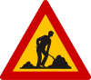 Danger due to roadworks
 Attention, junction or place where the traffic is set by a three-colored traffic signal
 Danger due to low-flying aircraft
 Danger due to crosswind (From left)
 Danger due to crosswind (From right)
 Two-way traffic announcement. This sign shall mean an imminent entry from a roadway or from a section of road comprising two lanes separated by direction with an island in a road section with traffic on it is in two directions, either temporarily or permanently.
 Attention, intersection where the priority applies from the right
 Intersection with a road, the users of which must give way
 Intersection with a vertical road in left, the users of which must give way.
 Intersection with a vertical road in right, the users of which must give way.
 Intersection with an oblique road in left, the users of which must give way.
 Intersection with an oblique road in right, the users of which must give way.
 Approach to a circular mandatory route
 Attention, other Dangers (Not shown on other signs)
 Danger due to level crossing with gates or intersection with tramway line.
 Danger due to level crossing without gates
 Distance to level crossing or swing bridge
 Danger due to immediate proximity to single-track level crossing without gates or intersection with tramway line.
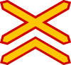 Danger due to immediate proximity to multitrack level crossing without gates or intersection with tramway line.
 Soft verges on the left
 Soft verges on the right
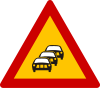 Frequent traffic queues
 Tunnel
 Danger due to intersection with tramway line without gates
 Danger due to fog
 Danger due to parallel pedestrian and bicycle crossings
 Danger due to common pedestrian and bicycle crossing
Regulatory signs[9]
Prohibitory signs are round with white backgrounds and red borders.
- Prohibitory signs
 Give Way. This sign means that at the junction where it's placed, the drivers must give priority to the vehicles that move to the other road
 Stop. 1) This sign, when it's placed before a junction, means the mandatory stopping of the vehicle before entering the junction and the prioritization of the vehicles moving on the road to which it is approaching. (2) When placed to points other than a junction, means a mandatory stopping of the vehicle in the position of the sign and not start until the driver is sure that they can do so without risk.
 Priority road
 End of Priority road
 Priority for oncoming vehicles, because road narrows
 Priority over oncoming vehicles (Because road narrows)
 No entry to all vehicles
 Road closed to all vehicles in both directions
 No motor vehicles except for motorcycles with two wheels.
 No motorcycles
 No bicycles
 No mopeds
 No lorries. The number of tons, either in white on the vehicle or on an additional sign placed under the pictured one, means that the prohibition applies only if the maximum permissible weight of the vehicle or the combination of vehicles exceeds this number
 No motor vehicle pulling trailer, other than a semi-trailer or trailer with only one axle. The number of tons, either white in the trailer or on an additional sign, which is placed under the pictured, means that the prohibition applies only if the maximum authorized weight of the trailer exceeds this number.
 No pedestrians
 No animal-drawn vehicles
 No handcarts
 No farm machinery
 No motor vehicles
 No specific vehicles (eg motor and animal-drawn vehicles)
 No vehicles with overall width exceeding (eg 2 meters).
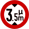 No vehicles with overall height exceeding (eg 3,5 meters)
 No vehicles with overall weight exceeding (eg 5 tons)
 No vehicles with overall weight exceeding (eg 2 tons) in one axle.
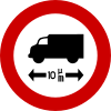 No vehicles with overall length exceeding (eg 10 meters).
 No driving with distance less than (eg 70) meters from two vehicles
 No left turn
 No right turn
 No U-turns (180 degree turn)
 No overtaking by motor vehicles except motorcycles with two wheels
 No overtaking by lorries
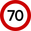 The maximum speed is limited to the indicated number (e.g., 70 km) per hour.The number of tons, on an additional sign, which is placed under the pictured, means that the speed limit applies only to vehicles with a total weight exceeding this number.
 No horn (Except for avoiding an accident)
 Passing without stopping prohibited at customs
 Passing without stopping prohibited at toll post
 End of all local prohibitions which have been imposed by prohibitory signs on moving vehicles
 End of speed limit which have been imposed by a prohibitory sign (eg 60 km/h)
 End of overtaking restriction which have been imposed by a prohibitory sign.
 No parking
 No stopping and parking, unless otherwise specified by an additional sign, etc. The prohibitions on these signs apply from the position of the signs to the next meeting point with a road and on the side of the pavement in which they are placed
 Alternative parking (prohibited on the sign's side on odd months of year)
 Alternative parking (prohibited on the sign's side on the even months of year)
 No parking zone (limited-time parking).
 End of no parking zone
 No vehicles carrying over a certain quantity of explosives or flammable goods
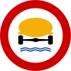 No vehicles carrying over a certain quantity of goods which could pollute water
 Highest speed area
 End of highest speed limit zone (eg 50 km/h)
 No trailers with weight exceeding (eg 3 tons)
 No vehicles carrying dangerous goods
 Direction to be followed. Left only
 Direction to be followed. Right only
 Direction to be followed. Forward only
 Direction to be followed. Turn left or right.
 Direction to be followed. Turn left
 Direction to be followed. Turn right
 Direction to be followed. Turn left or continue straight ahead.
 Direction to be followed. Turn right or continue straight ahead.
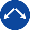 Pass this side. Either side
 Pass this side. Left
 Pass this side. Right
 Roundabout
 Track for cycles and mopeds
 Footpath
 Bridleway
 Snow chains compulsory
 Compulsory track for pedestrians, cyclists and moped drivers. Dual track
 Compulsory track for pedestrians, cyclists and moped drivers. Dual track
 Compulsory track for pedestrians, cyclists and moped drivers.
 Beginning of lane reserved for scheduled buses etc.
 End lane reserved for scheduled buses etc.
 Reserved lane for buses, trolleybuses and bicycles
 End of reserved lane for buses, trolleybuses and bicycles
 Controlled Parking
 Parking for TAXIs
 Parking for disabled (Special license required)
.png) Parking for specific disablet person (Special license and registration number required)
Parking for specific disablet person (Special license and registration number required) Direction to be followed for vehicles carrying dangerous goods. Turn left
 Direction to be followed for vehicles carrying dangerous goods. Turn right
 Direction to be followed for vehicles carrying dangerous goods. Turn left
 Direction to be followed for vehicles carrying dangerous goods. Turn right
 Water protection area
 Beginning of lane reserved for trams
 End lane reserved for trams
Informatory signs
- Informatory signs
 E-road numbering
 Pedestrian crossing
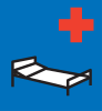 Hospital
 One-way street ahead
.svg.png) One-way street
One-way street Dead end ahead on 90 degrees roads
 Dead end ahead on non-90 degrees roads
 Dead end
 Alternative direction
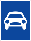 Expressway
 End of expressway
 Motorway
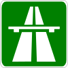 Motorway (alternative)
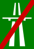 End of motorway
 End of motorway (alternative)
 First aid
 Workshop
 Telephone
 Petrol station
 Hotel
Hotel Restaurant
 Refreshments
 Picnic site
 Hiking trail
 Caravan site
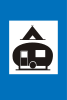 Camping site
 Youth hostel
 Information
 Bathing
 Toilet
 Radio station for road and traffic information
 Built-up area
 End of built-up area
 Disabled persons
.svg.png) Sharp bend, Right (alternative)
Sharp bend, Right (alternative).svg.png) Sharp bend, Left (alternative)
Sharp bend, Left (alternative) Sharp bend, Right
 Sharp bend, Left
 Motorway numbering
 National road numbering (used on motorway signs only)
 National road numbering (used on every road type but motorways)
 Direction sign in Expressway intersections with two directions
 Direction sign in Expressway intersections with one direction
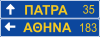 Direction sign on usual roads
 Direction sign on roads of local road network
 Direction sign on tourist roads
 Direction sign on tourist roads
 Direction sign
 Direction sign
 Direction sign to Airport
 Advance direction sign, diagrammatic type
Rare, special or unofficial signs
 Acropolis museum direction sign
 Bilingual direction sign without km
 Motorway exit
 Direction to airport
 Sign used when entering Greece from other country
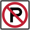 No parking
 Pedestrian cross direction sign
 Direction arrow
 Continuous pedestrian crossings
 Speed bump
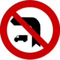 No lorries turning left
 No lorries turning right
 Lorries over 6 tones are prohibited to enter the road
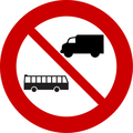 Lorries and buses are prohibited to enter the road
 Buses are prohibited to enter the road
 Passing without stopping prohibited (control)
 Regulatory sign of reserved lane for lorries
 Regulatory sign of reserved lane for cars
 Other dangers (temporary)
 Fog likely (Alternative)
 No parking
Athens Bus Service signs
Bus Service road signs for prohibiting parking on bus route narrow turning points
 "No parking. Bus passing". Athens Urban Transport Servive (OASA) and Thermal Bus Company (ETHEL) road sign.
 "No parking. Bus passing". Athens Urban Transport Servive (OASA) and Thermal Bus Company (ETHEL) road sign.
 "Bus passing. Illegally parked vehicles will be towed". Athens Urban Transport Servive (OASA) and Thermal Bus Company (ETHEL) new road sign.
Bus route guidance road signs
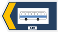 Left arrow - Athens Urban Transport Servive (OASA) guidance sign (with route label).
 Forward arrow - Athens Urban Transoport Servive (OASA) guidance (without route label).
 Right arrow - Athens Urban Transoport Servive (OASA) guidance (without route label).
Bus stop signs
 Old Athens bus stop sign (OASA-ETHEL) circa 1994-2005.
 Recent Athens bus stop sign (OASA-ETHEL) circa 2005-2015.
 Most recent Athens bus stop sign (OASA-OSY) since 2015 circa.
Retired signs (no longer in use)
Below, signs are withdrawn or replaced with new diagrams of the same meaning.


Other marks[12]
 Stopping is obligatory (Stop)
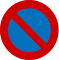 Stopping
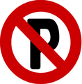 Parking
 Course like arrows
 Course like arrows
 Progressive load indications
 Course like arrows
 Course like arrows
 Course like arrow
 Mandatory bicycle space
 Traffic area exclusively by pedestrians
 Obligatory run of the depicted vehicle
Useful indications[12]
 Parking lot
 Gasoline or diesel oil
 Phone
Phone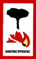 Attention to the forest. The Greek text says "Fire hazard"
 Parking lot for caravans
 Hospital
 First aid
 Workshop
 Camping site
 Special directional & distance sign for the vehicle shown in white space
Warning signs[13][14]
 Pavement with abnormalities
 Dangerous continuous curves
 Right curne
 Left curve
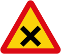 Non-priority cross-junction
 Cross-junction with moving priority as the arrow
 Cross-junction with moving priority as the arrow
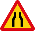 Narrow road
 Slope (Αmount indicted)
 Sliperry road
 Swing bridge
 Danger
 Works on the road
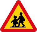 School
 Pedestrian crossing
 Animal passage
 Level crossing is guarded
 Level crossing is unguarded
 Alert for unguarded level crossing
 Alert for level crossing distance
 Alert for level crossing distance
 Alert for level crossing distance (These signs were placed under the signs for the level crossings)
 Approach to a road where the vehicles on it have priority. (Yield)
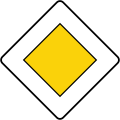 Priority road sign
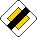 Priority expiration sign
Area indications[14]
- The numbers denoted the mileage
- The arrow indicated the direction
- Bypass with underpass
- Toponym
Temporarily retained signs (1974-1978).[15]
- Pd-1 - Beware, other hazards with the K-25's declaring significance
 Pd-2 - Mandatory stopping of the route (STOP) with the expressive importance of P-2.
- Pd - 3 No motor vehicles with the expressive meaning of P-19.
 Pd - 4 No parking with the expressive importance of R-39
 Pd-5 Parking is prohibited on the side of the sign during the odd months with the prominent significance of P-41
 Pd- 6 Parking is prohibited on the side of the sign, in the even months with the declarative significance of the P-42
Regulatory[16]
 No passing without stopping before the customs - By the word "Τελωνεῖον"
Informatory[17]
- Expressway Warning Signal with Mileage Distances - By the word "Ἀσπρόπυργος"
- Common road Warning Signal with Mileage Distances - By the word "Ἠράκλειον" and "Ἀθήναι"
- Direction of a toponym, arrow shape - By the word "Τρίλοφον"
- Direction of a toponym, arrow shape - By the word "Πειραιεύς"
- Direction of more toponym, arrow shape - With the words "'Ἀερολιμήν" and "Πειραιεύς"
- Direction of a toponym, rectangular shape - By the word "Ἠράκλειον"
- Airport Direction - By the word "Ἀθῆναι"
- Start of a residential area - By the word "Τρίπολις"
- End of residential area - By the word "Τρίπολις"
- Toponyms - "Ποταμός Εύρώτας"
- Tourist information - By the word "Πληροφορίαι"
Old motorway signs with blue background[18]
 Motorway (Blue background)
 End of motorway (Blue background)
References
- "Πρότυπα σήμανσης και εξοπλισμού οδών" (PDF). Ενημερωτικό δελτίου Τ.Ε.Ε. (Τεύχος 1980). 14 November 1997.
- "Πρότυπα σήμανσης και εξοπλισμού οδών" (PDF). Ενημερωτικό δελτίου Τ.Ε.Ε. (Τεύχος 1980). 14 November 1997.
- "Πριν τα αυτοκίνητα: Αυτός ήταν ο πρώτος ΚΟΚ της Ελλάδας". Μικροπράγματα (in Greek). 2018-08-31. Retrieved 2019-06-04.
- "Σήμανση οδών" (PDF).
- "ΕΛΠΑ - Ελληνική Λέσχη Αυτοκινήτου και Περιηγήσεων". 2014-07-07. Archived from the original on 2014-07-07. Retrieved 2019-09-17.
- "Σήμανση οδών" (PDF).
- "Σήματα ΚΟΚ". TestKOK.gr. Retrieved 2019-06-09.
- "ΚΟΚ On-line: Πινακίδες Αναγγελίας Κινδύνου | Glavopoulos Loss Adjusters Inc". Glavopoulos Loss Adjusters Inc. (in Greek). Retrieved 2018-10-03.
- "ΚΟΚ On-line: Πινακίδες Ρυθμιστικές της Κυκλοφορίας | Glavopoulos Loss Adjusters Inc". Glavopoulos Loss Adjusters Inc. (in Greek). Retrieved 2018-11-21.
- Agenta "Έσπερος". 1965.
- Μάθε νά κυκλοφορῆς (PDF). ΑΘΗΝΑΙ: BP Greece, Υπουργείον Μεταφορών. 1962. p. 39.
- Μάθε νά κυκλοφορῆς (PDF). ΑΘΗΝΑΙ: BP Greece, Υπουργείον Μεταφορών. 1962. p. 89.
- Μάθε νά κυκλοφορῆς (PDF). ΑΘΗΝΑΙ: BP Hellas, Υπουργείον Συγκοινωνιών. 1963. p. 91.
- Μάθε νά κυκλοφορῆς (PDF). ΑΘΗΝΑΙ: BP Greece, Υπουργείον Μεταφορών. 1962. p. 93.
- ΦΕΚ 676. 1974. p. 5201.
- ΦΕΚ 676. 1974. p. 5193.
- ΦΕΚ 676. 1974. pp. 5195–5199.
- Ερώτηση 10, Φύλλο #8 από τα "Φύλλα ερωτήσεων διά τήν εξέτασιν υποψηφίων οδηγών αυτοκινήτων - μοτοσυκλετών και μοτοποδηλάτων". Υπουργείον Συγκοινωνιών, Γεν. Δ/νσις Μεταφορών, Εκτύπωσις: Οικονόμου. 1976.
- Hellenic Road Police
- testkok.gr