River Mole, Devon
The River Mole a tributary of the River Taw in Devon which rises on the southwestern border of Exmoor. The river takes its name from the market towns of North and South Molton. The river used to be known as the Nymet.[1]
| River Mole | |
|---|---|
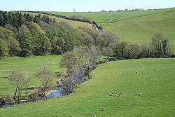 The River Mole below its confluence with the River Yeo. | |
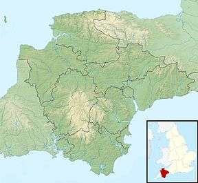 Location within Devon | |
| Location | |
| Country | England |
| Counties | Devon |
| District | North Devon |
| Towns | North Molton, South Molton |
| Physical characteristics | |
| Source | North Molton Ridge |
| ⁃ location | Twitchen, North Devon, Devon |
| ⁃ coordinates | 51°5′6.5″N 3°44′25″W |
| ⁃ elevation | 360 m (1,180 ft) |
| Mouth | River Taw |
⁃ location | Junction Pool, Devon |
⁃ coordinates | 50°56′30″N 03°54′24″W |
⁃ elevation | 6 m (20 ft) |
| Discharge | |
| ⁃ location | Woodleigh |
| ⁃ average | 8.70 m3/s (307 cu ft/s) |
| ⁃ minimum | 0.20 m3/s (7.1 cu ft/s)27 August 1976 |
| ⁃ maximum | 188.0 m3/s (6,640 cu ft/s)9 January 1968 |
Tributaries
- River Yeo
- Crooked Oak
- River Bray
- Little Silver Stream
See also
References
External links
This article is issued from Wikipedia. The text is licensed under Creative Commons - Attribution - Sharealike. Additional terms may apply for the media files.