Rifle Range, Penang
Rifle Range (Malay: Padang Tembak) is a residential neighbourhood within the city of George Town in Penang, Malaysia. Located within the Air Itam suburb, the neighbourhood lies 4.4 km (2.7 mi) west of the city centre and was completed in the 1970s.[1][2][3] Formerly a shooting range used by the British Army, low-cost flats were constructed within the area to provide affordable housing for the urban poor.
Rifle Range | |
|---|---|
| Other transcription(s) | |
| • Malay | Padang Tembak |
| • Chinese | 打枪埔 |
| • Hokkien | Phah-chhèng-pơ̄ |
 | |

| |
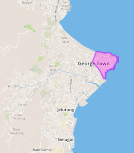 Rifle Range Location near George Town | |
| Coordinates: 5°24′38.2248″N 100°17′24.63″E | |
| Country | |
| State | |
| District | Northeast Penang Island |
| City | |
| Government | |
| • Local government | Penang Island City Council |
| • Mayor of Penang Island | Yew Tung Seang |
| • Kebun Bunga State Assemblyman | Ong Khan Lee (PKR) |
| • Bukit Bendera Member of Parliament | Wong Hon Wai (DAP) |
| Time zone | UTC+8 (MST) |
| • Summer (DST) | Not observed |
| Postal code | 11400, 11500 |
| Website | mbpp |
Etymology
Rifle Range was so named as the area was once used as a shooting range by the British Army and local police.[1][3]
History
Rifle Range, which was used by the military and the police as a shooting range during the British colonial era, was also the site where victims of the Imperial Japanese Army's Sook Ching massacres were buried.[4][5] During World War II, when Penang was under Japanese occupation, thousands of ethnic Chinese were brutally executed by the Japanese authorities and were buried in mass graves throughout Penang, including at Rifle Range. The remains of the victims would only be uncovered in the 1960s, when the construction of the Rifle Range flats was underway.
In 1964, the Malaysian federal government approved a pilot project to construct prefabricated high-rise housing at Rifle Range.[1][2] Six blocks of 17-storey flats and three blocks of 18-storey flats, which cumulatively contain 3,699 residential units and 66 shop lots, were to be assembled on-site using prefabricated concrete blocks. The construction of the flats, Penang's first low-cost high-rise housing project, was undertaken by the Penang Development Corporation.[1][2][3] The flats were completed in the 1970s.
Transportation
The major thoroughfares within the neighbourhood are Boundary Road and Rifle Range Road.[1][3][6] In addition, Rapid Penang bus routes 201, 202 and 204 include stops within Rifle Range.[7][8][9] These routes are complemented by Rapid Penang's Congestion Alleviation Transport (CAT) Air Itam route, a free-of-charge transit service within Air Itam.[10]
See also
References
- "The first low-cost high-rise flats built in the country were in Penang - Community | The Star Online". www.thestar.com.my. Retrieved 2018-01-21.
- "Home on the range". Home on the range. Retrieved 2018-01-21.
- "Rifle Range Market". Penang Trails. 2016-10-24. Retrieved 2018-01-21.
- "Malaysia's quiet remembrance - Asia Weekly - China Daily Asia". www.chinadailyasia.com. Retrieved 2018-01-21.
- "Old Penang: The Sook Ching massacres of World War II - anilnetto.com". anilnetto.com. 2013-10-06. Retrieved 2018-01-21.
- "Rifle Range – Penang's colourful time capsule - Views | The Star Online". www.thestar.com.my. Retrieved 2018-01-21.
- http://www.rapidpg.com.my/journey-planner/route-maps/details/201.gif
- http://www.rapidpg.com.my/journey-planner/route-maps/details/202.gif
- http://www.rapidpg.com.my/journey-planner/route-maps/details/204.gif
- "Rapid Penang". www.facebook.com. Retrieved 2018-04-01.
- "SK PADANG TEMBAK - PULAU PINANG - Carian Sekolah Malaysia". www.sekolahmy.com (in Malay). Retrieved 2018-01-21.