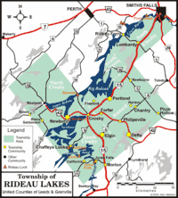
Rideau Lakes, Ontario
Rideau Lakes is a township located within Leeds and Grenville United Counties in Eastern Ontario, Canada. The township was incorporated on 1 January 1998 by amalgamating the former townships of North Crosby, South Crosby, Bastard, South Burgess and South Elmsley with the village of Newboro.[2]
Rideau Lakes | |
|---|---|
| Township of Rideau Lakes | |
 Municipal office | |
 | |
 Rideau Lakes | |
| Coordinates: 44°40′N 76°13′W | |
| Country | |
| Province | |
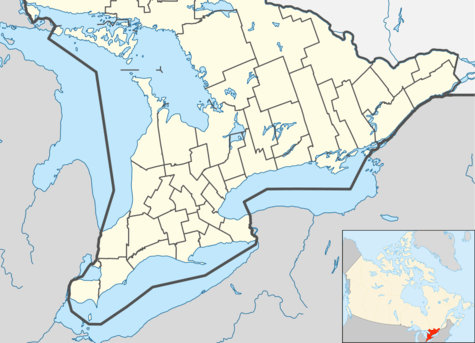
| County | Leeds and Grenville |
| Incorporated | 1 January 1998 |
| Government | |
| • Mayor | Arie Hoogenboom |
| • Federal riding | Leeds—Grenville—Thousand Islands and Rideau Lakes |
| • Prov. riding | Leeds—Grenville—Thousand Islands and Rideau Lakes |
| Area | |
| • Land | 729.09 km2 (281.50 sq mi) |
| Population (2011)[1] | |
| • Total | 10,207 |
| • Density | 14.0/km2 (36/sq mi) |
| Time zone | UTC-5 (EST) |
| • Summer (DST) | UTC-4 (EDT) |
| Postal Code | K0E |
| Area code(s) | 613 |
| Website | www.twprideaulakes.on.ca |
Rideau Lakes lies in the northwest corner of Leeds and Grenville, and is geographically the largest municipality in the county.
Farming, tourism, and service industries form the backbone of the local economy. The many tourist attractions in Rideau Lakes, including historic trails, the stone arch dam at Jones Falls, and the Rideau Waterway, are also an important part of the township's economy.
Rideau Lakes has 500 km (310 mi) of shoreline, excluding the Rideau Waterway. The waterway itself traverses the township, from the towering granite cliffs near Chaffeys Lock to the more gentle and pastoral areas of the Lower Rideau Lake.[3]
Communities
Rideau Lakes contains many villages and hamlets, including Chaffeys Lock, Chantry, Crosby, Daytown, Delta, Elgin, Forfar, Freeland, Harlem, Jones Falls, Lombardy, Morton, Newboro, Newboyne, Philipsville, Plum Hollow, Portland, Rideau Ferry, and Scotch Point. The township administrative offices are located in the hamlet of Chantry.
The independent village of Westport is entirely surrounded by Rideau Lakes, but is not part of the township.
The town of Smiths Falls is mostly located in Lanark County, while parts of the southern areas of the town is in the township of Rideau Lakes in the United Counties of Leeds and Grenville.
Newboro
A plaque was erected by the Ontario Heritage Foundation commemorating the founding of Newboro with the building of the Rideau Canal in 1826–32. Benjamin Tett settled here in 1833. He opened a store and later a post office. The community served as a major construction camp during the building of the Rideau Canal. Newboro was a trade centre for the region's lumbering industry and agriculture. The economic development of the community was enabled by the shipment of iron ore from local mines via the Rideau canal to smelters in Pittsburgh and Cleveland during the latter part of the 19th century.[4] The Village of Newboro was incorporated in 1876.
Chaffey's Lock
A plaque was erected by the Ontario Heritage Foundation commemorating the founding of Chaffey's Lock by Benjamin and Samuel Chaffey, who established mills here in 1820. Samuel Chaffey settling here shortly thereafter. The site included a distillery and saw, grist, carding, and fulling mills by 1827. The mills were flooded by the building of the Rideau Canal. A plaque was erected by the Chaffey's Lock and Area Heritage Society commemorating the founders, early builders, and all who have been part of the Chaffey's Lock community. Plaques have been erected by individuals and families on the Memory Wall, at Chaffey's Lock Cemetery.
The Queen's University Biological Station is located just southwest of Chaffey's Lock.
 Old school building in Crosby
 Elgin
Elgin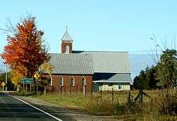 Lombardy
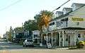 Newboro
Tourism and attractions
The Rideau Trail, a 300-km footpath from Kingston to Ottawa, passes through the township. The highest point on the trail is located in the Foley Mountain Conservation Area, which is located within the township. The Cataraqui Trail, a rail trail on a former Canadian National right-of-way, goes through the township, passing near Portland, Elgin, and Chaffey's Lock. The Old Stone Mill National Historic Site is located within the village of Delta.
Demographics
| Canada census – Rideau Lakes, Ontario community profile | |||
|---|---|---|---|
| 2011 | 2006 | ||
| Population: | 10,207 (-1.4% from 2006) | 10,350 (6.8% from 2001) | |
| Land area: | 729.09 km2 (281.50 sq mi) | 710.25 km2 (274.23 sq mi) | |
| Population density: | 14.0/km2 (36/sq mi) | 14.6/km2 (38/sq mi) | |
| Median age: | 47.1 (M: 46.7, F: 47.4) | ||
| Total private dwellings: | 6258 | 6468 | |
| Median household income: | $55,722 | ||
| References: 2011[5] 2006[6] earlier[7] | |||
Population trend:[8]
- Population in 2011: 10,207
- Population in 2006: 10,350
- Population in 2001: 9,687
- Population in 1996:
- Bastard and South Burgess Township: 2692
- Newboro Village: 291
- North Crosby Township: 1097
- South Crosby Township: 1910
- South Elmsley Township: 3574
- Population in 1991:
- Bastard and South Burgess Township: 2610
- Newboro Village: 282
- North Crosby Township: 968
- South Crosby Township: 1677
- South Elmsley Township: 3065
Mother tongue:[9]
- English as first language: 94.2%
- French as first language: 2.1%
- English and French as first language: 0.3%
- Other as first language: 3.4%
References
- "Rideau Lakes census profile". 2011 Census of Population. Statistics Canada. Retrieved 2012-02-14.
- Ontario Summary of Municipal Restructuring
- Township of Rideau Lakes
- http://www.heritagefdn.on.ca/userfiles/HTML/nts_1_5888_1.html Ontario Heritage Trust Founding of Newboro
- "2011 Community Profiles". 2011 Canadian Census. Statistics Canada. July 5, 2013. Retrieved 2012-02-14.
- "2006 Community Profiles". 2006 Canadian Census. Statistics Canada. March 30, 2011. Retrieved 2012-02-14.
- "2001 Community Profiles". 2001 Canadian Census. Statistics Canada. February 17, 2012.
- Statistics Canada: 1996, 2001, 2006 census
- Statistics Canada 2006 Census - Rideau Lakes community profile
External links
Places adjacent to Rideau Lakes, Ontario | |
|---|---|