Richfield, Minnesota
Richfield is a city in Hennepin County, Minnesota, United States. An inner-ring suburb of the Minneapolis–Saint Paul region, it is bordered by Minneapolis to the north, Minneapolis–Saint Paul International Airport to the east, Bloomington to the south, and Edina to the west. Best Buy, the U.S.'s largest electronics retailer, has its headquarters in Richfield. The population was 35,228 at the 2010 census.[6]
Richfield | |
|---|---|
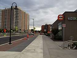 Corner of 66th St and Lyndale Avenue in downtown Richfield | |
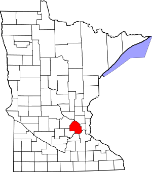
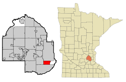 Location of Richfield within Hennepin County, Minnesota | |
| Coordinates: 44°52′55″N 93°16′06″W | |
| Country | United States |
| State | Minnesota |
| County | Hennepin |
| Founded | 1850s |
| Incorporated | 1908 |
| Government | |
| • Type | Village-manager[1] |
| • Mayor | Maria Regan Gonzalez |
| Area | |
| • City | 6.86 sq mi (17.76 km2) |
| • Land | 6.72 sq mi (17.41 km2) |
| • Water | 0.14 sq mi (0.35 km2) 2.00% |
| Elevation | 840 ft (256 m) |
| Population | |
| • City | 35,228 |
| • Estimate (2019)[4] | 36,354 |
| • Density | 5,378.81/sq mi (2,076.68/km2) |
| • Metro | 3,524,583 (US: 16th) |
| Time zone | UTC-6 (CST) |
| • Summer (DST) | UTC-5 (CDT) |
| ZIP code | 55423 |
| Area code(s) | 612 |
| FIPS code | 27-54214 |
| GNIS feature ID | 0650061[5] |
| Website | www.richfieldmn.gov |
History

In the 1820s, some small settlements developed around Fort Snelling. By the late 1830s, the fortress served as a destination for newcomers—lumbermen, missionaries, farmers, traders and travelers—migrating to the borderlands people were now calling "Minisota."[7] Minnesotan Franklin Steele first reached the area in 1837 where he worked as a sutler, selling goods to soldiers.[8]
Fort Snelling's garrison made up the bulk of the area's population,[9] along with Henry Sibley and Alexander Faribault's seventy-five person American Fur Company operation. Other small settlements of traders, farmers, missionaries and refugees began to develop outside the walls of the fort, some with permission, some without. These residents built communities on land that would become known as Richfield.
The fields of Richfield proved bountiful for the settlers. Early crops included corn, wheat and oats. Wheat immediately became the “cash” crop, sold in the area's first major market, St. Paul. Those in the southern parts of Hennepin County found it more profitable to haul their wheat crop to St. Paul than to the St. Anthony Falls district. This occurred in the days before “King Wheat” and the evolution of Minneapolis into a milling center.[10]
- Market gardening
Minneapolis became a favorite trading point for market gardeners in 1897 with the building of the modern, covered Second Street Market just two blocks west of Hennepin Avenue and Bridge Square. The market featured a massive platform for gardeners, including Richfield's sizable contingent, to unload and display produce. The new system freed streets from traffic snarls by allowing each person to unhitch and put up their horses, while their wagon was backed into an assigned space. Wholesale customers could then bring their teams to the platform and start negotiating prices when the starting bell sounded.[11]
Richfield Township is established
One of the first settlers to the area was Riley Bartholomew, a former general in the Ohio Militia. He became a Richfield Justice of the Peace and a Minnesota State Senator. Bartholomew built a house on the east shore of Wood Lake in 1852, and the restored Riley Lucas Bartholomew House is listed on the National Register of Historic Places. Today, the house and site are maintained by the Richfield Historical Society.
The Harmony post office, south of the Richland Mill on today's Lyndale Avenue, opened in 1854. Postmaster James Dunsmoor named the mail center after his hometown in Maine.[12] Richfield farmers looked on the metropolis to its north as their marketing target. They helped supply its restaurants, hotels, grocers and citizens with fresh produce, with enough left over to ship by railroad to other cities.[13]
On May 11, 1858, the Territory of Minnesota received approval from Congress to become the thirty second state to join the union. That same day, local citizens met in a schoolhouse at present-day 53rd and Lyndale, to form a municipal government. At that first meeting of the town electors, those who previously referred to themselves as living in Harmony or Richland Mills chose the name of Richfield for their community.[14][15]
Settlers from Maine made up 35 percent of the total number of U.S.-born adults (eighteen years old or older) in 1860 Richfield. New York immigrants, at 21 percent, were a notable but distant second. Immigrants from Ireland, numbering 58, represented half of the 119 adults from other nations. Just three of Richfield's citizens had been born in Minnesota.[16]
Boundary changes
Today's boundaries differ markedly from those originally set forth on April 10, 1858, by the Hennepin County Board of Commissioners when they established the towns of Richland, Minneapolis, Bloomington and Eden Prairie. The boundaries of Richfield included about sixty-three square miles. Richfield originally ranged to Minneapolis's Lake Street on the north, to what is now Highway 169 on the west, to Bloomington on the south, and to Fort Snelling and the Minnesota and Mississippi rivers on the east.[17]
Parts of Richfield were later lost to neighboring towns or villages through annexation. An 1886 partition of Richfield created the village of St. Louis Park, and a later division approved April 5, 1889, produced the village of Edina. Minneapolis absorbed sizeable portions of Richfield territory through legislative action or annexations in 1867, 1883, 1887 and 1927. The growth of Twin Cities International Airport during the last half of the twentieth century along with additions of land to the Fort Snelling compound meant further reductions.[18]
20th century
In 1908 that Richfield became a village. From 1908 until 1950, Richfield's local government consisted of a president, three trustees, and a city clerk. On November 7, 1950, residents voted for a city manager form of government, meaning the city had a Mayor, four council members, and one City Manager. This is still the form of government used today. Richfield's first mayor was Clarence Christian, who began serving in 1951, but served as president under the old format dating back to 1948. By the late 1940s, the city's population started increasing rapidly as farmland was sold to developers who were building homes for veterans returning from World War II. In 1955, the Richfield Chamber of Commerce was formed and has been deeply involved in the development, as well as the redevelopment, of the community since that time.[19]
Over the years, populations of all nearby communities increased and after World War II, Richfield flourished with commuters to Twin Cities jobs. As of 2019, Richfield has a population of about 35,000 residents who live within seven square miles of neighborhoods, parks, and shops.
Geography
According to the United States Census Bureau, the city has a total area of 7.01 square miles (18.16 km2), of which 6.87 square miles (17.79 km2) is land and 0.14 square miles (0.36 km2) is water.[20]
Interstates 35W and 494 and Minnesota State Highways 62 and 77 are four of the main routes in the city. Other main routes include 66th Street.
The majority of the 10,000 single-family homes were constructed in the 1950s, and the 5,000 apartments date from the 1960s and early 1970s. The Richfield Rediscovered Housing Program has established an environment of change in the community as it encourages home remodeling, expansion, and reconstruction. The program is gradually changing the face of Richfield's residential neighborhoods, upgrading them from small, post-WWII styles to larger homes.
| Richfield Land Use Areas (2005) | |||
|---|---|---|---|
| Land Use | Specific | Acres | Percent |
| Total City Area | 4569.4 | 100 | |
| Streets and Highways | 1249.6 | 27.3 | |
| Net Land Use Area | 3319.8 | 72.7 | |
| Total Residential | Total Residential Area | 2396.9 | 52.4 |
| Single Family | 2170.8 | 47.5 | |
| Two Family | 35.0 | 0.8 | |
| Town Housing | 3.4 | 0.07 | |
| Multi-family | 182.2 | 4.0 | |
| Care housing | 5.5 | 0.1 | |
| Total Non-Residential | Total Non-Residential Area | 922.3 | 20.2 |
| Commercial | 205.0 | 4.5 | |
| Public | 16.8 | 0.4 | |
| Quasi Public | 40.4 | 0.9 | |
| Church | 56.6 | 1.2 | |
| School | 109.2 | 2.4 | |
| Park | 468.6 | 10.3 | |
| Railroad | 11.8 | 0.3 | |
| Vacant | 13.9 | 0.3 | |
Economy
Business
.jpg)
Best Buy Company, Inc. moved its corporate headquarters into the city in 2003, becoming the largest employer in Richfield.[21]
Job growth in Richfield has reached unprecedented levels in recent years.[22] From the first quarter of 2001 to the first quarter of 2003, net job growth equaled 2,444 – the second highest in the metropolitan area. Additionally, total employment in Richfield jumped from 10,090 to nearly 15,000 between 1995 and 2005.[23]
In 2007, Cedar Point Commons opened in Richfield at Cedar Avenue and 66th Street, adjacent to Minneapolis–Saint Paul International Airport. SuperTarget and The Home Depot serve as its anchor tenants.[24]
Top employers
According to the City's 2014 Comprehensive Annual Financial Report,[25] the top employers in the city are:
| # | Employer | # of Employees |
|---|---|---|
| 1 | Best Buy (HQ) | 4,500 |
| 2 | US Bank | 2,400 |
| 3 | Richfield Public Schools | 682 |
| 4 | Target | 394 |
| 5 | Metro Sales Inc. (HQ) | 294 |
| 6 | Menards | 207 |
| 7 | DCM Services | 205 |
| 8 | Fraser School | 203 |
| 9 | City of Richfield | 191 |
| 10 | Weis Builders | 180 |
Education
Richfield has public schools, private schools, alternative education programs, and post-secondary options.[26]
Public schools
The school district, Independent School District 280, serves about 4,200 students in Richfield and part of Edina in grades K-12. Richfield schools are divided into elementary schools, middle schools, and high schools.[27]
Four elementary schools serve primary students in grades K-5: Centennial Elementary; Sheridan Elementary; R-STEM Elementary, which focuses its curriculum on science, technology, engineering, and math; and RDLS Elementary, a dual language school which teaches students in both English and Spanish.
Students in grades 6-8 attend Richfield Middle School.[28] Richfield High School serves approximately 1400 students in grades 9-12.[29]
Outside of the school district there is Watershed High School.
Private schools
- Academy of Holy Angels, a Catholic, co-educational high school that serves over 800 students in grades 9-12
- The Fraser School, serving children six-weeks to six-years old
- Blessed Trinity Catholic School
- Seven Hills Preparatory Academy[30]
- Mount Calvary Lutheran School
- Minnesota Japanese School
- Augsburg Park Montessori School
Post-secondary
- Adler Graduate School
- Globe University/Minnesota School of Business, a career college
- Minnesota Life College
Recreation
Richfield has more than 450 acres (1.8 km2) of parkland, 23 neighborhood parks and a nature preserve.[31] Wood Lake Nature Center is a 150-acre (0.6 km2) park operated by the city of Richfield that features wetlands, walking paths and an interpretive center. When the Nature Center opened in 1971, it was one of the first urban nature centers in the United States, and is currently home to more than 200 different kinds of birds and 30 mammals.[32]
Richfield's Ice Arena has two full-size indoor skating rinks. Hockey games, figure skating, broom ball games, open skating, and community events all take place in this facility.[33] Located near the ice arena is Richfield's outdoor pool. Renovated in 2003, the swim complex features a 50-meter competitive pool, wading pool, and a 28-foot (9 m) double waterslide.[34]
Demographics
| Historical population | |||
|---|---|---|---|
| Census | Pop. | %± | |
| 1860 | 866 | — | |
| 1870 | 930 | 7.4% | |
| 1880 | 1,501 | 61.4% | |
| 1890 | 1,324 | −11.8% | |
| 1900 | 1,537 | 16.1% | |
| 1910 | 2,673 | 73.9% | |
| 1920 | 2,411 | −9.8% | |
| 1930 | 1,301 | −46.0% | |
| 1940 | 3,778 | 190.4% | |
| 1950 | 17,502 | 363.3% | |
| 1960 | 42,523 | 143.0% | |
| 1970 | 47,231 | 11.1% | |
| 1980 | 37,851 | −19.9% | |
| 1990 | 35,710 | −5.7% | |
| 2000 | 34,439 | −3.6% | |
| 2010 | 35,228 | 2.3% | |
| Est. 2019 | 36,354 | [4] | 3.2% |
| U.S. Decennial Census[35][note 1]
2018 Estimate[37] | |||
2010 census
As of the census[3] of 2010, there were 35,228 people, 14,818 households, and 8,420 families living in the city. The population density was 5,127.8 inhabitants per square mile (1,979.9/km2). There were 15,735 housing units at an average density of 2,290.4 per square mile (884.3/km2). The racial makeup of the city was 69.8% White, 9.2% African American, 0.8% Native American, 6.1% Asian, 0.1% Pacific Islander, 10.4% from other races, and 3.5% from two or more races. Hispanic or Latino of any race were 18.3% of the population.
There were 14,818 households of which 26.7% had children under the age of 18 living with them, 41.2% were married couples living together, 10.8% had a female householder with no husband present, 4.9% had a male householder with no wife present, and 43.2% were non-families. 34.3% of all households were made up of individuals and 12.9% had someone living alone who was 65 years of age or older. The average household size was 2.35 and the average family size was 3.05.
The median age in the city was 36.2 years. 21.3% of residents were under the age of 18; 8.5% were between the ages of 18 and 24; 31.4% were from 25 to 44; 24.7% were from 45 to 64; and 14.2% were 65 years of age or older. The gender makeup of the city was 49.2% male and 50.8% female.
2000 census
As of the census of 2000, there were 34,439 people, 15,073 households, and 8,727 families living in the city. The population density was 4,993.9 people per square mile (1,927.1/km²). There were 15,357 housing units at an average density of 2,226.9 per square mile (859.3/km²). The racial makeup of the city was 81.25% White, 6.65% African American, 0.72% Native American, 5.30% Asian, 0.04% Pacific Islander, 3.41% from other races, and 2.64% from two or more races. Hispanic or Latino of any race was 6.27% of the population.
There were 15,073 households out of which 24.4% had children under the age of 18 living with them, 43.4% were married couples living together, 10.5% had a female householder with no husband present, and 42.1% were non-families. 33.7% of all households were made up of individuals and 12.0% had someone living alone who was 65 years of age or older. The average household size was 2.25 and the average family size was 2.89.
In the city, the population was spread out with 20.2% under the age of 18, 9.3% from 18 to 24, 33.4% from 25 to 44, 20.7% from 45 to 64, and 16.4% who were 65 years of age or older. The median age was 37 years. For every 100 females, there were 96.2 males. For every 100 females age 18 and over, there were 93.0 males.
The median income for a household in the city was $45,519, and the median income for a family was $56,434. Males had a median income of $38,417 versus $29,909 for females. The per capita income for the city was $24,709. About 3.9% of families and 6.3% of the population were below the poverty line, including 8.3% of those under age 18 and 3.8% of those age 65 or over.
Politics
The current Mayor of Richfield is Maria Regan Gonzalez, who is the first Latina mayor in Minnesota history. She was preceded by Pat Elliot. Maria Regan Gonzalez was a councilwoman in Ward 3 before being elected in 2018.
Richfield has five city council members, which include Mary Supple (Council At-Large), Simon Trautmann (Council Ward One), Edwina Garcia (Council Ward Two), and Ben Whalen (Council Ward Three) and Mayor Regan Gonzalez.[38] At the state level, Richfield is represented by DFLers, including state Sen. Patricia Torres Ray[39] and state representatives Jean Wagenius[40] and Michael Howard.[41] The city is located in Minnesota's 5th congressional district, represented by Ilhan Omar, a Democrat.
Notable people
- Steve Christoff – member of the 1980 USA men's hockey team that won the gold medal in the Miracle on Ice
- Larry Fitzgerald - football player
- Donald F. Gleason – American physician and pathologist, best known for devising the "Gleason score" of prostate cancer
- Darby Hendrickson – Former NHL player
- Jessica January - WNBA player
- Richard Kruger - Current CEO of Imperial Oil, former Vice President of ExxonMobil
- Charles W. Lindberg – U.S. Marine
- Bill Mack – Sculptor, Artist
- Damian Rhodes - hockey player
- Chad Smith – Red Hot Chili Peppers drummer
- Will Steger – Arctic explorer and environmentalist
- Christopher Tjornhom - Minnesota state legislator
- Miss Richfield 1981 - Theater Permorfer
Notes
- Population figures for 1930 and 1940 were corrected in the 1950 census by excluding the Fort Snelling count.[36]
References
- "About Richfield". City of Richfield, MN. Retrieved Dec 19, 2019.
- "2017 U.S. Gazetteer Files". United States Census Bureau. Retrieved Jan 3, 2019.
- "U.S. Census website". United States Census Bureau. Retrieved 2012-11-13.
- "Population and Housing Unit Estimates". Retrieved May 21, 2020.
- "US Board on Geographic Names". United States Geological Survey. 2007-10-25. Retrieved 2008-01-31.
- "2010 Census Redistricting Data (Public Law 94-171) Summary File". American FactFinder. U.S. Census Bureau, 2010 Census. Retrieved 23 April 2011.
- William Watts Folwell, A History of Minnesota 1:455-57,(St. Paul: Minnesota Historical Society). 1921 reprint 1956
- Rodney C. Loehr. "Franklin Steele, Frontier Businessman." Minnesota History 27 (December 1946): 312-314.
- Holcombe. Minnesota as a Territory, (Mankato: Publishing Society of Minnesota) 2:96. Folwell, A History of Minnesota, 1:503-515
- Attwater and Stevens, History of Minneapolis and Hennepin County, Minnesota 1413-1414. Richfield's George Odell wrote his town's history in the Atwater and Stevens book. Minnesota Farmer and Gardener, Lyman M. Ford and John H. Stevens, ed., No. 1. Nov. 18, 1860, 13. Letter from H. H. Hopkins in the December 1860 issue. pages 60-61.
- The new Second Street Market at 2nd Street and 2nd Avenue North is praised in the Minneapolis monthly magazine The Market garden: Journal for the Gardener and Trucker, 4 (Market 1897): 3.
- Johnson, Fred, Richfield, Minnesota's Oldest Suburb 14, (Richfield: Richfield Historical Society Press). Balcom, Early Richfield History 16-17.
- Johnson, Fred, Richfield, Minnesota's Oldest Suburb 37, (Richfield: Richfield Historical Society Press).
- History of Richfield Archived 2005-12-01 at the Wayback Machine, City of Richfield Website
- On April 10, 1858, the Hennepin County Board of Commissioners established a number of towns including "Richland." Folwell History of Minnesota. II: 10-11. Records of the Town of Richfield, County of Hennepin, State of Minnesota, See minutes of the May 11, 1858, meeting.
- Richfield History, Community Profile
- Johnson, Fred, Richfield, Minnesota's Oldest Suburb 14, (Richfield: Richfield Historical Society Press). David J. Butler. "Did the Town of Richfield ever extend as far north as Franklin Avenue?" Richfield Historical Society Bulletin, (Summer 2006):3-4. Balcom, Early Richfield History
- Johnson, Fred, Richfield, Minnesota's Oldest Suburb 1, (Richfield: Richfield Historical Society Press).
- Richfield Historical Society's web site
- "US Gazetteer files 2010". United States Census Bureau. Archived from the original on January 12, 2012. Retrieved 2012-11-13.
- Best Buy Corporate Office Headquarters
- Richfield Jobs (MN) | Simply Hired
- Richfield Community Profile
- Cedar Point Commons Archived 2009-06-24 at the Wayback Machine
- City of Richfield CAFR
- rSchooltoday
- Richfield District
- Richfield Middle
- Richfield High School
- cmhehre. "Richfield Campus". Seven Hills Preparatory Academy. Retrieved 2019-03-13.
- "Parks". City of Richfield, Minnesota. Archived from the original on 14 May 2013. Retrieved 18 August 2013.
- "Woodlake Nature Center". City of Richfield, Minnesota. Archived from the original on 14 May 2013. Retrieved 18 August 2013.
- "Ice Arena". City of Richfield, Minnesota. Archived from the original on 21 March 2014. Retrieved 18 August 2013.
- "Outdoor Pool". City of Richfield, Minnesota. Archived from the original on 12 May 2015. Retrieved 18 August 2013.
- United States Census Bureau. "Census of Population and Housing". Retrieved June 15, 2013.
- "Number of Inhabitants - Minnesota" (PDF). 1950 Census of Population. United States Census Bureau.
- "Population Estimates". United States Census Bureau. Retrieved June 8, 2018.
- "City of Richfield Directory of Officials".
- "Minnesota State Senate". www.senate.mn. Retrieved 2019-03-13.
- "Rep. Jean Wagenius (63B) - Minnesota House of Representatives". www.house.leg.state.mn.us. Retrieved 2019-03-13.
- "Rep. Michael Howard (50A) - Minnesota House of Representatives". www.house.leg.state.mn.us. Retrieved 2019-03-13.
Further reading
- Johnson, Frederick L. (2008). Richfield: Minnesota's Oldest Suburb. Richfield Historical Society. ISBN 978-1-60585-636-0.
- Smetanka, Mary Jane (11 February 2008). "Richfield, the state's 'oldest suburb'". Star Tribune.
External links
| Wikimedia Commons has media related to Richfield, Minnesota. |
| Wikivoyage has a travel guide for Richfield, Minnesota. |
Municipalities and communities of Hennepin County, Minnesota, United States | ||
|---|---|---|
| Cities |
|  Map of Minnesota highlighting Hennepin County |
| Unorganized territory | ||
| Footnotes | ‡This populated place also has portions in an adjacent county or counties | |
| Authority control |
|
|---|