Raymond, Iowa
Raymond is a city in Black Hawk County, Iowa, United States. The population was 788 at the 2010 census. It is part of the Waterloo–Cedar Falls Metropolitan Statistical Area.
Raymond, Iowa | |
|---|---|
 | |
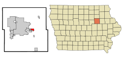 Location of Raymond, Iowa | |
| Coordinates: 42°28′6″N 92°13′16″W | |
| Country | |
| State | |
| County | Black Hawk |
| Area | |
| • Total | 1.63 sq mi (4.22 km2) |
| • Land | 1.63 sq mi (4.22 km2) |
| • Water | 0 sq mi (0 km2) |
| Elevation | 909 ft (277 m) |
| Population | |
| • Total | 788 |
| • Estimate (2018)[3] | 802 |
| • Density | 483/sq mi (186.6/km2) |
| Time zone | UTC-6 (Central (CST)) |
| • Summer (DST) | UTC-5 (CDT) |
| ZIP code | 50667 |
| Area code(s) | 319 |
| FIPS code | 19-65820 |
| GNIS feature ID | 0460541 |
History
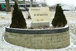
Raymond was platted in 1867. It was a shipping point on the Illinois Central Railroad.[4]
Geography
Raymond is located at 42°28′6″N 92°13′16″W (42.468381, -92.221178).[5]
According to the United States Census Bureau, the city has a total area of 1.63 square miles (4.22 km2), all land.[1]
Demographics
| Historical populations | ||
|---|---|---|
| Year | Pop. | ±% |
| 1880 | 122 | — |
| 1960 | 378 | +209.8% |
| 1970 | 582 | +54.0% |
| 1980 | 655 | +12.5% |
| 1990 | 619 | −5.5% |
| 2000 | 537 | −13.2% |
| 2010 | 788 | +46.7% |
| 2018 | 802 | +1.8% |
| Source:"U.S. Census website". United States Census Bureau. Retrieved 2020-03-29. and Iowa Data Center Source: | ||
2010 census
As of the census[2] of 2010, there were 788 people, 313 households, and 238 families living in the city. The population density was 483.4 inhabitants per square mile (186.6/km2). There were 320 housing units at an average density of 196.3 per square mile (75.8/km2). The racial makeup of the city was 97.1% White, 0.9% African American, 0.5% Asian, 0.1% Pacific Islander, 0.5% from other races, and 0.9% from two or more races. Hispanic or Latino of any race were 1.0% of the population.
There were 313 households of which 32.9% had children under the age of 18 living with them, 67.4% were married couples living together, 5.1% had a female householder with no husband present, 3.5% had a male householder with no wife present, and 24.0% were non-families. 20.8% of all households were made up of individuals and 7.4% had someone living alone who was 65 years of age or older. The average household size was 2.52 and the average family size was 2.91.
The median age in the city was 40.4 years. 23.1% of residents were under the age of 18; 6.3% were between the ages of 18 and 24; 27.9% were from 25 to 44; 29.4% were from 45 to 64; and 13.3% were 65 years of age or older. The gender makeup of the city was 49.1% male and 50.9% female.
2000 census
As of the census[7] of 2000, there were 537 people, 204 households, and 161 families living in the city. The population density was 348.5 people per square mile (134.6/km²). There were 206 housing units at an average density of 133.7 per square mile (51.6/km²). The racial makeup of the city was 98.51% White, 0.56% from other races, and 0.93% from two or more races. Hispanic or Latino of any race were 1.68% of the population.
There were 204 households out of which 33.8% had children under the age of 18 living with them, 69.1% were married couples living together, 7.4% had a female householder with no husband present, and 20.6% were non-families. 18.1% of all households were made up of individuals and 6.9% had someone living alone who was 65 years of age or older. The average household size was 2.63 and the average family size was 2.98.
26.4% are under the age of 18, 5.4% from 18 to 24, 28.5% from 25 to 44, 26.6% from 45 to 64, and 13.0% who were 65 years of age or older. The median age was 38 years. For every 100 females, there were 96.0 males. For every 100 females age 18 and over, there were 93.6 males.
The median income for a household in the city was $47,813, and the median income for a family was $55,417. Males had a median income of $39,306 versus $25,192 for females. The per capita income for the city was $22,201. About 3.3% of families and 3.6% of the population were below the poverty line, including 8.1% of those under age 18 and none of those age 65 or over.
Education
Raymond is within the Waterloo Community School District.[8]
See also
William Waterfield House is on the National Register of Historic Places listings in Black Hawk County, Iowa.
References
- "US Gazetteer files 2010". United States Census Bureau. Archived from the original on 2012-01-25. Retrieved 2012-05-11.
- "U.S. Census website". United States Census Bureau. Retrieved 2012-05-11.
- "Population and Housing Unit Estimates". Retrieved February 29, 2020.
- Hartman, John C. (1915). History of Black Hawk County, Iowa, and Its People, Volume 1. S. J. Clarke Publishing Company. p. 307.
- "US Gazetteer files: 2010, 2000, and 1990". United States Census Bureau. 2011-02-12. Retrieved 2011-04-23.
- "Census of Population and Housing". Census.gov. Retrieved June 4, 2015.
- "U.S. Census website". United States Census Bureau. Retrieved 2008-01-31.
- "Waterloo" (PDF). Iowa Department of Education. Retrieved 2019-07-15.
External links
| Wikimedia Commons has media related to Raymond, Iowa. |
- City Data Comprehensive Statistical Data and more about Raymond
Municipalities and communities of Black Hawk County, Iowa, United States | ||
|---|---|---|
| Cities | Map of Iowa highlighting Black Hawk County | |
| Townships | ||
| CDP | ||
| Other unincorporated communities | ||
| Footnotes | ‡This populated place also has portions in an adjacent county or counties | |