La Porte City, Iowa
La Porte City is a city in Black Hawk County, Iowa, United States. The population was 2,285 at the 2010 census. It is part of the Waterloo–Cedar Falls Metropolitan Statistical Area.
La Porte City, Iowa | |
|---|---|
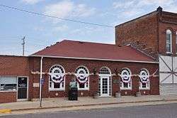 La Porte City's City Hall | |
 Location of La Porte City, Iowa | |
| Coordinates: 42°18′49″N 92°11′18″W | |
| Country | |
| State | |
| County | Black Hawk |
| Area | |
| • Total | 2.62 sq mi (6.79 km2) |
| • Land | 2.55 sq mi (6.60 km2) |
| • Water | 0.07 sq mi (0.18 km2) |
| Elevation | 830 ft (253 m) |
| Population | |
| • Total | 2,285 |
| • Estimate (2018)[3] | 2,259 |
| • Density | 896/sq mi (346.0/km2) |
| Time zone | UTC-6 (Central (CST)) |
| • Summer (DST) | UTC-5 (CDT) |
| ZIP code | 50651 |
| Area code(s) | 319 |
| FIPS code | 19-43365 |
| GNIS feature ID | 0458156 |
History
La Porte City was platted in 1855. It is named after La Porte, Indiana, the former home of one of its founders.[4]
Geography
La Porte City is located at 42°18′49″N 92°11′18″W (42.313606, -92.188291).[5]
According to the United States Census Bureau, the city has a total area of 2.62 square miles (6.79 km2), of which 2.55 square miles (6.60 km2) is land and 0.07 square miles (0.18 km2) is water.[1]
Demographics
| Historical populations | ||
|---|---|---|
| Year | Pop. | ±% |
| 1880 | 1,006 | — |
| 1890 | 1,052 | +4.6% |
| 1900 | 1,419 | +34.9% |
| 1910 | 1,233 | −13.1% |
| 1920 | 1,443 | +17.0% |
| 1930 | 1,470 | +1.9% |
| 1940 | 1,594 | +8.4% |
| 1950 | 1,770 | +11.0% |
| 1960 | 1,953 | +10.3% |
| 1970 | 2,256 | +15.5% |
| 1980 | 2,324 | +3.0% |
| 1990 | 2,128 | −8.4% |
| 2000 | 2,275 | +6.9% |
| 2010 | 2,285 | +0.4% |
| 2018 | 2,259 | −1.1% |
| Source:"U.S. Census website". United States Census Bureau. Retrieved 2020-03-29. and Iowa Data Center Source: | ||
2010 census
As of the census[2] of 2010, there were 2,285 people, 915 households, and 601 families living in the city. The population density was 896.1 inhabitants per square mile (346.0/km2). There were 996 housing units at an average density of 390.6 per square mile (150.8/km2). The racial makeup of the city was 97.8% White, 0.8% African American, 0.1% Native American, 0.2% Asian, 0.1% from other races, and 1.0% from two or more races. Hispanic or Latino of any race were 1.0% of the population.
There were 915 households of which 34.5% had children under the age of 18 living with them, 52.6% were married couples living together, 9.6% had a female householder with no husband present, 3.5% had a male householder with no wife present, and 34.3% were non-families. 29.9% of all households were made up of individuals and 15.3% had someone living alone who was 65 years of age or older. The average household size was 2.45 and the average family size was 3.04.
The median age in the city was 39.6 years. 27% of residents were under the age of 18; 5.5% were between the ages of 18 and 24; 24.9% were from 25 to 44; 24.4% were from 45 to 64; and 18.3% were 65 years of age or older. The gender makeup of the city was 47.0% male and 53.0% female.
2000 census
As of the census[7] of 2000, there were 2,275 people, 936 households, and 643 families living in the city. The population density was 866.3 people per square mile (334.0/km²). There were 980 housing units at an average density of 373.2 per square mile (143.9/km²). The racial makeup of the city was 99.16% White, 0.13% African American, 0.22% Native American, 0.09% Asian, 0.04% from other races, and 0.35% from two or more races. Hispanic or Latino of any race were 0.22% of the population.
There were 936 households out of which 33.0% had children under the age of 18 living with them, 55.7% were married couples living together, 10.6% had a female householder with no husband present, and 31.3% were non-families. 28.2% of all households were made up of individuals and 16.5% had someone living alone who was 65 years of age or older. The average household size was 2.43 and the average family size was 2.97.
In the city, the population was spread out with 26.4% under the age of 18, 8.0% from 18 to 24, 26.3% from 25 to 44, 20.7% from 45 to 64, and 18.6% who were 65 years of age or older. The median age was 37 years. For every 100 females, there were 91.3 males. For every 100 females age 18 and over, there were 86.3 males.
The median income for a household in the city was $37,540, and the median income for a family was $46,544. Males had a median income of $31,629 versus $22,133 for females. The per capita income for the city was $19,266. About 4.1% of families and 6.2% of the population were below the poverty line, including 6.6% of those under age 18 and 7.5% of those age 65 or over.
Education
Union Community School District serves the municipality.[8] The district was established on July 1, 1993 by the merger of the La Porte City Community School District and the Dysart-Geneseo Community School District.[9]
Notable people
- Fran Allison, old-time radio and early TV personality
- Patrick Bedard, automotive journalist and driver in the 1983 & 1984 Indianapolis 500
- Peg Mullen (1917–2009), anti-war activist and writer.[10]
References
- "US Gazetteer files 2010". United States Census Bureau. Archived from the original on 2012-01-25. Retrieved 2012-05-11.
- "U.S. Census website". United States Census Bureau. Retrieved 2012-05-11.
- "Population and Housing Unit Estimates". Retrieved December 18, 2019.
- Hartman, John C. (1915). History of Black Hawk County, Iowa, and Its People, Volume 1. S. J. Clarke Publishing Company. p. 287.
- "US Gazetteer files: 2010, 2000, and 1990". United States Census Bureau. 2011-02-12. Retrieved 2011-04-23.
- "Census of Population and Housing". Census.gov. Retrieved June 4, 2015.
- "U.S. Census website". United States Census Bureau. Retrieved 2008-01-31.
- Iowa Department of Education. "Union" (PDF). Retrieved 2019-08-01.
- "REORGANIZATION & DISSOLUTION ACTIONS SINCE 1965-66" (PDF). Iowa Department of Education. Archived from the original (PDF) on 2019-02-09. Retrieved 2019-08-01.
- Martin, Douglas. "Peg Mullen, 92, Who Fanned Her Anger Over Son’s Death Into Antiwar Drive, Dies", The New York Times, October 5, 2009. Accessed October 6, 2009.
Municipalities and communities of Black Hawk County, Iowa, United States | ||
|---|---|---|
| Cities | Map of Iowa highlighting Black Hawk County | |
| Townships | ||
| CDP | ||
| Other unincorporated communities | ||
| Footnotes | ‡This populated place also has portions in an adjacent county or counties | |
| Authority control |
|
|---|