Ras Atiya
Ras Atiya (Arabic: رأس عطيّه; Hebrew: ראס עטיה) is a Palestinian town in the Qalqilya Governorate in the western area of the West Bank, located 27 km south of Tulkarm and 11 km south of Qalqiliya. According to the Palestinian Central Bureau of Statistics, the village had a population of approximately 1,599 inhabitants in 2006.[3]
Ras Atiya | |
|---|---|
| Arabic transcription(s) | |
| • Arabic | رأس عطيّه خربة رأس عطيّه |
| • Latin | Ras Atiya (official) Khirbat Ras Atiya (unofficial) |
 | |
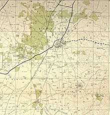
 Ras Atiya Location of Ras Atiya within Palestine | |
| Coordinates: 32°09′31.32″N 34°59′26.89″E | |
| Palestine grid | 149/174 |
| State | State of Palestine |
| Governorate | Qalqilya |
| Government | |
| • Type | Village council |
| Population (2006) | |
| • Total | 1,599 |
| Name meaning | Râs ’Atîyeh: "The hill-top of ’Ata"[1] Kh. Ras et Tireh: "The ruin of the hill-top of the fort of Tireh"[2] |
Location
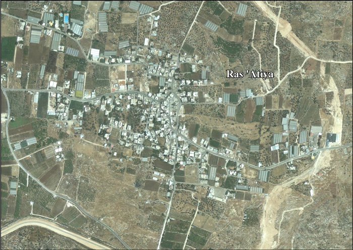
Ras ‘Atiya (including Ras at Tira and Wadi ar Rasha) is located 4-5 km south of Qalqiliya. It is bordered by ‘Izbat al Ashqar to the east, Ad Dab’a to the east and south, ‘Izbat Jalud and Al Mudawwar to the south, Habla to the west, and An Nabi Elyas and ‘Arab Abu Farda to the north.[4]
History
In 1882, the PEF's Survey of Western Palestine found at Kh. Ras et Tireh: "walls and cisterns."[5]
Jordanian era
In the wake of the 1948 Arab–Israeli War, and after the 1949 Armistice Agreements, the area came under Jordanian rule.
In 1961, the population was 224.[6]
Post-1967
After the Six-Day War in 1967, the area has been under Israeli occupation.
After the 1995 accords, 32.2 % of Ras 'Atiya land is defined as Area B, while the remainder 67.8 % is Area C.[7] Under the same accord, 5% of Ras al-Tira land is defined as Area B, while the remainder 95 % is Area C,[7] while 100% of Wadi ar Rasha land is Area C,[7]
Israel has confiscated 51 dunams of land from Ras at Tira in order to construct the Israeli settlement of Alfei Menashe.[8]
References
- Palmer, 1881, p. 240
- Palmer, 1881, p. 236
- Projected Mid -Year Population for Qalqiliya Governorate by Locality 2004- 2006 Palestinian Central Bureau of Statistics
- Ras ‘Atiya Village Profile (including Ras at Tira & Wadi ar Rasha Localities), ARIJ, p. 4
- Conder and Kitchener, 1882, SWP II, p. 355
- Government of Jordan, 1964, p. 27
- Ras ‘Atiya Village Profile (including Ras at Tira & Wadi ar Rasha Localities), ARIJ, p. 17
- Ras ‘Atiya Village Profile (including Ras at Tira & Wadi ar Rasha Localities), ARIJ, p. 18
Bibliography
| Wikimedia Commons has media related to Ras Atiya. |
| Wikimedia Commons has media related to Ras at-Tira. |
- Conder, C.R.; Kitchener, H.H. (1882). The Survey of Western Palestine: Memoirs of the Topography, Orography, Hydrography, and Archaeology. 2. London: Committee of the Palestine Exploration Fund.
- Government of Jordan, Department of Statistics (1964). First Census of Population and Housing. Volume I: Final Tables; General Characteristics of the Population (PDF).
- Palmer, E.H. (1881). The Survey of Western Palestine: Arabic and English Name Lists Collected During the Survey by Lieutenants Conder and Kitchener, R. E. Transliterated and Explained by E.H. Palmer. Committee of the Palestine Exploration Fund.
External links
- Welcome To Khirbat Ras Atiya
- Welcome To Kh. Ras al-Tira
- Survey of Western Palestine, Map 14: IAA, Wikimedia commons
- Ras 'Atiya (including Ras at Tira & Wadi ar Rasha Localities) (Fact Sheet), Applied Research Institute–Jerusalem, ARIJ
- Ras ‘Atiya Village Profile (including Ras at Tira & Wadi ar Rasha Localities), ARIJ
- Ras ‘Atiya, aerial photo, ARIJ
- Development Priorities and Needs in Ras ‘ATiya (including Ras at Tira & Wadi ar Rasha Localities), ARIJ
| Cities |  | |
|---|---|---|
| Municipalities |
| |
| Villages |
| |