Kafr Laqif
Kafr Laqif (Arabic: كفر لاقف) is a Palestinian village in the Qalqilya Governorate in the western West Bank, located 22 kilometers southwest of Nablus. According to the Palestinian Central Bureau of Statistics, the village had a population of approximately 984 inhabitants in 2006.[3]
Kafr Laqif | |
|---|---|
Local Development Committee | |
| Arabic transcription(s) | |
| • Arabic | كفر لاقف |
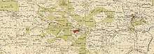
 Kafr Laqif Location of Kafr Laqif within Palestine | |
| Coordinates: 32°10′58″N 35°05′26″E | |
| Palestine grid | 158/176 |
| State | State of Palestine |
| Governorate | Qalqilya |
| Government | |
| • Type | Local Development Committee |
| Elevation | 342 m (1,122 ft) |
| Population (2006) | |
| • Total | 984 |
| Name meaning | The village of Lakif, meaning a ruinous structure, especially a well or cistern.[2] |
Location
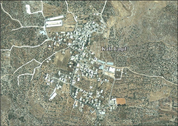
Kafr Laqif is located 12.04 kilometers (7.48 mi) (horizontally) east of Qalqiliya. It is bordered by Hajja to the east, Wadi Qana to the south, ‘Azzun to the west, and Khirbet Sir and Baqat al Hatab to the north.[1]
History
Ceramics from the Byzantine era has been found here.[4]
Ottoman era
Kafr Laqif, like all of Palestine was incorporated into the Ottoman Empire in 1517, and in the 1596 tax registers, it was part of the nahiya ("subdistrict") of Bani Sa'b, part of the larger Sanjak of Nablus. It had a population of 15 households, all Muslims. The inhabitants paid a fixed tax rate of 33,3% on agricultural products, including wheat, barley, summer crops, olive trees, goats and beehives, in addition to occasional revenues and a fixed tax for people of Nablus area; a total of 10,740 akçe. 37.5% of the revenue went to a Muslim charitable endowment.[5]
In 1838, Robinson noted Kefr Lakif as a Muslim village in the Beni Sa'ab district, west of Nablus.[6]
In 1882, the PEF's Survey of Western Palestine (SWP) described Kefr Lekif as resembling Kafr Jammal, that is: "a small stone village on a knoll, with cisterns."[7]
British Mandate era
In the 1922 census of Palestine conducted by the British Mandate authorities, Kufr Laqef had a population of 95 Muslims,[8] increasing in the 1931 census to 141 Muslims, in 27 houses.[9]
In the 1945 statistics the population of Kafr Laqif was 210 Muslims,[10] while the total land area was 2,854 dunams, according to an official land and population survey.[11] Of this, 477 were allocated for plantations and irrigable land, 840 for cereals,[12] while 19 dunams were classified as built-up (urban) areas.[13]
 Kafr Laqif 1943 1:20,000
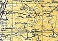 Kafr Laqif 1945 1:250,000
Jordanian era
In the wake of the 1948 Arab–Israeli War, and after the 1949 Armistice Agreements, Kafr Laqif came under Jordanian rule.
The Jordanian census of 1961 found 304 inhabitants.[14]
Post 1967
During the Six-Day War in 1967, Kafr Laqif came under Israeli occupation.
After the 1995 accords, 28.2% of village land is classified as Area B land, while the remaining 71.8% is classified as Area C land. The Israelis have expropriated land in Kafr Laqif for its settlements, most notably Karne Shomron and its environs. In addition, according to the plans, (as of 2007) the Israeli West Bank barrier will isolate 657 dunums (22.8% of the village’s total area) on the western Israeli side of the wall.[15]
References
- Kafr Laqif Village Profile, 2013, ARIJ, p. 4
- Palmer, 1881, p. 184
- Projected Mid -Year Population for Qalqiliya Governorate by Locality 2004- 2006 Archived 2008-02-07 at the Wayback Machine Palestinian Central Bureau of Statistics
- Dauphin, 1998, p. 801
- Hütteroth and Abdulfattah, 1977, p. 140
- Robinson and Smith, 1841, vol 3, Appendix 2, p. 127
- Conder and Kitchener, 1882, p. 165
- Barron, 1923, Table IX, Sub-district of Nablus, p. 25
- Mills, 1931, p. 62
- Government of Palestine, Department of Statistics, 1945, p. 18
- Government of Palestine, Department of Statistics. Village Statistics, April, 1945. Quoted in Hadawi, 1970, p. 60
- Government of Palestine, Department of Statistics. Village Statistics, April, 1945. Quoted in Hadawi, 1970, p. 106.
- Government of Palestine, Department of Statistics. Village Statistics, April, 1945. Quoted in Hadawi, 1970, p. 156.
- Government of Jordan, Department of Statistics, 1964, p. 26
- Kafr Laqif Village Profile, 2013, ARIJ, pp. 17-18
Bibliography
- Barron, J.B., ed. (1923). Palestine: Report and General Abstracts of the Census of 1922. Government of Palestine.
- Conder, C.R.; Kitchener, H.H. (1882). The Survey of Western Palestine: Memoirs of the Topography, Orography, Hydrography, and Archaeology. 2. London: Committee of the Palestine Exploration Fund.
- Dauphin, Claudine (1998). La Palestine byzantine, Peuplement et Populations. BAR International Series 726 (in French). III : Catalogue. Oxford: Archeopress. ISBN 0-860549-05-4.
- Government of Jordan, Department of Statistics (1964). First Census of Population and Housing. Volume I: Final Tables; General Characteristics of the Population (PDF).
- Government of Palestine, Department of Statistics (1945). Village Statistics, April, 1945.
- Hadawi, S. (1970). Village Statistics of 1945: A Classification of Land and Area ownership in Palestine. Palestine Liberation Organization Research Center.
- Hütteroth, Wolf-Dieter; Abdulfattah, Kamal (1977). Historical Geography of Palestine, Transjordan and Southern Syria in the Late 16th Century. Erlanger Geographische Arbeiten, Sonderband 5. Erlangen, Germany: Vorstand der Fränkischen Geographischen Gesellschaft. ISBN 3-920405-41-2.
- Mills, E., ed. (1932). Census of Palestine 1931. Population of Villages, Towns and Administrative Areas. Jerusalem: Government of Palestine.
- Palmer, E.H. (1881). The Survey of Western Palestine: Arabic and English Name Lists Collected During the Survey by Lieutenants Conder and Kitchener, R. E. Transliterated and Explained by E.H. Palmer. Committee of the Palestine Exploration Fund.
- Robinson, E.; Smith, E. (1841). Biblical Researches in Palestine, Mount Sinai and Arabia Petraea: A Journal of Travels in the year 1838. 3. Boston: Crocker & Brewster.
External links
- Welcome To Kafr Laqif
- Survey of Western Palestine, Map 11: IAA, Wikimedia commons
- Kafr Laqif Village (Fact Sheet), Applied Research Institute–Jerusalem (ARIJ)
- Kafr Laqif Village Profile, ARIJ
- Kafr Laqif, aerial photo, ARIJ
- Development Priorities and Needs in Kafr Laqif, ARIJ
| Cities |  | |
|---|---|---|
| Municipalities |
| |
| Villages |
| |