Radava
Radava (Hungarian: Rendve) is a village and municipality in the Nové Zámky District in the Nitra Region of south-west Slovakia.
Radava | |
|---|---|
Municipality | |
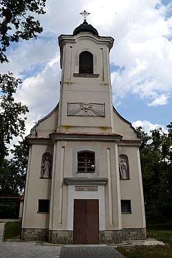 Church of the Holy Spirit | |
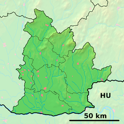 Radava Location of Radava in the Nitra Region 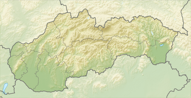 Radava Location of Radava in Slovakia | |
| Coordinates: 48°06′N 18°18′E | |
| Country | |
| Region | Nitra |
| District | Nové Zámky |
| First mentioned | 1237 |
| Area | |
| • Total | 7.599 km2 (2.934 sq mi) |
| Elevation | 151 m (495 ft) |
| Population | |
| • Total | 850 |
| • Density | 110/km2 (290/sq mi) |
| Time zone | UTC+1 (CET) |
| • Summer (DST) | UTC+2 (CEST) |
| Postal code | 941 47 |
| Area code(s) | 421-35 |
| Car plate | NZ |
| Website | www.radava.sk |
History
In historical records the village was first mentioned in 1237.
Geography
The municipality lies at an altitude of 151 meters and covers an area of 7.599 km². It has a population of about 850 people.
Ethnicity
The population is nearly 100% Slovak.
Facilities
The village has a small public library, a gym and a football pitch.
External links

- Official website

- http://www.statistics.sk/mosmis/eng/run.html
- Radava – Nové Zámky Okolie
This article is issued from Wikipedia. The text is licensed under Creative Commons - Attribution - Sharealike. Additional terms may apply for the media files.