Quebec Autoroute 530
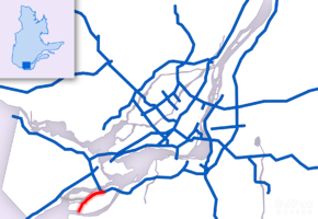
Autoroute 530 (A-530) is an autoroute located Salaberry-de-Valleyfield, Montérégie, Quebec. The 12.9 km (8.0 mi) spur route links Autoroute 30 with Salaberry-de-Valleyfield and features two interchanges, one at Boulevard Pie XII and the other at Route 201.[1] Originally, Autoroute 530 was to connect to Autoroute 20 and Autoroute 30 along the Route 201 corridor through Salaberry-de-Valleyfield, crossing the St. Lawrence River via the Monseigneur Langlois Bridge.[2] Part of this highway was built during Autoroute 20 construction in Coteau-du-Lac, but designated as part of Route 201.
| ||||
|---|---|---|---|---|
 | ||||
| Route information | ||||
| Maintained by Transports Québec | ||||
| Length | 12.9 km[1] (8.0 mi) | |||
| Existed | 2012–present | |||
| History | 1976 (opened as part of A-30)[1] | |||
| Major junctions | ||||
| West end | ||||
| East end | ||||
| Location | ||||
| Major cities | Salaberry-de-Valleyfield | |||
| Highway system | ||||
| ||||

Autoroute 530 was originally part of Autoroute 30, but was re-designated in 2012 when A-30 was realigned to cross the St. Lawrence River.[3][4]
Exit list
From west to east. The entire route is located in Salaberry-de-Valleyfield, Montérégie.
| km[5] | mi | Exit[6] | Destinations | Notes | ||
|---|---|---|---|---|---|---|
| 0.0 | 0.0 | Western terminus; traffic signals; Route 132 / Route 201 concurrency begins | ||||
| 0.4 | 0.25 | (2) | Boulevard Gérard-Cadieux | Traffic signals | ||
| 1.6 | 0.99 | (3) | Boulevard des Érables | Traffic signals | ||
| 5.0 | 3.1 | 5 | Route 132 / Route 201 concurrency ends | |||
| 9.0 | 5.6 | 9 | Boulevard Pie-XII – Saint-Louis-de-Gonzague | |||
| 12.9 | 8.0 | 12 | Eastern terminus; A-30 exit 13 | |||
1.000 mi = 1.609 km; 1.000 km = 0.621 mi
| ||||||
Photo gallery
.jpg)
.jpg)
.jpg)
.jpg)
.jpg)
.jpg)
.jpg)
References
- "Répertoire des autoroutes du Québec". Transports Québec (in French). Retrieved October 23, 2016.
- Paquin, Jean-Guy (1971). Numérotage des autoroutes du Québec, réseau actuel et projeté, plan n°1 (in French). Montréal: Ministère de la Voirie.
- "Western Section". Autoroute 30. Transports Quebec. July 18, 2011. Archived from the original on August 7, 2011. Retrieved February 20, 2012.
- "Autoroute 530 (Québec)". Wikipédia (in French). June 11, 2017. Retrieved June 26, 2017.
- Google (June 28, 2017). "A-530 in Quebec" (Map). Google Maps. Google. Retrieved June 28, 2017.
- "New numerotation: Changes to traffic signs" (PDF). Junction A-30: Monthly Newsletter Concerning the Completion of Autoroute 30. 7 (1). July 2011. ISSN 1715-7501.
External links
| Wikimedia Commons has media related to Quebec Autoroute 530. |
- Transports Quebec Map (in French)