Pylon Peak (British Columbia)
Pylon Peak is the southernmost of six named volcanic peaks comprising the Mount Meager massif in British Columbia, Canada. Two pinnacled ridges extend from Pylon and are named respectively the Pylons and the Marionettes. Pylon Peak overlooks the Meager Creek Hot Springs.
| Pylon Peak | |
|---|---|
| Highest point | |
| Elevation | 2,481 m (8,140 ft) |
| Prominence | 311 m (1,020 ft) |
| Coordinates | 50°35′50.6″N 123°31′03.7″W |
| Geography | |
| Location | British Columbia, Canada |
| Parent range | Pacific Ranges |
| Topo map | NTS 92J/12 |
| Geology | |
| Age of rock | Pliocene |
| Mountain type | Stratovolcano |
| Volcanic arc/belt | Canadian Cascade ArcGaribaldi Volcanic Belt |
| Last eruption | Pleistocene |
| Climbing | |
| First ascent | 1931 N. Carter; A. Dalgleish; T. Fyles; M. Winram |
Erosional remnants of flows from Devastator Peak form the stratified crags of Pylon Peak. These flows occurred 0.5–1.0 million years ago.
See also
- Cascade Volcanoes
- Garibaldi Volcanic Belt
- Volcanism of Canada
- Volcanism of Western Canada
- List of volcanoes in Canada
References
| British Columbia | 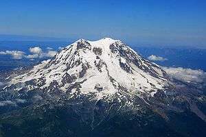 | |
|---|---|---|
| Washington | ||
| Oregon | ||
| California | ||
This article is issued from Wikipedia. The text is licensed under Creative Commons - Attribution - Sharealike. Additional terms may apply for the media files.