Putre
Putre is a Chilean town and commune, capital of the Parinacota Province in the Arica-Parinacota Region. It is located 130 km (81 mi) east of Arica, at an altitude of 3,500 m (11,483 ft). The town is backdropped by Taapaca volcanic complex.
Putre | |
|---|---|
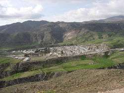 Panoramic view of Putre | |
 Flag  Coat of arms  Map of Putre commune in Arica and Parinacota Region 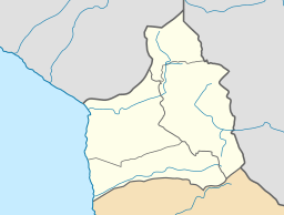 Putre Location in Chile 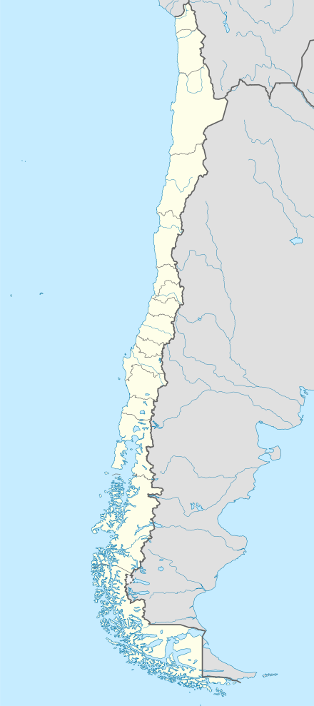 Putre Putre (Chile) | |
| Coordinates (city): 18°12′S 69°35′W | |
| Country | |
| Region | |
| Province | Parinacota |
| Founded | 1580 |
| Seat | Putre |
| Government | |
| • Type | Municipal council |
| Area | |
| • Town and Commune | 5,902.5 km2 (2,279.0 sq mi) |
| Elevation | 3,371 m (11,060 ft) |
| Population (2012 Census)[1] | |
| • Town and Commune | 1,366 |
| • Density | 0.23/km2 (0.60/sq mi) |
| • Urban | 1,235 |
| • Rural | 742 |
| Demonym(s) | Putreño / a |
| Sex | |
| • Male | 1,345 |
| • Female | 632 |
| Time zone | UTC-4 (CLT [2]) |
| • Summer (DST) | UTC-3 (CLST [3]) |
| Area code(s) | 56 + 58 |
| Climate | ET |
| Website | Official website (in Spanish) |
Putre is on the edge of the Lauca National Park, and is popular with visitors to the National Park wishing to acclimatise to the altitude.
There is a historical church in Putre.
The commune also includes the localities of Socoroma, Tignamar, Belén, Chapiquiña, Pachama, Ancuta, Guallatiri, Parinacota, Chucuyo and Caquena.
On March 6, 2011, a 6.2 magnitude earthquake centered 110 km (68 mi) beneath Putre shook northern Chile and southern Peru, causing no injuries and only minor damage.[4]
Climate
According to the Köppen climate classification, Putre has a tundra climate (ET), bordering closely on a cold desert climate (BWk).
| Climate data for Putre (1976–2009) | |||||||||||||
|---|---|---|---|---|---|---|---|---|---|---|---|---|---|
| Month | Jan | Feb | Mar | Apr | May | Jun | Jul | Aug | Sep | Oct | Nov | Dec | Year |
| Average high °C (°F) | 14.5 (58.1) |
14.8 (58.6) |
15.1 (59.2) |
16.1 (61.0) |
15.6 (60.1) |
14.8 (58.6) |
14.2 (57.6) |
15.2 (59.4) |
15.7 (60.3) |
16.1 (61.0) |
15.9 (60.6) |
15.4 (59.7) |
15.3 (59.5) |
| Daily mean °C (°F) | 9.2 (48.6) |
9.4 (48.9) |
9.8 (49.6) |
9.1 (48.4) |
8.1 (46.6) |
7.5 (45.5) |
8.6 (47.5) |
8.9 (48.0) |
9.3 (48.7) |
9.3 (48.7) |
9.5 (49.1) |
9.3 (48.7) |
9.0 (48.2) |
| Average low °C (°F) | 3.9 (39.0) |
3.9 (39.0) |
3.7 (38.7) |
3.5 (38.3) |
2.5 (36.5) |
1.4 (34.5) |
0.7 (33.3) |
1.9 (35.4) |
2.2 (36.0) |
2.5 (36.5) |
3.1 (37.6) |
3.2 (37.8) |
2.7 (36.9) |
| Average precipitation mm (inches) | 63 (2.5) |
52 (2.0) |
28 (1.1) |
1 (0.0) |
1 (0.0) |
1 (0.0) |
1 (0.0) |
2 (0.1) |
2 (0.1) |
2 (0.1) |
2 (0.1) |
20 (0.8) |
176 (6.9) |
| Source: Atlas Agroclimatico de Chile[5] | |||||||||||||
Demographics
According to the 2002 census of the National Statistics Institute, Putre had 1,977 inhabitants (1,345 men and 632 women). Of these, 1,235 (62.5%) lived in urban areas and 742 (38.5%) in rural areas. The population fell by 29.5% (826 persons) between the 1992 and 2002 censuses.[1]
Administration
As a commune, Putre is a third-level administrative division of Chile administered by a municipal council, headed by a mayor alcalde who is directly elected every four years.
Within the electoral divisions of Chile, Putre is represented in the Chamber of Deputies by Mr. Nino Baltolu (UDI) and Mr. Orlando Vargas (PPD) as part of the 1st electoral district, which includes the entire Arica and Parinacota Region.The commune is represented in the Senate by Fulvio Rossi Ciocca (PS) and Jaime Orpis Bouchon (UDI) as part of the 1st senatorial constituency (Arica and Parinacota Region and Tarapacá Region).
References
- (in Spanish) Instituto Nacional de Estadísticas
- "Chile Time". WorldTimeZones.org. Archived from the original on 13 July 2010. Retrieved 9 September 2010.
- "Chile Summer Time". WorldTimeZones.org. Archived from the original on 11 September 2007. Retrieved 9 September 2010.
- Associated Press (6 March 2011). "Magnitude-6.2 earthquake shakes northern Chile". Houston Chronicle. Retrieved 8 March 2011.
- "Atlas Agroclimático de Chile–Estado Actual y Tendencias del Clima (Tomo I: Regiones de Arica Y Parinacota, Tarapacá y Antofagasta" (in Spanish). Universidad de Chile. 2017. pp. 136–146. Retrieved 9 December 2018.
Communes and municipalities in Arica y Parinacota Region Tarapacá Region | ||
|---|---|---|
| Arica |  | |
| Parinacota | ||