Potštát
Potštát (Czech pronunciation: [ˈpot.ʃtaːt]; German: Bodenstadt) is a town in the Olomouc Region, Czech Republic. From 1938 to 1945 it was one of the municipalities in Sudetenland.
Potštát | |
|---|---|
Town | |
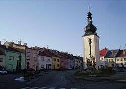 Town square | |
 Flag  Coat of arms | |
 Potštát Location in the Czech Republic | |
| Coordinates: 49°38′N 17°38′E | |
| Country | Czech Republic |
| Region | Olomouc |
| District | Přerov |
| First mentioned | 1322 |
| Government | |
| • Mayor | Alena Otáhalová |
| Area | |
| • Total | 34.11 km2 (13.17 sq mi) |
| Elevation | 502 m (1,647 ft) |
| Population (2006-07-03) | |
| • Total | 1,214 |
| • Density | 36/km2 (92/sq mi) |
| Time zone | UTC+1 (CET) |
| • Summer (DST) | UTC+2 (CEST) |
| Postal code | 753 62 |
| Website | www.potstat.cz |
This article is issued from Wikipedia. The text is licensed under Creative Commons - Attribution - Sharealike. Additional terms may apply for the media files.