Poronaysk
Poronaysk (Russian: Порона́йск; Japanese: 敷香町 Shikuka-chō; Ainu: Sistukari or Sisi Tukari[8]) is a town and the administrative center of Poronaysky District of Sakhalin Oblast, Russia, located on the Poronay River 288 kilometers (179 mi) north of Yuzhno-Sakhalinsk. Population: 16,120 (2010 Census);[2] 17,954 (2002 Census);[9] 25,971 (1989 Census).[10]
Poronaysk Поронайск | |
|---|---|
Town[1] | |
.gif) Flag .svg.png) Coat of arms | |
Location of Poronaysk 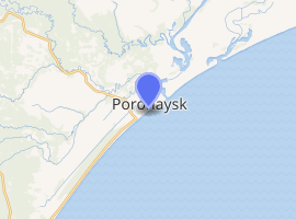
| |
 Poronaysk Location of Poronaysk 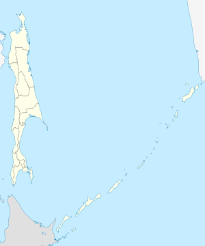 Poronaysk Poronaysk (Sakhalin Oblast) | |
| Coordinates: 49°13′N 143°07′E | |
| Country | Russia |
| Federal subject | Sakhalin Oblast[1] |
| Administrative district | Poronaysky District[1] |
| Founded | 1869 |
| Area | |
| • Total | 55 km2 (21 sq mi) |
| Elevation | 3 m (10 ft) |
| Population | |
| • Total | 16,120 |
| • Estimate (2018)[3] | 15,311 (-5%) |
| • Density | 290/km2 (760/sq mi) |
| • Capital of | Poronaysky District[1] |
| • Urban okrug | Poronaysky Urban Okrug[4] |
| • Capital of | Poronaysky Urban Okrug[4] |
| Time zone | UTC+11 (MSK+8 |
| Postal code(s)[6] | 694240–694242 |
| Dialing code(s) | +7 42431[7] |
| OKTMO ID | 64740000001 |
| Twin towns | Kitami |
| Website | web |
History
It was founded in 1869 as a Russian outpost Tikhmenevsky near the Nivkh and Ainu settlements in the area. The Treaty of Portsmouth transferred it to Japanese control along with the rest of the southern half of the island of Sakhalin. It was renamed Shikuka (敷香町, Shikuka-chō), remaining under Japanese control until the Soviet Army retook the whole of the island in 1945.
After the town had been granted to the Soviet Union, it was named Poronaysk in 1946, after the river on which it stands. The river's name is from Ainu poro nay, meaning "broad river," "big river," or "growing river." Various Japanese place name Horonai (幌内) share the same etymology with Poronaysk.
Administrative and municipal status
Within the framework of administrative divisions, Poronaysk serves as the administrative center of Poronaysky District and is subordinated to it.[1] As a municipal division, the town of Poronaysk, one urban-type settlement, and eleven rural localities of Poronaysky District are incorporated as Poronaysky Urban Okrug.[4]
Economy
Poronaysk has a paper mill, as well as timber and fishing industries. Sakhalinskaya GRES power station is supplied with coal from an open cut mine close to the town.
Transportation
The town lies on the island's railway network, as well as on the main highway connecting Yuzhno-Sakhalinsk with Alexandrovsk-Sakhalinsky.
Climate
Poronaysk, owing to the cold Sea of Okhotsk surrounding the town, has a subarctic climate (Dfc) with short, mild and very foggy summers and very cold winters.
| Climate data for Poronaysk (1908-2012) | |||||||||||||
|---|---|---|---|---|---|---|---|---|---|---|---|---|---|
| Month | Jan | Feb | Mar | Apr | May | Jun | Jul | Aug | Sep | Oct | Nov | Dec | Year |
| Record high °C (°F) | 2.0 (35.6) |
5 (41) |
12.0 (53.6) |
19.8 (67.6) |
33.5 (92.3) |
33.9 (93.0) |
34.6 (94.3) |
35.0 (95.0) |
30.1 (86.2) |
23.5 (74.3) |
16.1 (61.0) |
8.4 (47.1) |
35.0 (95.0) |
| Average high °C (°F) | −10.6 (12.9) |
−8.1 (17.4) |
−2.5 (27.5) |
3.6 (38.5) |
8.8 (47.8) |
13.3 (55.9) |
16.7 (62.1) |
19.3 (66.7) |
16.6 (61.9) |
9.8 (49.6) |
.1 (32.2) |
−8 (18) |
4.9 (40.8) |
| Daily mean °C (°F) | −15.9 (3.4) |
−13.9 (7.0) |
−7.2 (19.0) |
.1 (32.2) |
4.7 (40.5) |
9.5 (49.1) |
13.6 (56.5) |
15.7 (60.3) |
12.1 (53.8) |
5.2 (41.4) |
−4.5 (23.9) |
−12.9 (8.8) |
0.6 (33.1) |
| Average low °C (°F) | −21.2 (−6.2) |
−20.1 (−4.2) |
−12.7 (9.1) |
−3.2 (26.2) |
1.6 (34.9) |
6.6 (43.9) |
11.1 (52.0) |
12.6 (54.7) |
7.7 (45.9) |
0.7 (33.3) |
−9 (16) |
−18.1 (−0.6) |
−3.7 (25.3) |
| Record low °C (°F) | −39.8 (−39.6) |
−39.1 (−38.4) |
−34.2 (−29.6) |
−23.5 (−10.3) |
−8.1 (17.4) |
−2.5 (27.5) |
0.3 (32.5) |
1.3 (34.3) |
−3.3 (26.1) |
−13.2 (8.2) |
−29.8 (−21.6) |
−36.7 (−34.1) |
−39.8 (−39.6) |
| Average precipitation mm (inches) | 24.5 (0.96) |
22.2 (0.87) |
35.6 (1.40) |
50.4 (1.98) |
69.5 (2.74) |
68.2 (2.69) |
83.0 (3.27) |
98.6 (3.88) |
121.2 (4.77) |
86.8 (3.42) |
54.9 (2.16) |
35.1 (1.38) |
750 (29.52) |
| Source: | |||||||||||||
Notable people
References
Notes
- Law #25-ZO
- Russian Federal State Statistics Service (2011). "Всероссийская перепись населения 2010 года. Том 1" [2010 All-Russian Population Census, vol. 1]. Всероссийская перепись населения 2010 года [2010 All-Russia Population Census] (in Russian). Federal State Statistics Service.
- "26. Численность постоянного населения Российской Федерации по муниципальным образованиям на 1 января 2018 года". Federal State Statistics Service. Retrieved January 23, 2019.
- Law #524
- "Об исчислении времени". Официальный интернет-портал правовой информации (in Russian). June 3, 2011. Retrieved January 19, 2019.
- Почта России. Информационно-вычислительный центр ОАСУ РПО. (Russian Post). Поиск объектов почтовой связи (Postal Objects Search) (in Russian)
- Телефонные коды Сахалина - Dialing codes of Sakhalin (in Russian)
- Bronisław Piłsudski, Jan Michał Rozwadowski, Materials for the study of the Ainu language and folklore, Imperial academy of sciences (Spasowicz fund), 1912, p. 177.
- Russian Federal State Statistics Service (May 21, 2004). "Численность населения России, субъектов Российской Федерации в составе федеральных округов, районов, городских поселений, сельских населённых пунктов – районных центров и сельских населённых пунктов с населением 3 тысячи и более человек" [Population of Russia, Its Federal Districts, Federal Subjects, Districts, Urban Localities, Rural Localities—Administrative Centers, and Rural Localities with Population of Over 3,000] (XLS). Всероссийская перепись населения 2002 года [All-Russia Population Census of 2002] (in Russian).
- "Всесоюзная перепись населения 1989 г. Численность наличного населения союзных и автономных республик, автономных областей и округов, краёв, областей, районов, городских поселений и сёл-райцентров" [All Union Population Census of 1989: Present Population of Union and Autonomous Republics, Autonomous Oblasts and Okrugs, Krais, Oblasts, Districts, Urban Settlements, and Villages Serving as District Administrative Centers]. Всесоюзная перепись населения 1989 года [All-Union Population Census of 1989] (in Russian). Институт демографии Национального исследовательского университета: Высшая школа экономики [Institute of Demography at the National Research University: Higher School of Economics]. 1989 – via Demoscope Weekly.
- The Russian presence in Japan
Sources
- Сахалинская областная Дума. Закон №25-ЗО от 23 марта 2011 г. «Об административно-территориальном устройстве Сахалинской области», в ред. Закона №62-ЗО от 27 июня 2013 г. «О внесении изменения в статью 10 Закона Сахалинской области "Об административно-территориальном устройстве Сахалинской области"». Вступил в силу 9 апреля 2011 г.. Опубликован: "Губернские ведомости", №55(3742), 29 марта 2011 г. (Sakhalin Oblast Duma. Law #25-ZO of March 23, 2011 On the Administrative-Territorial Structure of Sakhalin Oblast, as amended by the Law #62-ZO of June 27, 2013 On Amending Article 10 of the Law of Sakhalin Oblast "On the Administrative-Territorial Structure of Sakhalin Oblast". Effective as of April 9, 2011.).
- Сахалинская областная Дума. Закон №524 от 21 июля 2004 г. «О границах и статусе муниципальных образований в Сахалинской области», в ред. Закона №45-ЗО от 27 мая 2013 г. «О внесении изменения в Закон Сахалинской области "О границах и статусе муниципальных образований в Сахалинской области"». Вступил в силу 1 января 2005 г. Опубликован: "Губернские ведомости", №175–176(2111–2112), 31 июля 2004 г. (Sakhalin Oblast Duma. Law #524 of July 21, 2004 On the Borders and Status of the Municipal Formations in Sakhalin Oblast, as amended by the Law #45-ZO of May 27, 2013 On Amending the Law of Sakhalin Oblast "On the Borders and Status of the Municipal Formations in Sakhalin Oblast". Effective as of January 1, 2005.).
Administrative center: Yuzhno-Sakhalinsk • Rural localities | |||
| Administrative districts | |||
| Cities and towns | |||
| Urban-type settlements | |||