Pontinia
Pontinia is a comune (municipality) in the Province of Latina in the Italian region Lazio, located about 70 kilometres (43 mi) southeast of Rome and about 15 kilometres (9 mi) southeast of Latina.
Pontinia | |
|---|---|
| Comune di Pontinia | |
 Coat of arms | |
Location of Pontinia 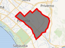
| |
 Pontinia Location of Pontinia in Italy 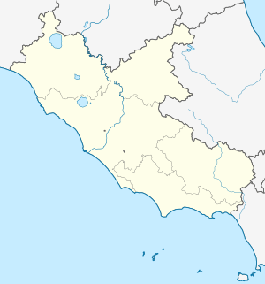 Pontinia Pontinia (Lazio) | |
| Coordinates: 41°24′N 13°3′E | |
| Country | Italy |
| Region | Lazio |
| Province | Latina (LT) |
| Government | |
| • Mayor | Carlo Medici |
| Area | |
| • Total | 112.2 km2 (43.3 sq mi) |
| Elevation | 4 m (13 ft) |
| Population (31 December 2017)[2] | |
| • Total | 14,909 |
| • Density | 130/km2 (340/sq mi) |
| Demonym(s) | Pontiniani |
| Time zone | UTC+1 (CET) |
| • Summer (DST) | UTC+2 (CEST) |
| Postal code | 04014 |
| Dialing code | 0773 |
| Patron saint | St. Anne |
| Saint day | July 26 |
Pontinia was established in 1935, as part of the project under Prime Minister Benito Mussolini which drained the Pontine Marshes and converted them to agriculture.[3] The town plan was designed by engineer Alfredo Pappalardo, an employee of the Opera Nazionale Combattenti, the agency which oversaw the engineering works and settlement of the Pontine Marshes.
Pontinia borders the following municipalities: Latina, Priverno, Sabaudia, Sezze, Sonnino, Terracina.
Twin cities


References
- "Superficie di Comuni Province e Regioni italiane al 9 ottobre 2011". Istat. Retrieved 16 March 2019.
- "Popolazione Residente al 1° Gennaio 2018". Istat. Retrieved 16 March 2019.
- Duany, Andrés, Elizabeth Plater-Zyberk, and Robert Alminana (2003). The New Civic Art. Rizzoli International Publications, New York.
This article is issued from Wikipedia. The text is licensed under Creative Commons - Attribution - Sharealike. Additional terms may apply for the media files.