Polo, Missouri
Polo is a city in Caldwell County, Missouri, and is part of the Kansas City metropolitan area with the United States. The population was 575 at the 2010 census.
Polo, Missouri | |
|---|---|
 Location of Polo, Missouri | |
| Coordinates: 39°33′10″N 94°2′20″W | |
| Country | United States |
| State | Missouri |
| County | Caldwell |
| Area | |
| • Total | 0.63 sq mi (1.63 km2) |
| • Land | 0.62 sq mi (1.61 km2) |
| • Water | 0.01 sq mi (0.03 km2) |
| Elevation | 1,014 ft (309 m) |
| Population | |
| • Total | 575 |
| • Estimate (2018)[3] | 537 |
| • Density | 910/sq mi (350/km2) |
| Time zone | UTC-6 (Central (CST)) |
| • Summer (DST) | UTC-5 (CDT) |
| ZIP code | 64671 |
| Area code(s) | 660 |
| FIPS code | 29-58916[4] |
| GNIS feature ID | 0724721[5] |
History
Polo was laid out in 1867.[6] The city's name is a transfer from Polo, Illinois.[7] A post office called Polo has been in operation since 1868.[8]
Geography
Polo is located at 39°33′10″N 94°2′20″W (39.552842, -94.039022).[9]
According to the United States Census Bureau, the city has a total area of 0.63 square miles (1.63 km2), of which 0.62 square miles (1.61 km2) is land and 0.01 square miles (0.03 km2) is water.[1]
Demographics
| Historical population | |||
|---|---|---|---|
| Census | Pop. | %± | |
| 1880 | 72 | — | |
| 1890 | 415 | 476.4% | |
| 1900 | 539 | 29.9% | |
| 1910 | 526 | −2.4% | |
| 1920 | 606 | 15.2% | |
| 1930 | 584 | −3.6% | |
| 1940 | 590 | 1.0% | |
| 1950 | 549 | −6.9% | |
| 1960 | 469 | −14.6% | |
| 1970 | 438 | −6.6% | |
| 1980 | 583 | 33.1% | |
| 1990 | 539 | −7.5% | |
| 2000 | 582 | 8.0% | |
| 2010 | 575 | −1.2% | |
| Est. 2018 | 537 | [3] | −6.6% |
| U.S. Decennial Census[10] | |||
2010 census
As of the census[2] of 2010, there were 575 people, 229 households, and 136 families residing in the city. The population density was 927.4 inhabitants per square mile (358.1/km2). There were 256 housing units at an average density of 412.9 per square mile (159.4/km2). The racial makeup of the city was 95.1% White, 0.3% African American, 0.2% Asian, 0.3% from other races, and 4.0% from two or more races. Hispanic or Latino of any race were 1.9% of the population.
There were 229 households of which 31.0% had children under the age of 18 living with them, 41.5% were married couples living together, 13.1% had a female householder with no husband present, 4.8% had a male householder with no wife present, and 40.6% were non-families. 33.6% of all households were made up of individuals and 17% had someone living alone who was 65 years of age or older. The average household size was 2.46 and the average family size was 3.17.
The median age in the city was 38.9 years. 26.8% of residents were under the age of 18; 6.8% were between the ages of 18 and 24; 24.2% were from 25 to 44; 22.8% were from 45 to 64; and 19.5% were 65 years of age or older. The gender makeup of the city was 47.3% male and 52.7% female.
2000 census
As of the census[4] of 2000, there were 582 people, 239 households, and 150 families residing in the city. The population density was 1,006.4 people per square mile (387.4/km²). There were 262 housing units at an average density of 453.0 per square mile (174.4/km²). The racial makeup of the city was 99.48% White, 0.17% from other races, and 0.34% from two or more races. Hispanic or Latino of any race were 1.37% of the population.
There were 239 households out of which 28.5% had children under the age of 18 living with them, 49.4% were married couples living together, 7.5% had a female householder with no husband present, and 37.2% were non-families. 31.4% of all households were made up of individuals and 17.2% had someone living alone who was 65 years of age or older. The average household size was 2.44 and the average family size was 3.09.
In the city the population was spread out with 25.8% under the age of 18, 8.6% from 18 to 24, 27.5% from 25 to 44, 22.3% from 45 to 64, and 15.8% who were 65 years of age or older. The median age was 36 years. For every 100 females, there were 94.6 males. For every 100 females age 18 and over, there were 94.6 males.
The median income for a household in the city was $34,250, and the median income for a family was $36,705. Males had a median income of $32,375 versus $21,111 for females. The per capita income for the city was $15,868. About 5.2% of families and 7.1% of the population were below the poverty line, including 5.5% of those under age 18 and 6.3% of those age 65 or over.
References
- "US Gazetteer files 2010". United States Census Bureau. Archived from the original on 2012-07-02. Retrieved 2012-07-08.
- "U.S. Census website". United States Census Bureau. Retrieved 2012-07-08.
- "Population and Housing Unit Estimates". Retrieved March 14, 2020.
- "U.S. Census website". United States Census Bureau. Retrieved 2008-01-31.
- "US Board on Geographic Names". United States Geological Survey. 2007-10-25. Retrieved 2008-01-31.
- "Caldwell County Place Names, 1928–1945 (archived)". The State Historical Society of Missouri. Archived from the original on 24 June 2016. Retrieved 7 September 2016.CS1 maint: BOT: original-url status unknown (link)
- Eaton, David Wolfe (1916). How Missouri Counties, Towns and Streams Were Named. The State Historical Society of Missouri. pp. 266.
- "Post Offices". Jim Forte Postal History. Retrieved 7 September 2016.
- "US Gazetteer files: 2010, 2000, and 1990". United States Census Bureau. 2011-02-12. Retrieved 2011-04-23.
- "Census of Population and Housing". Census.gov. Retrieved June 4, 2015.
External links
- Historic maps of Polo in the Sanborn Maps of Missouri Collection at the University of Missouri
Municipalities and communities of Caldwell County, Missouri, United States | ||
|---|---|---|
| Cities | 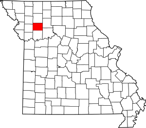 Map of Missouri highlighting Caldwell County | |
| Townships | ||
| Unincorporated communities | ||
| Ghost town | ||