Pogoniani
Pogoniani (Greek: Πωγωνιανή, pronounced [poɣoɲaˈni], before 1928: Βοστίνα,Vostina;[2] Albanian: Voshtinë[3]) is a village and a former community in the Ioannina regional unit, Epirus, Greece. Since the 2011 local government reform it is part of the municipality Pogoni, of which it is a municipal unit.[4] The municipal unit has an area of 56.693 km2, the community 18.830 km2.[5] The municipal unit consists of 4 villages: Pogoniani, Dolo, Drymades, Stavroskiadi.
Pogoniani Πωγωνιανή | |
|---|---|
 Pogoniani Location within the regional unit 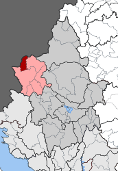 | |
| Coordinates: 40°00′N 20°25′E | |
| Country | Greece |
| Administrative region | Epirus |
| Regional unit | Ioannina |
| Municipality | Pogoni |
| • Municipal unit | 56.693 km2 (21.889 sq mi) |
| Population (2011)[1] | |
| • Municipal unit | 567 |
| • Municipal unit density | 10/km2 (26/sq mi) |
| Community | |
| • Population | 425 (2011) |
| • Area (km2) | 18.830 |
| Time zone | UTC+2 (EET) |
| • Summer (DST) | UTC+3 (EEST) |
| Vehicle registration | ΙΝ |
History
In antiquity the area of Pogoniani was inhabited by Molossians, one of the three main Ancient Greek tribes of the northwestern Greek group.[6]
The establishment of the bishopric of Pogoniani is associated with the reign of Byzantine Emperor Constantine Pogonatos (r. 641–668) due to the latter's nickname, but it first appears in the Notitiae Episcopatuum during the reign of Andronikos III Palaiologos (r. 1328–1341).[7] The seat of the archbishop was most likely in Depalitsa (modern Molyvdoskepastos).[8] Pogoniani fell to the Ottoman Empire in 1447.[7]
The three-aisled Orthodox basilica of Pogoniani was erected in 1873, with donations by the local Zosimas brothers benefactors.[9] In the late Ottoman period and until 1923, the village of Pogoniani (known as Vostina) was inhabited by Muslim Albanians alongside Orthodox Greek inhabitants.[10] Until 1924, Muslim Albanians from the village of Pogoniani used to have close relations and exchanges with people from the town of Libohovë in Albania.[3]
During the period prior to the First World War the British member of the International Commission that was responsible of the delineation of the Greek-Albanian border noticed that the villages that were ceded to Albania, which consist of the northern portion of Pogoniani are entirely Greek-speaking.[11]
References
- "Απογραφή Πληθυσμού - Κατοικιών 2011. ΜΟΝΙΜΟΣ Πληθυσμός" (in Greek). Hellenic Statistical Authority.
- Name changes of settlements in Greece
- Gilles de Rapper & Pierre Sintès (2008). "Faire et Defaire les Frontieres du Mariage - Échanges matrimoniaux entre la Grèce et l’Albanie -le cas de la région de Gjirokastër". p. 4. "Dans ce modèle, la frontière internationale n’est pas un obstacle, tant qu’elle est ouverte au passage, parce qu’elle ne correspond pas aux lignes de partage locales : Grecs et Albanais, chrétiens et musulmans, peuvent se marier de part et d’autre de la frontière, à l’intérieur de leur groupe. C’est le cas entre les deux parties du Pogon jusqu’à la fermeture de la frontière en 1944 ; entre les musulmans de Libohovë et ceux de Voshtinë/Pogonniani jusqu’à l’expulsion de ces derniers en 1924 ; entre les Grecs du Haut Dropull et ceux de la Mourgana jusqu’en 1944 (Dino 2007, 18), entre ceux de Konispol et ceux de Filiates. Lorsque la frontière devient infranchissabl e et lorsque l’autre côté est considéré comme « ennemi », comme ce fut le cas à partir de 1944, les échanges matrimoniaux transfrontaliers disparaissent et laissent la place à d’autres alliances, qui semblaient jusqu’alors impossibles ou qui ne semblaient apporter aucun « avantage » : mariages entre minoritaires grecs et Albanais majoritaires, entre musulmans et chrétiens, entre gens des villages et gens des villes."
- Kallikratis law Greece Ministry of Interior (in Greek)
- "Population & housing census 2001 (incl. area and average elevation)" (PDF) (in Greek). National Statistical Service of Greece.
- Hammond, N.G.L. (1997). "The Tribal Systems of Epirus and Neighbouring Areas down to 400 B.C." Epirus, 4000 Years of Greek History and Civilization: 54.
In central Epirus the Molossoi expanded southwards from Pogoniane...
- Soustal, Peter; Koder, Johannes (1981). Tabula Imperii Byzantini, Band 3: Nikopolis und Kephallēnia (in German). Vienna: Verlag der Österreichischen Akademie der Wissenschaften. p. 240. ISBN 978-3-7001-0399-8.
- Soustal, Peter; Koder, Johannes (1981). Tabula Imperii Byzantini, Band 3: Nikopolis und Kephallēnia (in German). Vienna: Verlag der Österreichischen Akademie der Wissenschaften. pp. 140–141, 240. ISBN 978-3-7001-0399-8.
- "Prefecture of Ioannina, Epirus-Greece" (PDF). Prefectural Committee of Tourist Promotion. 2008. p. 29. Retrieved 2009-11-02.
- Sarah Green (2005). Notes from the Balkans: Locating Marginality and Ambiguity on the Greek-Albanian border. Princeton University Press. pp. 56-57.
- British documents on the origins of the war, 1898-1914 ,. H.M.S.O., 1926, p. 184: "Frontier as laid down cut off small northern portion of Pogoniani district which contained Greek villages and was entirely Greek-speaking"