Połaniec
Połaniec [pɔˈwaɲet͡s] (![]()
![]()
Połaniec | |
|---|---|
Town | |
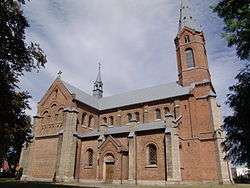 Saint Martin's Church | |
 Flag  Coat of arms | |
 Połaniec | |
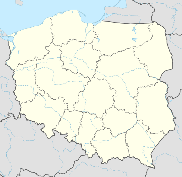
| Coordinates: 50°25′59″N 21°16′49″E | |
| Country | |
| Voivodeship | Świętokrzyskie |
| County | Staszów |
| Gmina | Połaniec |
| Town rights | 1264 |
| Parts of town | Townships' List
|
| Area (through the years 2008-2010)[1] | |
| • Total | 17.41 km2 (6.72 sq mi) |
| Elevation | 166.3 m (545.6 ft) |
| Population (31 December 2012 at Census)[1] | |
| • Total | 8,406 |
| • Density | 480/km2 (1,300/sq mi) |
| Time zone | UTC+1 (CET) |
| • Summer (DST) | UTC+2 (CEST) |
| Postal code | 28-230 |
| Area code(s) | +48 15 |
| Car plates | TSZ |
| Website | http://www.polaniec.pl |

The Połaniec Power Station, is one of the largest (1800 MW) coal-fired power plants in Poland and, since 2012, one of the largest biomass plants in the world. It is located outside the town, in the nearby village of Zawada. [3]
History
The history of Połaniec dates back to the 11th century, when a gord was built near the spot where the Czarna flows into the Vistula. A settlement emerged in the 11th–12th centuries, with St. Catherine church in the vicinity of the gord. In 1241 Połaniec was completely destroyed in the Mongol invasion of Poland, and near the local village of Tursko a battle took place with the invaders. Połaniec recovered, gaining town rights before 1264, and by 1340, it had some 400 residents. Ten years later, in 1350, King Kazimierz Wielki ordered the town to move from its location on the Winna Góra hill to its present location. In the late Middle Ages, Połaniec was an important trade centre, located along the merchant route from Kraków to Sandomierz, and near the very important waterway, the Vistula. Until 1795 the town belonged to Lesser Poland's Sandomierz Voivodeship.
At the beginning of the 16th century, Połaniec was burned to the ground by the Crimean Tatars, so that King Zygmunt Stary lowered the residents' taxes. In 1526 the town was once again in a conflagration. In the mid-16th century, a town hall, funded by hetman Jan Tarnowski was erected in Połaniec. At the beginning of the 17th century, a hospital was built. In 1772 (see Partitions of Poland), Połaniec suddenly became a border town, when the Austrian province of Galicia was created. Establishing a border along the Vistula slowed economic development in Połaniec. In 1794 the town was one of centres of the Kościuszko Uprising: it was the scene of the Proclamation of Połaniec on 7 May 1794. In 1795 the town was annexed by the Austrian Empire, and in 1815 it became part of Russian-controlled Congress Poland. On 1 June 1869, as a punishment for the January Uprising, it lost its town privileges. At that time, its population was around 2,000. While in the Kielce Voivodeship during the Second Polish Republic Połaniec suffered badly in the 1934 floods. Połaniec had a large Jewish population, who were murdered in the Holocaust by Germans and polish collaborators.
In the 1970s, the Tadeusz Kościuszko Power Plant was built, and in 1980, Połaniec regained its town rights.
Demography
According to the 2011 Poland census, there were 8,227 people residing in Połaniec, of whom 49.6% were male and 50.4% were female. In the town, the population was distributed such that 18.6% under the age of 18, 40.9% from 18 to 44, 31.8% from 45 to 64, and 8.7% who were 65 or older.[1]
Table 1. Population level of town in 2010 – by age group[1] SPECIFICATION Measure
unitPOPULATION
(by age group in 2010)TOTAL 0-4 5-9 10-14 15-19 20-24 25-29 30-34 35-39 40-44 45-49 50-54 55-59 60-64 65-69 70-74 75-79 80-84 85 + I. TOTAL person 8,227 434 355 442 537 820 842 574 465 425 695 964 735 419 141 120 124 73 62 — of which in % 100 5.3 4.3 5.4 6.5 10 10.2 7 5.7 5.2 8.4 11.7 8.9 5.1 1.7 1.5 1.5 0.9 0.8 1. BY SEX A. Males person 4,078 220 166 232 257 404 464 289 244 196 304 479 378 226 74 54 46 35 10 — of which in % 49.6 2.7 2 2.8 3.1 4.9 5.6 3.5 3 2.4 3.7 5.8 4.6 2.7 0.9 0.7 0.6 0.4 0.1 B. Females person 4,149 214 189 210 280 416 378 285 221 229 391 485 357 193 67 66 78 38 52 — of which in % 50.4 2.6 2.3 2.6 3.4 5.1 4.6 3.5 2.7 2.8 4.8 5.9 4.3 2.3 0.8 0.8 0.9 0.5 0.6
Figure 1. Population pyramid of town in 2010 – by age group and sex[1]
Table 2. Population level of town in 2010 – by sex[1] SPECIFICATION Measure
unitPOPULATION
(by sex in 2010)TOTAL Males Females I. TOTAL person 8,227 4,078 4,149 — of which in % 100 49.6 50.4 1. BY AGE GROUP A. At pre-working age person 1,530 759 771 — of which in % 18.6 9.2 9.4 B. At working age. grand total person 5,984 3,100 2,884 — of which in % 72.7 37.7 35 a. at mobile working age person 3,364 1,713 1,651 — of which in % 40.9 20.8 20.1 b. at non-mobile working age person 2,620 1,387 1,233 — of which in % 31.8 16.8 15 C. At post-working age person 713 219 494 — of which in % 8.7 2.7 6

International relations
References
- "Local Data Bank (Bank Danych Lokalnych) – Layout by NTS nomenclature (Układ wg klasyfikacji NTS)". demografia.stat.gov.pl: GUS. 10 March 2011.
- Bielec, Jan (ed.); Szwałek, Stanisława (1982). Wykaz urzędowych nazw miejscowości w Polsce. T. III: P – Ż [List of official names of localities in Poland, Vol. III: P – Ż] (in Polish). Ministry of Administration, Spatial Economy and Environmental Protection (1st ed.). Warsaw, Poland: Central Statistical Office.CS1 maint: extra text: authors list (link)
- Sitek, Janusz (1991). Nazwy geograficzne Rzeczypospolitej Polskiej [Geographical names of the Republic of Poland] (in Polish). Ministry of Physical Planning and Construction, Surveyor General of Poland, Council of Ministers' Office, Commission for Establishing Names of Localities and Physiographical Objects (1st ed.). Warsaw, Poland: Eugeniusz Romer State Cartographical Publishing House. ISBN 83-7000-071-1.
- "Połaniec, miasto, gmina Połaniec – miasto, powiat staszowski, województwo świętokrzyskie" [Połaniec, town, Połaniec Commune – urban area, Staszów County, Świętokrzyskie Province, Poland]. Topographical map prepared in 1:10,000 scale. Aerial and satellite orthophotomap (in Polish). Head Office of Geodesy and Cartography, Poland, Warsaw. 2011. geoportal.gov.pl. Retrieved 27 April 2011. - Polaniec Biomass Power Plant
- "Twinnings" (PDF). Central Union of Municipalities & Communities of Greece. Retrieved 25 August 2013.
External links
| Wikimedia Commons has media related to Połaniec. |
| Town and seat |  | ||||
|---|---|---|---|---|---|
| Parts of town |
| ||||
| Villages |
| ||||
| Part of village |
| ||||
| Colonies |
| ||||
| Farmstead |
| ||||
| Smaller locality | |||||