Plumtree, Zimbabwe
Plumtree is a small town in Zimbabwe. Alongside marula trees, wild plum trees ('umqokolo' in Ndebele language) grew abundantly in the area, hence the name Plumtree. The town was once called Getjenge by the Kalanga people which is the dominant tribe. Another name which is mainly used is Titji which simple means station due to the railway station which was operating in the area around 1897.
Plumtree | |
|---|---|
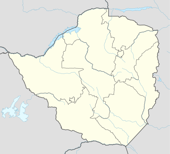 Plumtree Location in Zimbabwe | |
| Coordinates: 20°30′00″S 27°48′00″E | |
| Country | |
| Province | Matabeleland South |
| Districts of Zimbabwe | Bulilimamangwe District |
| Municipality | Plumtree Town Council |
| Government | |
| • Mayor | Eroc Garcia |
| Elevation | 1,387 m (4,551 ft) |
| Population (2012 Census) | |
| • Total | 11,626 |
| Time zone | UTC+2 (CAT) |
| Climate | Cwa |
Location
The town is located in Bulilimamangwe District, Matabeleland South Province, in southwestern Zimbabwe, at the international border with Botswana. It is located about 100 kilometres (62 mi), by road, southwest of Bulawayo, the nearest large city.[1] The town sits on the main road between Bulawayo in Zimbabwe and Francistown in Botswana, about 85 kilometres (53 mi), further southwest from Plumtree. The border is defined by the Ramokgwebana River. The village of Ramokgwebana is opposite Plumtree on the Botswana side.
Overview
It is the local administrative centre for Bulilimamangwe District, which is made up of three sub-districts; namely (a) Bulilima West (b) Bulilima East and (c) Mangwe. Plumtree is located in Bulilima East. Neighbourhoods Villages near Plumtree Town are: Tokwana, Nopemano, Masendu, Madlambudzi, Muke, Matjinge, Kungubo, Ndolwane, Diba, and Gwambe. Gonde, Ngwana, Malalume, Mafeha, Malopa, Hhingwe, Jutjume and many more.
At an altitude of 1,387 metres (4,551 ft), above sea level,[2] the town sits on the watershed between the Limpopo River basin to the south and the Zambezi basin to the north. The Tati River rises near Plumtree, running west and then south into the Shashe River, a tributary of the Zambezi. The annual rainfall is about 500 millimetres (20 in), with a long dry season from April to October.[3] The railway from Bulawayo to Francistown crosses the border near Plumtree. There is a functioning casino in Plumtree. There are several elementary and secondary schools in the town. ZB Bank Limited, a commercial bank, maintains a branch in town.[4]
Population
The current population of Plumtree is not publicly known. In 2004, the population of the town was estimated at 2 184.[5] The next national population census in Zimbabwe is scheduled from 18 August 2012 through 28 August 2012.[6] There are two main languages spoken in Plumtree; (a) Kalanga and (b) Ndebele. Other languages spoken to a lesser extent include Tswana, used near the Botswana border.
Climate
| Climate data for Plumtree, Zimbabwe (1961–1990) | |||||||||||||
|---|---|---|---|---|---|---|---|---|---|---|---|---|---|
| Month | Jan | Feb | Mar | Apr | May | Jun | Jul | Aug | Sep | Oct | Nov | Dec | Year |
| Average high °C (°F) | 28.1 (82.6) |
27.5 (81.5) |
27.4 (81.3) |
26.2 (79.2) |
24.1 (75.4) |
21.7 (71.1) |
21.6 (70.9) |
24.5 (76.1) |
28.2 (82.8) |
29.7 (85.5) |
29.0 (84.2) |
28.0 (82.4) |
26.3 (79.3) |
| Average low °C (°F) | 16.9 (62.4) |
16.5 (61.7) |
15.7 (60.3) |
13.6 (56.5) |
10.8 (51.4) |
8.4 (47.1) |
8.3 (46.9) |
10.5 (50.9) |
13.8 (56.8) |
15.9 (60.6) |
16.7 (62.1) |
16.6 (61.9) |
13.6 (56.5) |
| Average rainfall mm (inches) | 120.2 (4.73) |
114.0 (4.49) |
70.0 (2.76) |
35.9 (1.41) |
6.8 (0.27) |
2.7 (0.11) |
1.3 (0.05) |
0.7 (0.03) |
8.8 (0.35) |
32.5 (1.28) |
90.7 (3.57) |
118.8 (4.68) |
602.4 (23.72) |
| Average rainy days | 10 | 9 | 5 | 3 | 1 | 0 | 0 | 0 | 1 | 4 | 8 | 10 | 51 |
| Source: World Meteorological Organization[7] | |||||||||||||
Notable people linked to Plumtree
External links
References
- Road Distance Between Bulawayo And Plumtree With Map
- Elevation of Plumtree, Zimbabwe Above Sea Level
- Average Annual Rainfall In Plumtree, Zimbabwe
- List of Branches of ZB Bank Limited
- Estimated Population of Plumtree, Zimbabwe In 2004
- Next Population Census In Zimbabwe Scheduled For August 2012 Archived 5 December 2012 at Archive.today
- "World Weather Information Service – Plumtree". World Meteorological Organization. Retrieved 13 May 2016.