Plover, Wisconsin
Plover is a village in Portage County, Wisconsin, United States. A suburb of Stevens Point, it is part of the Stevens Point Micropolitan Statistical Area. The population was 12,123 at the 2010 census.
Plover, Wisconsin | |
|---|---|
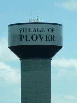 The Plover Watertower | |
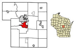 Location of Plover in Portage County, Wisconsin. | |
 Plover, Wisconsin Location of Plover, Wisconsin | |
| Coordinates: 44°27′16″N 89°35′1″W | |
| Country | United States |
| State | Wisconsin |
| County | Portage |
| Settled, platted | 1844-45 |
| First incorporation | March 6, 1857 |
| Second incorporation | March 11, 1912 |
| Third incorporation | September 28, 1971 |
| Dissolved (twice) | 1870; 1931 |
| Area | |
| • Total | 11.08 sq mi (28.69 km2) |
| • Land | 10.60 sq mi (27.45 km2) |
| • Water | 0.48 sq mi (1.24 km2) |
| Elevation | 1,070 ft (326 m) |
| Population | |
| • Total | 12,123 |
| • Estimate (2019)[4] | 13,099 |
| • Density | 1,231.93/sq mi (475.65/km2) |
| Time zone | UTC-6 (Central (CST)) |
| • Summer (DST) | UTC-5 (CDT) |
| Zip code | 54467 |
| Area code(s) | 715 & 534 |
| FIPS code | 55-63550[5] |
| GNIS feature ID | 1583942[2] |
| Website | www |
History
An 1825 treaty establishes a "Plover Portage of the Ouisconsin" as a boundary point between the Chippewa and Winnebago[6]
The area that later became Plover was selected as the county seat of Portage in 1844. The election for the county seat only noted the general location of an unsettled area around present-day Plover. Until the area was settled, county business was actually conducted in the community of Rushville. The Plover area was platted in 1845, and received a post office at the same time under the name "Plover Portage".[7] The name of the post office was changed to "Plover" in 1850.[8]
In 1857, State Senator Luther Hanchett of Plover introduced a bill to incorporate the Village of Clayton in the community; he later amended the bill to make the name the Village of Algernon. That bill passed the Wisconsin Legislature, incorporating the Village of Algernon on March 6, 1857.[9] (Algernon was probably named for Algernon B. Crosby, a postmaster in Portage County.) On May 4, 1858, the name of the village was again changed, this time to the Village of Stanton. And in 1864, the name of the village was finally changed to Plover.[8]
In 1868, the county seat was moved to Stevens Point, following an energetic battle in newspapers and the state legislature. The village of Plover was dissolved. Government of the area fell to the Town of Plover.[10]
Plover was again incorporated as a village on March 8, 1912 after area residents' approval in an election.[11] This incorporation was not long lived, as Plover was again dissolved on October 7, 1931 after another election.[12] An attempt at re-incorporation failed in 1965.[8]
Plover re-incorporated, for the third time, on September 28, 1971. The vote for incorporation was narrow: 311 for and 289 against. The population of the village at that time was 2618.[13] It incorporated about 6.75 square miles (17 km2) of territory, and increased to about 7.25 square miles (19 km2) in 1981, after annexation. Annexations continued nearly every year until the present.[14]
The village president is Tom Davies, who was first elected in 2015.[15]
Geography
According to the United States Census Bureau, the village has a total area of 10.79 square miles (27.95 km2), of which, 10.35 square miles (26.81 km2) of it is land and 0.44 square miles (1.14 km2) is water.[16]
Demographics
| Historical population | |||
|---|---|---|---|
| Census | Pop. | %± | |
| 1880 | 412 | — | |
| 1890 | 319 | −22.6% | |
| 1980 | 5,310 | — | |
| 1990 | 8,176 | 54.0% | |
| 2000 | 10,520 | 28.7% | |
| 2010 | 12,123 | 15.2% | |
| Est. 2019 | 13,099 | [4] | 8.1% |
| U.S. Decennial Census[17] | |||
2010 census
As of the census[3] of 2010, there were 12,123 people, 4,948 households, and 3,242 families living in the village. The population density was 1,171.3 inhabitants per square mile (452.2/km2). There were 5,188 housing units at an average density of 501.3 per square mile (193.6/km2). The racial makeup of the village was 92.8% White, 0.5% African American, 0.4% Native American, 3.8% Asian, 1.0% from other races, and 1.5% from two or more races. Hispanic or Latino of any race were 3.2% of the population.
There were 4,948 households of which 32.7% had children under the age of 18 living with them, 52.8% were married couples living together, 9.0% had a female householder with no husband present, 3.7% had a male householder with no wife present, and 34.5% were non-families. 26.4% of all households were made up of individuals and 8.5% had someone living alone who was 65 years of age or older. The average household size was 2.44 and the average family size was 2.99.
The median age in the village was 35.9 years. 25.3% of residents were under the age of 18; 9% were between the ages of 18 and 24; 27.2% were from 25 to 44; 27.5% were from 45 to 64; and 11% were 65 years of age or older. The gender makeup of the village was 49.1% male and 50.9% female.
2000 census
As of the census[5] of 2000, there were 10,520 people, 3,985 households, and 2,845 families living in the village. The population density was 1,238.2 people per square mile (477.9/km²). There were 4,133 housing units at an average density of 486.5 per square mile (187.7/km²). The racial makeup of the village was 96.82% White, 0.43% Black or African American, 0.42% Native American, 0.95% Asian, 0.04% Pacific Islander, 0.41% from other races, and 0.94% from two or more races. 1.35% of the population were Hispanic or Latino of any race.
There were 3,985 households out of which 39.5% had children under the age of 18 living with them, 59.9% were married couples living together, 8.4% had a female householder with no husband present, and 28.6% were non-families. 20.8% of all households were made up of individuals and 4.6% had someone living alone who was 65 years of age or older. The average household size was 2.63 and the average family size was 3.11.
In the village, the population was spread out with 28.8% under the age of 18, 9.8% from 18 to 24, 32.1% from 25 to 44, 22.9% from 45 to 64, and 6.5% who were 65 years of age or older. The median age was 33 years. For every 100 females, there were 98.4 males. For every 100 females age 18 and over, there were 97.0 males.
The median income for a household in the village was $51,238, and the median income for a family was $60,146. Males had a median income of $40,206 versus $26,521 for females. The per capita income for the village was $23,085. About 4.2% of families and 6.0% of the population were below the poverty line, including 8.0% of those under age 18 and 4.3% of those age 65 or over.
Religion
Saint Bronislava Catholic Church,[18] Woodlands Church,[19] and Divine Word Lutheran Church, affiliated with the Wisconsin Evangelical Lutheran Synod (WELS), are in Plover.[20]
Notable people
- James S. Alban, Wisconsin State Senator
- Dennis Hall, world champion wrestler, Olympic medalist, Pan American Games gold medalist
- Harley M. Jacklin, Wisconsin State Senator
- Robert Lampman, economist
- Alexander S. McDill, United States representative
- Joe Pavelski, NHL player, Dallas Stars
- Clayton K. Slack, Medal of Honor
- Walt Wilmot, baseball player, stole 76 bases in one season for 1890 Chicago Cubs
References
- "2018 U.S. Gazetteer Files". United States Census Bureau. Retrieved Feb 15, 2020.
- "US Board on Geographic Names". United States Geological Survey. 2007-10-25. Retrieved 2008-01-31.
- "U.S. Census website". United States Census Bureau. Retrieved 2012-11-18.
- "Population and Housing Unit Estimates". Retrieved May 21, 2020.
- "U.S. Census website". United States Census Bureau. Retrieved 2008-01-31.
- "Treaty with The Sioux etc - 1825". www.firstpeople.us. Retrieved 12 June 2020.
- Malcolm Rosholt. "PLOVER, the Unincorporated Village of" in Our County Our Story: Portage County, Wisconsin. Stevens Point, Wis.: Portage County Board of Supervisors, 1959, pp 370-377.
- Michael Riley, "A History of Plover to 1984".
- http://sos.nmtvault.com/pdf/THEOSOS_004/images/00002935.pdf
- http://www.pchswi.org/archives/communities/plover/algernon.html
- http://sos.nmtvault.com/pdf/THEOSOS_004/images/00002936.pdf
- http://sos.nmtvault.com/pdf/THEOSOS_004/images/00002938.pdf
- http://sos.nmtvault.com/pdf/THEOSOS_010/images/00006611.pdf
- http://sos.nmtvault.com/SearchResults.aspx?City=V457%5B%5D
- "Village Board: Village President". Village of Plover. Retrieved March 26, 2018.
- "US Gazetteer files 2010". United States Census Bureau. Archived from the original on 2012-01-25. Retrieved 2012-11-18.
- "Census of Population and Housing". Census.gov. Retrieved June 4, 2015.
- http://stbrons.com/
- http://woodlandschurch.org/
- "Divine Word Lutheran Church, Plover, WI".
External links
Municipalities and communities of Portage County, Wisconsin, United States | ||
|---|---|---|
| City | 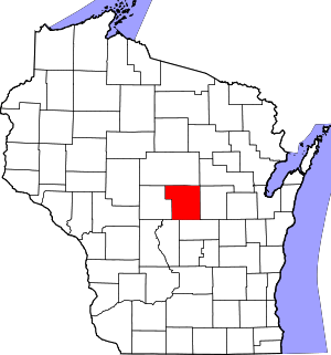 | |
| Villages | ||
| Towns | ||
| CDPs | ||
| Unincorporated communities | ||
| Ghost town/neighborhood | ||
| Footnotes | ‡This populated place also has portions in an adjacent county or counties | |
| Authority control |
|
|---|