Phana District
Phana (Thai: พนา, pronounced [pʰā.nāː]) is a district (amphoe) of Amnat Charoen Province, northeastern Thailand.
Phana พนา | |
|---|---|
 | |
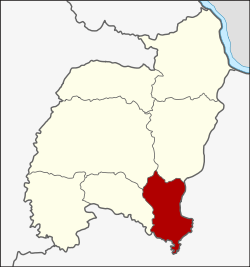 District location in Amnat Charoen Province | |
| Coordinates: 15°41′0″N 104°50′48″E | |
| Country | Thailand |
| Province | Amnat Charoen |
| Subdistricts | 4 |
| Mubans | 56 |
| District established | 1950 |
| Area | |
| • Total | 235.0 km2 (90.7 sq mi) |
| Population (2010) | |
| • Total | 28,001 |
| • Density | 216.2/km2 (560/sq mi) |
| Time zone | UTC+7 (ICT) |
| Postal code | 37180 |
| Geocode | 3704 |
History
The district goes back to Mueang Phana Nikhom (พนานิคม), which was a subordinate of Mueang Ubon Ratchathani. It was converted into a district in 1914. The district office was in Ban Khulu, which is now in Trakan Phuet Phon District. On 1 December 1951 the western part of the district was split off as the minor district (king amphoe) Phana.[1] It was upgraded to a full district on 22 July 1959.[2] In 1993 it was one of the districts which formed the new province, Amnat Charoen.[3]
Geography
Neighboring districts are (from the west clockwise): Lue Amnat, Mueang Amnat Charoen, and Pathum Ratchawongsa of Amnat Charoen Province; and Trakan Phuet Phon, Lao Suea Kok, and Muang Sam Sip of Ubon Ratchathani Province.
Administration
The district is divided into four sub-districts (tambons), which are further subdivided into 56 villages (mubans). There are two sub-district municipalities (thesaban tambons). Phra Lao covers parts of tambon Phra Lao, and Phana covers further parts of tambon Phra Lao and parts of tambon Phana. There are a further three tambon administrative organizations (TAO).
| No. | Name | Thai | Villages | Pop.[4] |
|---|---|---|---|---|
| 1. | Phana | พนา | 11 | 4,856 |
| 2. | Chan Lan | จานลาน | 18 | 8,535 |
| 3. | Mai Klon | ไม้กลอน | 16 | 7,461 |
| 4. | Phra Lao | พระเหลา | 11 | 7,149 |
References
- ประกาศกระทรวงมหาดไทย เรื่อง ยกฐานะตำบลขึ้นเป็นกิ่งอำเภอ (PDF). Royal Gazette (in Thai). 68 (9 ง): 399–400. 1951-01-30.
- พระราชกฤษฎีกาจัดตั้งอำเภอกระสัง อำเภอกระนวน อำเภอบางกอกใหญ่ อำเภอขุนหาร อำเภอพนา อำเภอปากช่อง อำเภอวังเหนือ อำเภอวังชิ้น อำเภอแม่ทา อำเภอหนองหมู อำเภอสระแก้ว อำเภออมก๋อย อำเภอบางซ้าย อำเภอทับสะแก อำเภอบุณฑริก อำเภอลานสะกา อำเภอจอมบึง อำเภอท่ายาง อำเภอสามเงา อำเภอฟากท่า อำเภอบ้านเขว้า อำเภอชานุมาน อำเภอแม่พริก อำเภอท่าสองยาง อำเภอสะเมิง อำเภอหนองแขม อำเภอพระแสง พ.ศ. ๒๕๐๑ (PDF). Royal Gazette (in Thai). 75 (55 ก): 321–327. 1958-07-22.
- พระราชบัญญัติตั้งจังหวัดอำนาจเจริญ พ.ศ. ๒๕๓๖ (PDF). Royal Gazette (in Thai). 110 (125 ก ฉบับพิเศษ): 4–6. 1993-09-02.
- "Population statistics 2010". Department of Provincial Administration. Archived from the original on 2011-09-10. Retrieved 2011-11-08.
External links
- amphoe.com (Thai)