Perrin, Texas
Perrin is a census-designated place (CDP) and unincorporated community in southeastern Jack County, Texas, United States. As of the 2010 census it had a population of 398.[1] It is located at the intersection of US Highway 281 and FM 2210.
Perrin, Texas | |
|---|---|
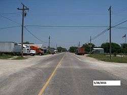 In front of Mark Street on FM 2210, looking east | |
 Perrin  Perrin | |
| Coordinates: 33°02′02″N 98°04′09″W | |
| Country | United States |
| State | Texas |
| County | Jack |
| Area | |
| • Total | 1.61 sq mi (4.16 km2) |
| • Land | 1.59 sq mi (4.11 km2) |
| • Water | 0.02 sq mi (0.04 km2) |
| Elevation | 1,045 ft (330 m) |
| Population (2010) | |
| • Total | 398 |
| • Density | 250/sq mi (96.7/km2) |
| Time zone | UTC-6 (Central (CST)) |
| • Summer (DST) | UTC-5 (CDT) |
| ZIP code | 76486 |
| Area code(s) | 940 |
| FIPS code | 48-56864[1] |
| GNIS feature ID | 1343870[2] |
It was established in 1870 and named for Levi W. Perrin, the father of the town's founder, Louis Perrin. In the early 20th century, the small town supported two banks and was larger than Jacksboro. Perrin was in prime consideration for the county seat and was only passed over for Jacksboro because it was not centrally located within the county.
US 281 leads north from Perrin 14 miles (23 km) to Jacksboro and south 16 miles (26 km) to Mineral Wells. Fort Worth is 53 miles (85 km) to the southeast.
Businesses in the community include the Pirates Cove (the town's only gas station), Perrin Feed and Hardware, the US Post Office (ZIP code 76486), multiple churches, and the school.
The Perrin-Whitt Consolidated Independent School District serves area students including those living in the nearby community of Whitt.
Bluegrass festivals
Two miles east of Perrin is Mitchell Resort and RV Park, which was founded by the William and Frances Mitchell family. The park hosts bluegrass festivals, with the first presented in 1975. The Mitchell Family Bluegrass Gospel Band (William and Frances, along with their five children performed at the festivals and were nationally renowned. The festivals ended in approximately 1998 and did not begin again until 2004, under new owners who are still the current owners. The youngest of the Mitchell family, Patty Beth, served in the early 1990s as interim bassist/mandolinist and lead vocalist for an early lineup of the Dixie Chicks.
References
- "Geographic Identifiers: 2010 Census Summary File 1 (G001): Perrin CDP, Texas". American Factfinder. U.S. Census Bureau. Archived from the original on February 13, 2020. Retrieved November 30, 2018.
- U.S. Geological Survey Geographic Names Information System: Perrin, Texas
External links
Municipalities and communities of Jack County, Texas, United States | ||
|---|---|---|
| Cities |  Jack County map | |
| CDP | ||
| Other unincorporated communities | ||