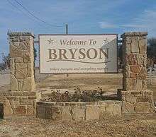
Bryson, Texas
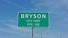
Bryson is a city in Jack County, Texas, in the United States. As of the 2010 census, the population was 539.[5]
Bryson, Texas | |
|---|---|
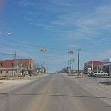
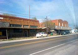 Downtown Bryson | |
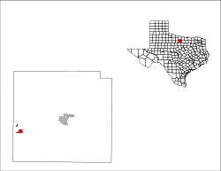
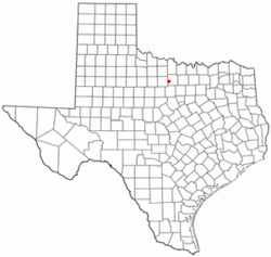 Location of Bryson, Texas | |
 | |
| Coordinates: 33°9′38″N 98°23′16″W | |
| Country | United States |
| State | Texas |
| County | Jack |
| Area | |
| • Total | 1.43 sq mi (3.69 km2) |
| • Land | 1.32 sq mi (3.41 km2) |
| • Water | 0.11 sq mi (0.28 km2) |
| Elevation | 1,250 ft (381 m) |
| Population (2010) | |
| • Total | 539 |
| • Estimate (2019)[2] | 536 |
| • Density | 407.29/sq mi (157.30/km2) |
| Time zone | UTC-6 (Central (CST)) |
| • Summer (DST) | UTC-5 (CDT) |
| ZIP code | 76427 |
| Area code(s) | 940 |
| FIPS code | 48-10960[3] |
| GNIS feature ID | 1331472[4] |
| Website | cityofbrysontexas |
Geography
Bryson is located in western Jack County at 33°9′38″N 98°23′16″W (33.160523, -98.387805).[6] It is situated 14 miles (23 km) southwest of Jacksboro, the county seat, along U.S. Highway 380.[7] US 380 continues southwest 13 miles (21 km) to Graham, the county seat of Young County.
According to the United States Census Bureau, Bryson has a total area of 1.4 square miles (3.7 km2), of which 1.3 square miles (3.4 km2) are land and 0.1 square miles (0.3 km2), or 7.64%, are water.[5] The water area encompasses Lake Bryson, a reservoir 2.5 miles (4.0 km) northwest of the city. Bryson is in the Rock Creek watershed, flowing south to the Brazos River.

History
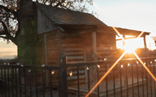
The community was first settled in the late 19th century. Originally known as "Mount Hecla", a post office opened under that name in 1878.[8] Henry Bryson built the area's first residence, a log cabin, that same year.[7] The community was later renamed after him. This change was officially recognized in 1884, when the local post office took the name "Bryson". Mr. Bryson went on to serve as County Commissioner.[8] Early pioneer family names of Bryson were Blount, Chambers, Clayton, Cook, Crumpton, Cullers, Enlow, Epperson, Henderson, Keyser, Kuykendall, McCloud, Moore, Raley, Shanafelt and Vanhooser.
The Chicago, Rock Island and Texas Railway, a subsidiary of the Chicago, Rock Island and Pacific Railroad, reached Bryson in the fall of 1902. Although oil had been discovered in Jack County as early as 1898, it wasn't until the mid-1920s that Bryson became an oil processing center for local producers.[7] The resulting population boom led to the community being known as Jack County's "second city" (after Jacksboro).[8]
On June 6, 1929, the town incorporated a mayor-council form of government. Men that served there include B.B. Bryson, Sam Cullers, L.O. Moore, J.R. Clayton, Willis Williams, and Williard Schlitter. The town had a population of 641 in the 1930 census. A 1938 oil boom in Bryson saw the population explode with many people forced to live in tents. In 1940, the census dropped back to 806. As oil production declined, so did the population. The low point occurred in 1970, when only 455 people lived within the city limits.[8] During the latter half of the 20th century, Bryson slowly grew to over 500 residents. In 1988, there were seven businesses serving the community.[7] There were reportedly 22 businesses in Bryson as of 2004.[9]
Demographics
As of the census[3] of 2000, there were 528 people, 222 households, and 146 families residing in the city. The population density was 426.0 people per square mile (164.4/km2). There were 261 housing units at an average density of 210.6 per square mile (81.3/km2). The racial makeup of the city was 93.75% White, 0.76% African American, 2.27% Native American, 0.38% Asian, 0.19% from other races, and 2.65% from two or more races. Hispanic or Latino of any race were 1.70% of the population.
| Historical population | |||
|---|---|---|---|
| Census | Pop. | %± | |
| 1930 | 641 | — | |
| 1940 | 806 | 25.7% | |
| 1950 | 588 | −27.0% | |
| 1960 | 545 | −7.3% | |
| 1970 | 455 | −16.5% | |
| 1980 | 579 | 27.3% | |
| 1990 | 520 | −10.2% | |
| 2000 | 528 | 1.5% | |
| 2010 | 539 | 2.1% | |
| Est. 2019 | 536 | [2] | −0.6% |
| U.S. Decennial Census[10] | |||
There were 222 households, out of which 31.1% had children under the age of 18 living with them, 53.2% were married couples living together, 9.5% had a female householder with no husband present, and 33.8% were non-families. 30.6% of all households were made up of individuals, and 14.9% had someone living alone who was 65 years of age or older. The average household size was 2.38 and the average family size was 2.98.
In the city, the population was spread out, with 26.5% under the age of 18, 7.8% from 18 to 24, 27.1% from 25 to 44, 22.7% from 45 to 64, and 15.9% who were 65 years of age or older. The median age was 38 years. For every 100 females, there were 92.7 males. For every 100 females age 18 and over, there were 86.5 males.
The median income for a household in the city was $26,071, and the median income for a family was $30,588. Males had a median income of $27,083 versus $20,114 for females. The per capita income for the city was $13,264. About 12.3% of families and 17.4% of the population were below the poverty line, including 15.9% of those under age 18 and 26.5% of those age 65 or over.
Education
The city is served by the Bryson Independent School District.
Bryson Independent School District
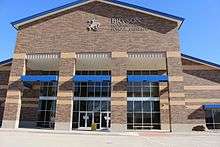
In 1875, the first school was started at a log cabin and was named "Cottonwood". As the town and its population grew, its log cabin school was replaced with a frame building, which was later replaced by a two-story building. In 1885, the school was renamed "Bryson Academy" with two new instructors named J.T. Lippard, and C.B Hickman. In 1905, the two story frame was turned into a brick structure for elementary and high school. In 1938, the school built a gym. Later, a new high school was built and the old brick building was turned into an AG shop. In 1957 a new elementary school building was built. In 2012, the old school was torn down and a new school was raised.
References
- "2019 U.S. Gazetteer Files". United States Census Bureau. Retrieved June 26, 2020.
- "Population and Housing Unit Estimates". United States Census Bureau. May 24, 2020. Retrieved May 27, 2020.
- "U.S. Census website". United States Census Bureau. Retrieved 2008-01-31.
- "US Board on Geographic Names". United States Geological Survey. 2007-10-25. Retrieved 2008-01-31.
- "Geographic Identifiers: 2010 Census Summary File 1 (G001): Bryson city, Texas". American Factfinder. U.S. Census Bureau. Archived from the original on February 13, 2020. Retrieved November 29, 2018.
- "US Gazetteer files: 2010, 2000, and 1990". United States Census Bureau. 2011-02-12. Retrieved 2011-04-23.
- "Bryson, Texas". The Handbook of Texas online. Retrieved 2009-02-14.
- "Bryson, Texas". Texas Escapes Online Magazine. Retrieved 2009-02-14.
- Texas Almanac – Retrieved February 14, 2009.
- "Census of Population and Housing". Census.gov. Retrieved June 4, 2015.
| Wikimedia Commons has media related to Bryson, Texas. |
External links
- City of Bryson official website
- Handbook of Texas Online: Bryson, Texas
- Bryson Independent School District
Municipalities and communities of Jack County, Texas, United States | ||
|---|---|---|
| Cities |  Jack County map | |
| CDP | ||
| Other unincorporated communities | ||