Penmarch
Penmarc'h or Penmarch is a commune in the Finistère department of Brittany in north-western France. It lies 18 km south-west of Quimper by road.
Penmarch Penmarc'h | |
|---|---|
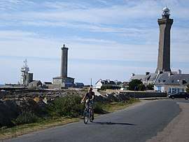 Lighthouses on the Pointe de Penmarc'h | |
 Coat of arms | |
Location of Penmarch 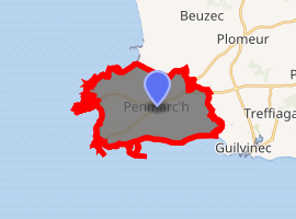
| |
 Penmarch  Penmarch | |
| Coordinates: 47°48′46″N 4°20′12″W | |
| Country | France |
| Region | Brittany |
| Department | Finistère |
| Arrondissement | Quimper |
| Canton | Pont-l'Abbé |
| Intercommunality | Pays Bigouden Sud |
| Government | |
| • Mayor (2014–2020) | Raynald Tanter |
| Area 1 | 16.39 km2 (6.33 sq mi) |
| Population (2017-01-01)[1] | 5,247 |
| • Density | 320/km2 (830/sq mi) |
| Time zone | UTC+01:00 (CET) |
| • Summer (DST) | UTC+02:00 (CEST) |
| INSEE/Postal code | 29158 /29760 |
| Elevation | −1–23 m (−3.3–75.5 ft) |
| 1 French Land Register data, which excludes lakes, ponds, glaciers > 1 km2 (0.386 sq mi or 247 acres) and river estuaries. | |
Geography
Penmarch is the southwest most township of Pays Bigouden, at the southern end of the Bay of Audierne. It is the most populous township of the Guilvinec's canton, with a population of 5,889 inhabitants in 1999 (21,813 for the entire township).
The territory of the town is particularly flat and a very low altitude. There are many marshy lagoons, some of which have been drained and filled, especially in St. Guénolé to save space or habitat for the installation of local handicrafts.
The municipality consists of four villages:
- Penmarch-Bourg, formerly known as the Tréoultré;
- Saint Guénolé (main fishing port);
- Kerity (fishing port side moving towards the hosting of the craft);
- St. Pierre (port for very small units).
Many islands or reefs of very variable dimensions punctuate the coast of Penmarch; the most important are the Etocs south of Kerity, and the island St. Nonna west of Saint-Pierre.
The port of Saint-Guénolé has a pass opening due west, thought to be dangerous in rough weather. It is protected by two granite peninsulas: Krugen in the South, and Conq in the northwest. Krugen is connected to the mainland by a sandy isthmus. Conq is connected to shore by an artificial embankment itself protected by concrete blocks to better break the flood wave.
The rocky granite coast (called "savage coast" in St. Guénolé) is interspersed with several beaches:
- North, the beach of Pors Carn-which extends to the tip of the torch (joint Plomeur);
- West, the beach of Joy;
- South, the beach Steir Kerity which begins and continues through Guilvinec.
History
On the extremity of the peninsula on which it is situated are fortified remains of a town which was of considerable importance from the 14th to the 16th centuries and included, besides Penmarc'h, Saint-Guénolé and Kerity. It owed its prosperity to its cod-banks, the disappearance of which, together with the discovery of the Newfoundland cod-banks and the pillage of the place by the bandit La Fontenelle in 1595, contributed to its decline.
The church of Saint Nouna, a Gothic building of the early 16th century at Penmarc'h, and the church of St. Guénolé, an unfinished tower, and the church of Kerity are of interest. The coast is very dangerous. On the Pointe de Penmarc'h stands the Phare d'Eckmühl, with a light visible for 100 km (60 mi). There are numerous megalithic monuments in the vicinity.
Climate
Penmarch has a climate bordering between mediterranean (Köppen Csb) and oceanic (Cfb). It is heavily moderated by the Atlantic Ocean and the Gulf Stream influence, resulting in cool summers and very mild winters for the latitude as seasonal differences are low.
| Climate data for Penmarch (1981–2010 normals; extremes 1973–2017) | |||||||||||||
|---|---|---|---|---|---|---|---|---|---|---|---|---|---|
| Month | Jan | Feb | Mar | Apr | May | Jun | Jul | Aug | Sep | Oct | Nov | Dec | Year |
| Record high °C (°F) | 14.4 (57.9) |
14.6 (58.3) |
23.7 (74.7) |
25.8 (78.4) |
28.3 (82.9) |
33.0 (91.4) |
31.1 (88.0) |
32.7 (90.9) |
30.5 (86.9) |
22.6 (72.7) |
20.0 (68.0) |
16.0 (60.8) |
33.0 (91.4) |
| Average high °C (°F) | 10.1 (50.2) |
9.9 (49.8) |
11.4 (52.5) |
13.3 (55.9) |
16.6 (61.9) |
18.4 (65.1) |
19.7 (67.5) |
20.1 (68.2) |
18.8 (65.8) |
16.0 (60.8) |
13.1 (55.6) |
10.9 (51.6) |
14.8 (58.6) |
| Daily mean °C (°F) | 8.2 (46.8) |
7.8 (46.0) |
9.3 (48.7) |
10.8 (51.4) |
13.5 (56.3) |
15.8 (60.4) |
17.4 (63.3) |
17.7 (63.9) |
16.3 (61.3) |
14.0 (57.2) |
11.1 (52.0) |
8.9 (48.0) |
12.6 (54.7) |
| Average low °C (°F) | 6.4 (43.5) |
5.6 (42.1) |
7.1 (44.8) |
8.2 (46.8) |
11.0 (51.8) |
13.3 (55.9) |
15.1 (59.2) |
15.2 (59.4) |
13.8 (56.8) |
11.9 (53.4) |
9.1 (48.4) |
6.9 (44.4) |
10.3 (50.5) |
| Record low °C (°F) | −9.3 (15.3) |
−6.8 (19.8) |
−2.0 (28.4) |
0.4 (32.7) |
2.0 (35.6) |
6.0 (42.8) |
8.8 (47.8) |
8.3 (46.9) |
6.7 (44.1) |
−0.2 (31.6) |
−3.0 (26.6) |
−6.3 (20.7) |
−9.3 (15.3) |
| Average precipitation mm (inches) | 74.9 (2.95) |
59.6 (2.35) |
53.9 (2.12) |
47.8 (1.88) |
46.8 (1.84) |
29.0 (1.14) |
31.2 (1.23) |
29.6 (1.17) |
43.5 (1.71) |
72.3 (2.85) |
67.0 (2.64) |
77.5 (3.05) |
633.1 (24.93) |
| Average precipitation days | 13.7 | 10.3 | 11.1 | 10.0 | 9.2 | 5.7 | 5.8 | 6.1 | 7.4 | 11.8 | 12.4 | 12.7 | 116.1 |
| Source 1: Météo Climat [2] | |||||||||||||
| Source 2: Météo Climat [3] | |||||||||||||
Population
Inhabitants of Penmarc'h are called in French Penmarchais. The commune has a greater population than Guilvinec.
| Historical population | ||
|---|---|---|
| Year | Pop. | ±% |
| 1793 | 1,134 | — |
| 1800 | 1,166 | +2.8% |
| 1806 | 885 | −24.1% |
| 1821 | 1,462 | +65.2% |
| 1831 | 1,727 | +18.1% |
| 1836 | 1,781 | +3.1% |
| 1841 | 1,783 | +0.1% |
| 1846 | 1,867 | +4.7% |
| 1851 | 1,964 | +5.2% |
| 1856 | 1,987 | +1.2% |
| 1861 | 2,029 | +2.1% |
| 1866 | 2,227 | +9.8% |
| 1872 | 2,431 | +9.2% |
| 1876 | 2,641 | +8.6% |
| 1881 | 2,871 | +8.7% |
| 1886 | 3,238 | +12.8% |
| 1891 | 3,600 | +11.2% |
| 1896 | 4,298 | +19.4% |
| 1901 | 5,068 | +17.9% |
| 1906 | 5,702 | +12.5% |
| 1911 | 6,051 | +6.1% |
| 1921 | 6,735 | +11.3% |
| 1926 | 6,877 | +2.1% |
| 1931 | 7,037 | +2.3% |
| 1936 | 6,956 | −1.2% |
| 1946 | 7,077 | +1.7% |
| 1954 | 7,204 | +1.8% |
| 1962 | 7,652 | +6.2% |
| 1968 | 7,320 | −4.3% |
| 1975 | 6,921 | −5.5% |
| 1982 | 6,463 | −6.6% |
| 1990 | 6,272 | −3.0% |
| 1999 | 5,889 | −6.1% |
| 2008 | 5,633 | −4.3% |
Sights
Penmarch is also home to the 'Droguen' rock.
Literary references
Dorigen, the female protagonist in Geoffrey Chaucer's The Franklin's Tale, has a name similar to this, which may symbolise her obduracy..
See also
- Communes of the Finistère department
- The Penmarch monument aux morts has sculpture by Pierre Charles Lenoir
- The Penmarch serves as a landing point for SEA-ME-WE 3, the longest submarine cable on Earth
References
- "Populations légales 2017". INSEE. Retrieved 6 January 2020.
- "French climate normals 1981-2010". Météo Climat. Retrieved 19 September 2018.
- "Weather extremes for Penmarch". Météo Climat. Retrieved 19 September 2018.

Further reading
- Couliou, Jean-René (1997) La Pêche bretonne. 446 p. Rennes: Presses Universitaires de Rennes
- Foyer de l'enseignement (1950) Grandeurs ... au pays de Penmarc'h: terre et mer. 58 p. Les Amitiés de Lorraine et d'Alsace
- Le Gallo, Yves (ed.) (1991) Le Finistère de la Préhistoire à nos jours. Ed. Bordessoules
- Quaghebeur, Joëlle (2001) La Cornouaille du IXe au XIIe siècle. Société archéologique du Finistère
- Dubois, Xavier (2002) « La Crise sardinière et les Mutations de la conserverie », in: Humbert, M., ed. La Bretagne à l'heure de la mondialisation. Rennes: Presses Universitaire de Rennes; pp. 27–33
- Duigou, Serge, et al. (2003) Histoire du Pays bigouden. Ed. Palantines
- Dreyer, Francis & Fichou, Jean-Christophe (2005) L'histoire de tous les phares de France. 316 p. Ouest-France ISBN 2-7373-3704-6; pp. 179–182
External links
| Wikimedia Commons has media related to Penmarch. |
- Official website (in French)
- French Ministry of Culture list for Penmarc'h (in French)
| Authority control |
|
|---|