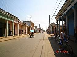
Pedro Betancourt
Pedro Betancourt, sometimes shortened as Betancourt, is a municipality and town in the Matanzas Province of Cuba. It is located in the center of the province, west of Jagüey Grande and east of Unión de Reyes. It was founded in 1833.[1]
Pedro Betancourt | |
|---|---|
 | |
 Coat of arms | |
.png) Pedro Betancourt municipality (red) within Matanzas Province (yellow) and Cuba | |
| Coordinates: 22°43′49″N 81°17′27″W | |
| Country | Cuba |
| Province | Matanzas |
| Founded | 1833[1] |
| Established | 1879 |
| Area | |
| • Total | 388 km2 (150 sq mi) |
| Elevation | 25 m (82 ft) |
| • Density | 83.0/km2 (215/sq mi) |
| Time zone | UTC-5 (EST) |
| Area code(s) | +53-52 |
History
Its original name was Corral Falso de Macurijes. Pedro Betancourt's name comes from a famous Spanish-Cuban patriot, Pedro Estanislao Betancourt Dávalos, who was one of the Major-General in the independence war, waged by the Cuban natives against the Spanish Crown.
Geography
The municipality was historically divided into the barrios of Cabecera Norte, Cabecera Sur (both constituting the town), Ciego, Linche, Navajas, Platanal, Punta Brava, Torriente and Tramojos.[1] Nowadays it counts the town itself and 6 popular councils (consejos populares, i.e. villages): Bolondrón, Camilo, Güira de Macurijes,[3] Manolito, Navajas and Pedroso-Socorro.[4]
Demographics
In 2004, the municipality of Pedro Betancourt had a population of .[5] With a total area of 388 km2 (150 sq mi),[2] it has a population density of 83.0/km2 (215/sq mi).
Sisters towns
References
- Guije.com. "Pedro Betancourt" (in Spanish). Retrieved 2007-10-07.
- Statoids (July 2003). "Municipios of Cuba". Retrieved 2007-10-07.
- (in Spanish) Güira de Macurijes on EcuRed
- (in Spanish) The Consejos Populares of Pedro Betancourt (EcuRed)
- Atenas.cu (2004). "2004 Population trends, by Province and Municipality" (in Spanish). Archived from the original on 2007-09-27. Retrieved 2007-10-07.
External links

Places adjacent to Pedro Betancourt | ||||||||||
|---|---|---|---|---|---|---|---|---|---|---|
| ||||||||||