Ciénaga de Zapata
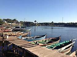
Ciénaga de Zapata is one of 14 municipalities of the Matanzas Province, Cuba, and the municipal seat is located at Playa Larga, at the northern end of the Bahia de Cochinos ("Bay of Pigs"). A large part of the municipality is protected as the Zapata Swamp.
Ciénaga de Zapata Zapata Swamp | |
|---|---|
 Playa Larga | |
.png) The Great Swamp municipality (red) within Matanzas Province (yellow) and Cuba | |
| Coordinates: 22°17′N 81°13′W | |
| Country | |
| Province | Matanzas |
| Seat | Playa Larga |
| Area | |
| • Total | 4,162 km2 (1,607 sq mi) |
| Elevation | 5 m (16 ft) |
| Population (2004)[2] | |
| • Total | 8,611 |
| • Density | 2/km2 (5/sq mi) |
| Time zone | UTC-5 (EST) |
| Area code(s) | +53-52 |
It is the largest municipality of Cuba with 4,162 km2.[1]
Among the villages included in the municipal territory, one of the most famous is Playa Girón, site of the Bay of Pigs Invasion in 1961. Other villages are Bermejas, Buenaventura, Caleta del Rosario, Caleta Sábalo, El Jiquí, El Maíz, El Rincón, Guamá, Guasasa, Helechal, La Ceiba, La Florestal, La Salina, Maneadero, Palpite, Playa Maceo, Playa Maquina, San Blás, San Lázaro, Santo Tomás and Sopillar.
In 2004, the municipality of Cienaga de Zapata had a population of 8,611.[2] With a total area of 4,162 km2 (1,607 sq mi),[1] it has a population density of 2.0/km2 (5.2/sq mi).
References
- Statoids (July 2003). "Municipios of Cuba". Retrieved 2007-10-17.
- Atenas.cu (2004). "2004 Population trends, by Province and Municipality" (in Spanish). Archived from the original on 2007-09-27. Retrieved 2007-10-17.
External links

Places adjacent to Ciénaga de Zapata | |
|---|---|