Paruna, South Australia
Paruna is a town in eastern South Australia. The town is located on the Browns Well Highway,[9] where it crosses the former Barmera railway line, 237 kilometres (147 mi) east of the state capital, Adelaide.
| Paruna South Australia | |||||||||||||||
|---|---|---|---|---|---|---|---|---|---|---|---|---|---|---|---|
 Railway Tce, the main street of Paruna | |||||||||||||||
 Paruna | |||||||||||||||
| Coordinates | 34°43′12″S 140°43′42″E[1] | ||||||||||||||
| Population | 53 (2016 census)[2] | ||||||||||||||
| Established | 23 July 1914 (town) 28 September 2000 (locality)[3][4] | ||||||||||||||
| Postcode(s) | 5311 | ||||||||||||||
| Elevation | 59 m (194 ft)(railway station) [5] | ||||||||||||||
| Time zone | ACST (UTC+9:30) | ||||||||||||||
| • Summer (DST) | ACST (UTC+10:30) | ||||||||||||||
| Location | |||||||||||||||
| LGA(s) | District Council of Loxton Waikerie[1] | ||||||||||||||
| Region | Murray and Mallee[1] | ||||||||||||||
| County | Alfred[1] | ||||||||||||||
| State electorate(s) | Chaffey[6] | ||||||||||||||
| Federal Division(s) | Barker[7] | ||||||||||||||
| |||||||||||||||
| |||||||||||||||
| Footnotes | Adjoining localities[1] | ||||||||||||||
Purana is an aboriginal word meaning "stopping place".[10]
The government town of Paruna was proclaimed on 23 July 1914 on land in the cadastral unit of the Hundred of Kekwick to the immediate north of the Paruna Railway Station.[5][3] The locality’s boundaries were created on 28 September 2000 with the site of the government town of Paruna being located in its approximate centre.[1][4]
The Barmera railway line from Adelaide was opened to Paruna on 1 May 1913 and a further 11 km to Meribah within the week.[11] It was later extended north to Paringa then across the Paringa Bridge to Renmark and Barmera, but has now been closed and removed.
Paruna School operated between 1917 and 1965, and Paruna North School between 1925 and 1941.[10] Brown's Well District Area School closed in 2007.[12][13] The effects of prolonged drought and the movement of population to larger centres has led to the closure of a number of other facilities over recent years, including the general store and the golf club.[14]
Paruna was the seat of the District Council of Brown's Well until a merger that created the District Council of Loxton Waikerie in 1997.[15]
The 2016 Australian census which was conducted in August 2016 reports that Paruna had a population of 53 people.[2]
Paruna is located within the federal division of Barker, the state electoral district of Chaffey and the local government area of the District Council of Loxton Waikerie.[7][6][1]
Gallery
 Former Brown's Well District Council chambers
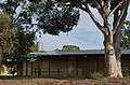 Former Brown's Well District area school
 General store, no longer operating
 A church in Paruna
References
- "Search results for 'Paruna, LOCB' with the following datasets being selected - 'Suburbs and Localities', 'Government Towns', 'Counties', 'Local Government Areas', 'SA Government Regions' and 'Gazetteer'". Location SA Map Viewer. Government of South Australia. Retrieved 10 May 2018.
- Australian Bureau of Statistics (27 June 2017). "Paruna". 2016 Census QuickStats. Retrieved 10 May 2018.

- Bice, John G. (23 July 1914). "TOWN OF PARUNA" (PDF). The South Australian Government Gazette. South Australian Government. p. 196. Retrieved 10 May 2018.
- Lawson, Robert (28 September 2000). "GEOGRAPHICAL NAMES ACT 1991 Notice to Assign Boundaries to Places (in the District Council of Loxton Waikerie )" (PDF). The South Australian Government Gazette. South Australian Government. p. 2282. Retrieved 10 May 2018.
- "Search results for 'Paruna Railway Station' with the following datasets being selected - 'Suburbs and Localities', 'Government Towns', 'Gazetteer' and 'Railways'". Location SA Map Viewer. Government of South Australia. Retrieved 10 May 2018.
- "District of Chaffey Background Profile". Electoral Commission SA. Retrieved 17 September 2015.
- "Federal electoral division of Barker, boundary gazetted 16 December 2011" (PDF). Australian Electoral Commission. Retrieved 17 September 2015.
- "Summary (climate) statistics LOXTON RESEARCH CENTRE (nearest weather station)". Commonwealth of Australia , Bureau of Meteorology. Retrieved 10 May 2018.
- "Murray Mallee, Riverland" (PDF). Naming of State Rural Roads. Government of South Australia. 6 December 2013. Rack Plan 870. Archived from the original (PDF) on 26 May 2014. Retrieved 3 October 2014.
- "The Manning Index of South Australian History". State Library South Australia. Retrieved 29 January 2010.
- Brown's Well Line, 1913, retrieved 27 June 2014
- "Brown's Well District Area School, Paruna". teachweb. Archived from the original on 15 October 2009. Retrieved 30 January 2010.
- "Vote closes Browns Well school". ABC News. 26 October 2007. Retrieved 29 January 2010.
- "Final tee for the Paruna Golf Club". ABC Riverland. 6 May 2008..
- "District Council of Loxton Waikerie - Council Information". District Council of Loxton Waikerie. 21 February 2006. Archived from the original on 6 March 2014. Retrieved 27 June 2014.