Palmer, Tennessee
Palmer is a town in Grundy County, Tennessee, United States. The population was 672 at the 2010 census.[6]
Palmer, Tennessee | |
|---|---|
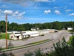 TN-108 passing through Palmer | |
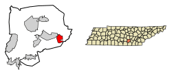 Location of Palmer in Grundy County, Tennessee. | |
| Coordinates: 35°21′23″N 85°33′43″W | |
| Country | United States |
| State | Tennessee |
| County | Grundy |
| Incorporated | 1925[1] |
| Area | |
| • Total | 4.93 sq mi (12.77 km2) |
| • Land | 4.93 sq mi (12.77 km2) |
| • Water | 0.00 sq mi (0.00 km2) |
| Elevation | 1,818 ft (554 m) |
| Population (2010) | |
| • Total | 672 |
| • Estimate (2018)[3] | 664 |
| • Density | 134.66/sq mi (52.00/km2) |
| Time zone | UTC-6 (Central (CST)) |
| • Summer (DST) | UTC-5 (CDT) |
| ZIP code | 37365 |
| Area code(s) | 931 |
| FIPS code | 47-56560[4] |
| GNIS feature ID | 1296690[5] |
History
Palmer was originally known as "Tate's Village". When it incorporated in 1925, it was renamed in honor of Clarence William Palmer (1850–1919), who owned much of the land upon which the town was established.[7][1] The town thrived during the early 20th century due in large part to mining operations conducted in the area by the Tennessee Consolidated Coal Company.[8]
Geography
Palmer is located in southeastern Grundy County at 35°21′23″N 85°33′43″W (35.356381, -85.561987).[9] It lies in a rugged area atop the Cumberland Plateau, just west of the Plateau's Sequatchie Valley escarpment. The point where Grundy, Marion, and Sequatchie counties meet is located just south of Palmer. Tennessee State Route 108 passes through Palmer, connecting the town with Gruetli-Laager to the west and Whitwell in the Sequatchie Valley to the southeast. The source of the 67-mile (108 km) Collins River is located just northeast of Palmer.[10]
According to the United States Census Bureau, the town has a total area of 4.9 square miles (12.8 km2), all of it land.[6]
Demographics
| Historical population | |||
|---|---|---|---|
| Census | Pop. | %± | |
| 1930 | 1,158 | — | |
| 1940 | 1,228 | 6.0% | |
| 1950 | 871 | −29.1% | |
| 1960 | 1,069 | 22.7% | |
| 1970 | 898 | −16.0% | |
| 1980 | 1,027 | 14.4% | |
| 1990 | 769 | −25.1% | |
| 2000 | 726 | −5.6% | |
| 2010 | 672 | −7.4% | |
| Est. 2018 | 664 | [3] | −1.2% |
| Sources:[11][12] | |||
As of the census[4] of 2000, there were 726 people, 305 households, and 207 families residing in the town. The population density was 138.0 people per square mile (53.3/km²). There were 331 housing units at an average density of 62.9 per square mile (24.3/km²). The racial makeup of the town was 98.76% White, and 1.24% from two or more races. Hispanic or Latino of any race were 0.28% of the population.
There were 305 households out of which 22.6% had children under the age of 18 living with them, 51.5% were married couples living together, 13.1% had a female householder with no husband present, and 32.1% were non-families. 28.5% of all households were made up of individuals and 11.8% had someone living alone who was 65 years of age or older. The average household size was 2.38 and the average family size was 2.93.
In the town, the population was spread out with 21.3% under the age of 18, 6.5% from 18 to 24, 26.9% from 25 to 44, 27.5% from 45 to 64, and 17.8% who were 65 years of age or older. The median age was 41 years. For every 100 females, there were 95.2 males. For every 100 females age 18 and over, there were 94.2 males.
The median income for a household in the town was $19,167, and the median income for a family was $23,929. Males had a median income of $29,167 versus $17,292 for females. The per capita income for the town was $10,251. About 23.8% of families and 27.1% of the population were below the poverty line, including 30.1% of those under age 18 and 23.3% of those age 65 or over.
Notable people
- The artist Jon Coffelt spent a good part of his childhood with his grandparents in Palmer. His grandfather John Ervin Coffelt taught him how to paint at eight years old.[13]
References
- "Palmer," Grundy County website. Retrieved: 13 August 2015.
- "2018 U.S. Gazetteer Files". United States Census Bureau. Retrieved February 23, 2020.
- "Population and Housing Unit Estimates". United States Census Bureau. June 27, 2019. Retrieved June 4, 2019.
- "U.S. Census website". United States Census Bureau. Retrieved 2008-01-31.
- "US Board on Geographic Names". United States Geological Survey. 2007-10-25. Retrieved 2008-01-31.
- "Geographic Identifiers: 2010 Demographic Profile Data (G001): Palmer town, Tennessee". American Factfinder. U.S. Census Bureau. Retrieved February 24, 2017.
- Larry Miller, Tennessee Place Names (Indiana University Press, 2001), p. 158.
- David Patton, "Search for the Palmers Archived 2016-03-04 at the Wayback Machine," Grundy County Historical Society. Accessed: 13 August 2015.
- "US Gazetteer files: 2010, 2000, and 1990". United States Census Bureau. 2011-02-12. Retrieved 2011-04-23.
- U.S. Geological Survey. Collins, TN. 1:24,000.
- "Census of Population and Housing: Decennial Censuses". United States Census Bureau. Retrieved 2012-03-04.
- "Incorporated Places and Minor Civil Divisions Datasets: Subcounty Resident Population Estimates: April 1, 2010 to July 1, 2012". Population Estimates. U.S. Census Bureau. Archived from the original on 11 June 2013. Retrieved 11 December 2013.
- Coffelt's background Archived 2017-01-18 at the Wayback Machine
External links
- Municipal Technical Advisory Service entry for Palmer — information on local government, elections, and link to charter
Municipalities and communities of Grundy County, Tennessee, United States | ||
|---|---|---|
| Cities | ||
| Towns | ||
| CDP | ||
| Footnotes | ‡This populated place also has portions in an adjacent county or counties | |
| Authority control |
|
|---|