Paidha
Paidha is a town in the Northern Region of Uganda.[2]
Paidha | |
|---|---|
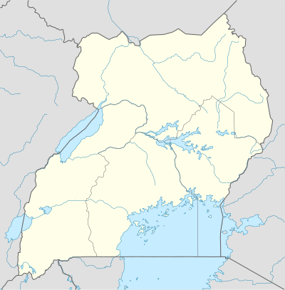 Paidha Map of Uganda showing the location of Paidha. | |
| Coordinates: 02°25′00″N 30°59′15″E | |
| Country | |
| Region | Northern Region of Uganda |
| Sub-region | West Nile sub-region |
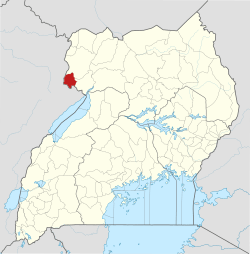
| District | Zombo District |
| Elevation | 1,500 m (4,900 ft) |
| Population (2014 Census) | |
| • Total | 33,426[1] |
| Time zone | UTC+3 (EAT) |
History
On 13 February 1965, Paidha and Goli were bombed by the Congolese Air Force in retaliation for the support of the Ugandan government for Simba rebels. The attack caused minimal damage.[3]
Location
Paidha is in Zombo District, West Nile sub-region. The town is near the border with the Democratic Republic of the Congo. It is approximately 95 kilometres (59 mi), by road, south of Arua, the largest city in the sub-region.[4] This is approximately 447 kilometres (278 mi), by road, northwest of Kampala, Uganda's capital and largest city.[5] Zombo, the town where the district headquarters are located, is approximately 16 kilometres (9.9 mi), by road, northwest of Paidha.[6] The coordinates of Paidha are 2°25'00.0"N, 30°59'15.0"E (Latitude:2.416667; Longitude:30.987500).[7]
Overview
Paidha is a busy border town in northwest Uganda at its border with the DRC. In 2013, it was the second-busiest border crossing between Uganda and the DRC, based on the volume of informal exports and imports.[8] See table below:
| Rank | Border Town | Share of Exports | Share of Imports |
|---|---|---|---|
| 1 | Mpondwe | 71.0% | 50.8% |
| 2 | Paidha | 6.6% | 22.6% |
| 3 | Odramachaku | 7.3% | 7.9% |
| 4 | Vurra | 3.8% | 9.0% |
| 5 | Bunagana | 3.6% | 5.6% |
| 6 | Ntoroko | 5.5% | 1.7% |
| 7 | Others | 2.2% | 2.4% |
Population
The 2002 national census estimated the population of Paidha at 24,079 and in 2010 the Uganda Bureau of Statistics (UBOS), estimated the population of the town at 29,700. In 2011, UBOS estimated the mid-year population of Paidha at 30,500.[9] In 2014, the population census put the population of the town at 33,426.[1]
Points of interest
The following additional points of interest lie within the town limits or close to the edges of town: (1) The offices of Paidha Town Council (2) The international border between Uganda and the DRC is at Goli, about 7.5 kilometres (5 mi) southeast of Paidha.[10] (3) Paidha Primary Teachers College, a public teacher training college administered by the Ministry of Education and Sports (Uganda). (4) Nyagak Power Station, a 3.5 megawatt hydropower station operated by WENRECO, a subsidiary of Industrial Promotion Services[11] (4) Nyagak III Power Station, a 4.36 megawatt hydropower station under development by the Uganda Electricity Generation Company Limited.[12] (5) Paidha Health Centre III.[2]
References
- UBOS, . (27 August 2014). "The Population of The Regions of the Republic of Uganda And All Cities And Towns of More Than 15,000 Inhabitants". Citypopulation.de Quoting Uganda Bureau of Statistics (UBOS). Retrieved 26 February 2015.CS1 maint: numeric names: authors list (link)
- Okaba, Patrick (13 August 2016). "Zombo leaders ask government to build district hospital". Daily Monitor. Kampala. Retrieved 28 October 2016.
- Omara-Otunnu 1987, p. 71.
- Globeeed.com (28 October 2016). "Distance between Arua, Northern Region, Uganda and Paidha Town Council, Paidha, Northern Region, Uganda". Globefeed.com. Retrieved 28 October 2016.
- Gobefeed.com (28 October 2016). "Distance between Post Bus Uganda Limited Terminal, Kampala Road, Kampala, Central Region, Uganda and Paidha, Northern Region, Uganda". Globefeed.com. Retrieved 28 October 2016.
- Globefeed.com (28 October 2016). "Distance between Paidha, Northern Region, Uganda and Zombo, Northern Region, Uganda". Globefeed.com. Retrieved 28 October 2016.
- Google (19 July 2015). "Location of Paidha At Google Maps" (Map). Google Maps. Google. Retrieved 19 July 2015.
- "THE INFORMAL CROSS BORDER TRADE SURVEY REPORT 2013", Bank of Uganda and Uganda Bureau of Statistics, November 2014, accessed 19 July 2015
- UBOS, . (2011). "Estimated Population of Paidha In 2002, 2010 & 2011". Uganda Bureau of Statistics (UBOS). Archived from the original (PDF) on 11 April 2019. Retrieved 26 February 2015.CS1 maint: numeric names: authors list (link)
- Globefeed.com (28 October 2016). "Distance between Paidha Town Council, Paidha, Northern Region, Uganda and Goli, Northern Region, Uganda". Globefeed.com. Retrieved 28 October 2016.
- Kalyango, Ronald (6 February 2006). "Paidha power plant launched". New Vision. Kampala. Retrieved 28 October 2016.
- UEGCL (28 October 2016). "Uganda Electricity Generation Company: Nyagak III Small Hydro Power Plant (5.5MW)". Kampala: Uganda Electricity Generation Company Limited (UEGCL). Archived from the original on 7 November 2016. Retrieved 28 October 2016.
Works cited
- Omara-Otunnu, Amii (1987). Politics and the Military in Uganda, 1890–1985. London: Palgrave Macmillan. ISBN 978-1-349-18738-6.CS1 maint: ref=harv (link)
External links
Capital: Zombo | ||
| Counties and sub-counties |
|  |
| Towns and villages | ||
| Economy |
| |
| Education |
| |
| Security | ||
| Notable people | ||