Padfield
Padfield is a small village near Hadfield in High Peak, Derbyshire, England. The village is on the west side of the Peak District National Park, and the nearest town is Glossop, where many local amenities and services are based. It is in a conservation area.[1] The population as of the 2011 census was 2,796.[2]
| Padfield | |
|---|---|
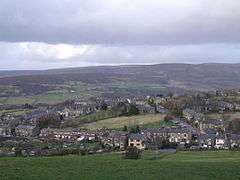 Padfield from above | |
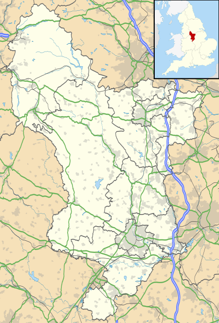 Padfield Location within Derbyshire | |
| Population | 2,796 (Ward. 2011) |
| OS grid reference | SK030961 |
| District | |
| Shire county | |
| Region | |
| Country | England |
| Sovereign state | United Kingdom |
| Post town | GLOSSOP |
| Postcode district | SK13 |
| Dialling code | 01457 |
| Police | Derbyshire |
| Fire | Derbyshire |
| Ambulance | North West |
| UK Parliament | |
Geography
Padfield is a small hamlet in a small side valley on the southern side of the River Etherow valley, which is known as Longdendale, in the High Peak district of Derbyshire, England. It is between 560 and 690 feet (170 and 210 m) above sea level.
History
Padfield was part of the Manor of Glossop, and at the time of the Domesday survey belonged to William the Conqueror.[3][4] King Henry I granted the land to William Peveril. In 1157, King Henry II gave it to the Abbey of Basenwick. In 1537, King Henry VIII gave it to the Earl of Shrewsbury, whence it came to the Howard family (Dukes of Norfolk). The Howards were responsible in the 1810s for the development of Glossop. In 1828, the Wesleyan Methodists built a chapel in Padfield, and the Independent Methodist built one too. By 1851 Padfield had 328 houses and 2,051 inhabitants.[4]
Transport
All the village is within 1,100 yards (1,000 m) of Hadfield railway station on the electrified line. All trains run through Dinting to Glossop and back through Dinting to Manchester Piccadilly. The railway, known as the Woodhead Line, used to run through to Penistone and Sheffield via the Woodhead Tunnel but passenger services were withdrawn in 1970. Goods trains ran until 1981, after which Hadfield became the terminus of the line. It is just off the B6105 road, which links with the A628 road, from Manchester to Barnsley and Sheffield, over the Woodhead pass. The B6105 starts in Glossop, on the A57, which links Manchester to Sheffield over the Snake Pass.
Padfield is within close proximity of the Greater Manchester county boundary, and some services are provided with this in mind. Though lying within Derbyshire, and technoically in the East Midlands, some of Padfield's transport facilities are managed by Transport for Greater Manchester, whilst Tameside and Glossop Acute Services, based in Tameside, Greater Manchester, is the NHS Trust that operates in the area.
Industry
Hadfield Mills on Platt Street is a former cotton mill, but the weaving sheds and other buildings are now used by a variety of small and medium enterprises.
Notable locals
- Happy Mondays frontman Shaun Ryder and Bez both lived in Padfield at one time.
References
| Wikimedia Commons has media related to Padfield. |
- Conservation Area Map Archived 2009-12-22 at the Wayback Machine
- "High Peak Council Ward population 2011". Neighbourhood Statistics. Office for National Statistics. Retrieved 29 March 2016.
- Domesday Book: A Complete Translation. London: Penguin, 2003. ISBN 0-14-143994-7
- Whites History, Gazetteer and Directory of the County of Derby, 1857. GENUKI Archived 2009-04-25 at the Wayback Machine