Otautau
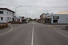
Otautau is a small farming, forestry and milling town located inland on the western edge of the Southland Plains of New Zealand on the banks of the Aparima River.[2] Otautau is located approximately 40 km north west of Invercargill.[3] The average elevation of Otautau is 60 meters.[4]
Otautau | |
|---|---|
 Otautau | |
| Coordinates: 46°08′34″S 167°59′59″E | |
| Country | |
| Region | Southland region |
| District | Southland District |
| Otautau | 1872 |
| Elevation | 60 m (200 ft) |
| Population (2013) | |
| • Total | 672 |
| Time zone | UTC+12:00 (NZST) |
| Postal code | 9610 (rural: 9682 9683 9689) [1] |
| Local iwi | Ngāi Tahu |
Otautau had a population of 672 at the 2013 New Zealand census, a decrease of 81 people since the 2006 census. There were 351 males and 318 females. Figures have been rounded and may not add up to totals.[5] 89.3% were European/Pākehā, 12.1% were Māori, 1.4% were Pacific peoples and 1.4% were Asian.[6]
Otautau is also known as “The Heart of Western Southland”.[7] Otautau Museum, based in the historic courthouse building in Main Street, focuses on the photographic and family history of the district, as well as the archives of local organisations.[8][9][10]
The New Zealand Ministry for Culture and Heritage gives a translation of "place of [an] ear pendant" for the name Ōtautau.[11]
Early history
There are some modern day claims made that Otautau was founded after the discovery of gold in Central Otago in 1861, to meet the needs of travelers on their way to the then newly discovered gold fields.[12] Yet others suggest that Otautau's early growth could be attributed to those traveling to Wakatipu, for similar reasons.[13] However, in an handbook printed for use by the newly arriving miners, no such route via Otautau exists for any goldfield, from Tuapeka to Wakatipu.[14]
Early records do hold vital clues that it was mainly agricultural needs and newly arrived settlers, which provided the bulk of early travel in the area, such as the diary entries quoted and early accounts of station life in Southland, re-printed in the series, 'The Conquerors – Saga of the Stations' found in the Southland Times, (the articles of which are collated into a book of the same name, held by Riverton Heritage Society, at Te Hikoi). In these, there is the idea that gold played some part in opening up land in the region, which it did, as miners later settled in the area, and invested their gains into many of the small towns and farming districts there, including Otautau,[15] (see also below, account of Robert Campbell). In early news reports of the day, Riverton did advertise as being the closest port to the gold diggings, but this did not last long, as once the railway from Bluff, first to Invercargill then to Winton was completed, this moved the main of the goldfield traffic to that route.[16] There are accounts of a few waggoners taking supplies both early on in the Wakatipu diggings and in later years, from Riverton, (a Mr. Cassels being one of them, and the partnership of Newsome, Rice and McIntosh,[17] another), via The Otautau area to The Lakes. However, many more accounts are given of waggoners taking supplies and gold to and from Invercargill to The Lakes.[18][19][20] The main of the traffic to and from the goldfields was through Dunedin and Port Chalmers, much different to what has been suggested or claimed in some modern accounts.[21]
The most accurate representation of the early Otautau area found to date, is from the book on Scotts Gap (just outside of Otautau, named after early run-holder, Matthew Scott): "Before the 1870s Otautau had very little settlement, being only an overnight camping stop for drovers and their wagons, quenching their thirst before fording the stream the next day to continue the journey inland."[22] What can be proven without doubt, is that Otautau Township was not surveyed until March 1872, by E. Tanner, the resulting map being drawn by W.J. Percival in 1874. Even in the 1867 map of Aparima Hundred, from which land Otautau was taken, there is a large blank space where Otautau would later be.[23] Giving further weight to the idea that the town may not have been founded in the 1860s as claimed, is the fact that the first general store in the township was not opened until 1876. This was owned by Robert Campbell, who was previously mining at Macetown.[24][25][26] In records held at Archives NZ, information shows that the first land sale in the township was not made until late 1872.
A very important factor in the growth of Otautau, came from the decision of the Wallace County Council, to move their office from Riverton to Otautau. This move was made official at the opening in March 1898 [27] and lasted nearly 100 years, until the amalgamation of county councils formed the new Southland District Council, in 1989.[28] Having the seat of administration for the County in Otautau meant many of its members moved there. The work created by and for the WCC (Wallace County Council), drew others to settle in the town with the promise of jobs. Between this and early agriculture which had originated with the Waste Land Leases in the area during the 1850s,[29] Otautau became the hub of farming and settlement for the whole Central Western Southland District. The railway having arrived in Dec 1879,[30] this added many advantages to both farmers and settlers.

Early businesses
One of the earliest businesses in town was the Otautau Hotel, (originally started in the old Accommodation House) which claims on its facade, to have been started in 1871.[31] However, it seems from land records and electoral rolls, to have only been owned by Thomas and Julianna Price from 1874. After a fire, the business moved to its still current site, on the Main Street in 1875.[32]
Other early businesses were blacksmiths, the earliest one on record is also that of Daniel Lynch's, built near to the above Otautau Hotel. This was advertised as being operational from Sept 1875.[33] Thomas Price himself built yet another Blacksmith's adjacent to his Otautau Hotel, advertised from July 1877.[34]
Otautau Standard and Wallace County Chronicle

Otautau was home to the Otautau Standard and Wallace County Chronicle from 1905 until publication ceased in 1946. The Otautau Standard was a weekly newspaper started by Frank Hyde. In 1906 Hyde sold the newspaper to John Fisher. The Fisher family remained in charge until its closure.[35]
Otautau war memorial

The Otautau war memorial is on Main Street, Otautau. It was opened by Prime Minister William Massey in 1922 and contains the names of local soldiers who died in World War I and World War II. Two canopied guns from Turkish and German forces are on either side of the memorial.[36]
Forestry
Soon after World War II the New Zealand Forest Service began operating from Otautau. The planting of alien species began in 1949 and grew rapidly from the middle of the 1960s as a direct result of seasonal labour.[12]
References
- "Suggest an Address".
- Google Maps – Otautau.
- Otautau – Town profile.
- "Mongabay – Population Profile (Otautau)".
- 2013 Census QuickStats about a place : Otautau
- 2013 Census QuickStats about a place (Cultural diversity) : Otautau
- Overview of Otautau.
- "Otautau Museum on NZ Museums". eHive. Retrieved 17 January 2020.
- "Otautau Museum". otautaumuseum.blogspot.com. Retrieved 17 January 2020.
- "Otautau Courthouse (Former) | Heritage New Zealand". www.heritage.org.nz. Retrieved 17 January 2020.
- "1000 Māori place names". New Zealand Ministry for Culture and Heritage. 6 August 2019.
- A Case Study of OTAUTAU (June 1998) November 25, 2010.
- Taonga, New Zealand Ministry for Culture and Heritage Te Manatu. "9. – Southland places – Te Ara Encyclopedia of New Zealand". teara.govt.nz. Retrieved 22 February 2020.
- "MANUAL OF THE OTAGO GOLD FIELDS, FOR THE USE OF NEW ARRIVALS". paperspast.natlib.govt.nz. Retrieved 23 February 2020.
- "PROVINCE OF SOUTHLAND". paperspast.natlib.govt.nz. Retrieved 23 February 2020.
- "SOUTHLAND AND THE DUNSTAN". paperspast.natlib.govt.nz. Retrieved 22 February 2020.
- "Obituary of Matthew Newsome". paperspast.natlib.govt.nz. Retrieved 23 February 2020.
- "INVERCARGILL. LATER NEWS FEOM THE WAKATIP". paperspast.natlib.govt.nz. Retrieved 22 February 2020.
- "Shortest and Most Direct Route to the Lake Diggings". paperspast.natlib.govt.nz. Retrieved 22 February 2020.
- "NEWS FROM THE SOUTH". paperspast.natlib.govt.nz. Retrieved 23 February 2020.
- Bye, Ken. (1988). Trial by fire, trial by water : history of Otautau. Otautau (N.Z.). Community Council. Otautau [N.Z.]: Published by the Centennial Book Committee on behalf of the Otautau Community Council. ISBN 0-473-00649-9. OCLC 35287268.
- Scotts Gap : a history of the people and the district, 1852–2000. Scotts Gap Book Committee. Otautau [N.Z.]: Scotts Gap Book Committee. 2002. ISBN 0-473-08406-6. OCLC 155863914.CS1 maint: others (link)
- "Crown Grant Map – Aparima Hundred". ndhadeliver.natlib.govt.nz. Retrieved 22 February 2020.
- "PERSONAL. Death of Robert Campbell". paperspast.natlib.govt.nz. Retrieved 22 February 2020.
- "Obituary Robert Campbell". paperspast.natlib.govt.nz. Retrieved 22 February 2020.
- "Obituary Mrs Robert Campbell". paperspast.natlib.govt.nz. Retrieved 22 February 2020.
- "Wallace County Council". paperspast.natlib.govt.nz. Retrieved 23 February 2020.
- "Wallace County Council | The Community Archive". thecommunityarchive.org.nz. Retrieved 23 February 2020.
- "Waste Lands Act 1854 (18 Victoriae 1854 No 6)". www.nzlii.org. Retrieved 23 February 2020.
- "OPENING OF THE OTAUTAU RAILWAY". paperspast.natlib.govt.nz. Retrieved 23 February 2020.
- "Pub Western Southland - Otautau Hotel".
- "DESTRUCTIVE FIRE". paperspast.natlib.govt.nz. Retrieved 22 February 2020.
- "Daniel Lynch: BLACKSMITH & WHEELWRIGHT". paperspast.natlib.govt.nz. Retrieved 22 February 2020.
- "NOTICE". paperspast.natlib.govt.nz. Retrieved 22 February 2020.
- New Zealand National Library (Past Papers).
- New Zealand History Online – Otautau war memorial.
- "You 'n' Lamb Festival at Otautau". The Southland Times. 9 November 2010. Retrieved 1 November 2011.
- Meat Trade News Daily Printed 21/11/2010.
External links
Further reading
- Bye, K. 1988. Trial By Fire, Trial By Water. History of Otautau. Otautau [N.Z.] : Published by the Centennial Book Committee on behalf of the Otautau Community Council, c1988. ISBN 0-473-00649-9 (hbk.)
- The Cyclopedia of New Zealand.