Ostrów Mazowiecka County
Ostrów Mazowiecka County (Polish: powiat ostrowski) is a unit of territorial administration and local government (powiat) in Masovian Voivodeship, east-central Poland. It came into being on January 1, 1999, as a result of the Polish local government reforms passed in 1998. Its administrative seat and largest town is Ostrów Mazowiecka, which lies 89 kilometres (55 mi) north-east of Warsaw. The only other town in the county is Brok, lying 12 km (7 mi) south of Ostrów Mazowiecka.
Ostrów Mazowiecka County Powiat ostrowski | |
|---|---|
_flag.svg.png) Flag  Coat of arms | |
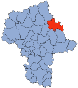 Location within the voivodeship | |
 Division into gminas | |
| Coordinates (Ostrów Mazowiecka): 52°48′N 21°54′E | |
| Country | |
| Voivodeship | Masovian |
| Seat | Ostrów Mazowiecka |
| Gminas | |
| Area | |
| • Total | 1,218.06 km2 (470.30 sq mi) |
| Population (2006) | |
| • Total | 75,073 |
| • Density | 62/km2 (160/sq mi) |
| • Urban | 24,419 |
| • Rural | 50,654 |
| Car plates | WOR |
| Website | http://www.powiatostrowmaz.pl |
The county covers an area of 1,218.06 square kilometres (470.3 sq mi). As of 2006 its total population is 75,073, out of which the population of Ostrów Mazowiecka is 22,560, that of Brok is 1,859, and the rural population is 50,654.
Neighbouring counties
Ostrów Mazowiecka County is bordered by Łomża County to the north, Zambrów County to the north-east, Wysokie Mazowieckie County to the east, Sokołów County and Węgrów County to the south, Wyszków County to the south-west, and Ostrołęka County to the north-west.
Administrative division
The county is subdivided into 11 gminas (one urban, one urban-rural and nine rural). These are listed in the following table, in descending order of population.
| Gmina | Type | Area (km²) |
Population (2006) |
Seat |
| Ostrów Mazowiecka | urban | 22.1 | 22,560 | |
| Gmina Ostrów Mazowiecka | rural | 283.7 | 12,654 | Ostrów Mazowiecka * |
| Gmina Małkinia Górna | rural | 134.1 | 12,224 | Małkinia Górna |
| Gmina Wąsewo | rural | 119.2 | 4,582 | Wąsewo |
| Gmina Andrzejewo | rural | 118.6 | 4,467 | Andrzejewo |
| Gmina Stary Lubotyń | rural | 109.2 | 3,984 | Stary Lubotyń |
| Gmina Zaręby Kościelne | rural | 88.9 | 3,844 | Zaręby Kościelne |
| Gmina Nur | rural | 102.9 | 3,191 | Nur |
| Gmina Boguty-Pianki | rural | 89.1 | 2,900 | Boguty-Pianki |
| Gmina Brok | urban-rural | 110.2 | 2,843 | Brok |
| Gmina Szulborze Wielkie | rural | 46.7 | 1,824 | Szulborze Wielkie |
| * seat not part of the gmina | ||||
References
| Seat |
| |
|---|---|---|
| Urban-rural gmina | ||
| Rural gminas | ||