Żuromin County
Żuromin County (Polish: powiat żuromiński) is a unit of territorial administration and local government (powiat) in Masovian Voivodeship, east-central Poland. It came into being on January 1, 1999, as a result of the Polish local government reforms passed in 1998. Its administrative seat and largest town is Żuromin, which lies 121 kilometres (75 mi) north-west of Warsaw. Other towns in the county are Bieżuń, lying 13 km (8 mi) south of Żuromin and Lubowidz, lying 9 km (6 mi) north-west of Żuromin.
Żuromin County Powiat żuromiński | |
|---|---|
 Flag  Coat of arms | |
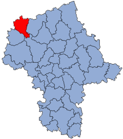 Location within the voivodeship | |
 Division into gminas | |
| Coordinates (Żuromin): 53°4′N 19°54′E | |
| Country | |
| Voivodeship | Masovian |
| Seat | Żuromin |
| Gminas | |
| Area | |
| • Total | 805.01 km2 (310.82 sq mi) |
| Population (2014) | |
| • Total | 39,885 |
| • Density | 50/km2 (130/sq mi) |
| • Urban | 10,898 |
| • Rural | 28,987 |
| Car plates | WZU |
| Website | http://www.zuromin-powiat.pl |
The county covers an area of 805.01 square kilometres (310.8 sq mi). As of 2016 its total population is 38,515, out of which the population of Żuromin is 8,987, that of Bieżuń is 1,910, and the rural population is 28,987.
Neighbouring counties
Żuromin County is bordered by Działdowo County to the north-east, Mława County to the east, Płońsk County to the south-east, Sierpc County to the south-west, and Rypin County and Brodnica County to the west.
Administrative division
The county is subdivided into six gminas (three urban-rural and three rural). These are listed in the following table, in descending order of population.
| Gmina | Type | Area (km²) |
Population (2016) |
Seat |
| Gmina Żuromin | urban-rural | 132.4 | 14,617 | Żuromin |
| Gmina Lubowidz | urban-rural | 190.8 | 7,026 | Lubowidz |
| Gmina Bieżuń | urban-rural | 122.0 | 5,168 | Bieżuń |
| Gmina Kuczbork-Osada | rural | 121.6 | 4,857 | Kuczbork-Osada |
| Gmina Lutocin | rural | 126.0 | 4,381 | Lutocin |
| Gmina Siemiątkowo | rural | 112.1 | 3,564 | Siemiątkowo |
References
Seat: Żuromin | ||
| Urban-rural gminas | | |
| Rural gminas | ||