Ontario Highway 418
King's Highway 418, or simply Highway 418, is a tolled freeway in the Canadian province of Ontario. The 400-series highway is 9.2 km (5.7 mi) long, travelling through the Regional Municipality of Durham to connect Highway 401 with the eastern extension of Highway 407. The freeway is located entirely within the Municiality of Clarington near Durham Regional Road 34 (Courtice Road).
| ||||
|---|---|---|---|---|
| East Durham Link | ||||

Highway 418 highlighted in red | ||||
| Route information | ||||
| Length | 9.2 km[1][2] (5.7 mi) | |||
| History | Proposed 1990s Opened on December 9, 2019[3] | |||
| Major junctions | ||||
| South end | ||||
| North end | ||||
| Highway system | ||||
| ||||

The route number was confirmed by the Ministry of Transportation of Ontario (MTO) alongside Highway 412 on February 6, 2015.[4] Prior to this, it was known as the East Durham Link.[5] Highway 418 opened on December 9, 2019 alongside the extension of Highway 407 to Highways 35 and 115.[3]
Route description
Highway 418 is a 9.2-kilometre (5.7 mi) four-lane tollway extending from Highway 401 to Highway 407E. The entire length of the route lies between Hancock Road and Rundle Road, east of Courtice. At the southern end, the route begins at a three-level stack interchange with Highway 401, from which it proceeds north. It then interchanges with former Highway 2.[6]
North of former Highway 2, the route swerves eastward and crosses Solina Road. Just before a partial interchange with Taunton Road, the highway again swerves slightly eastward to the former alignment of Rundle Road. Immediately north of Taunton Road, the route ends at a three-level stack interchange with Highway 407E, which is also a toll route thus no ETC cameras are present there.[6]
History

Highway 418 is the second of two freeways connecting the eastern extension of Highway 407 with Highway 401; the other is Highway 412, located to the west in Whitby. The two routes, known then as the East Durham Link and West Durham Link, first appeared as part of the June 2007 "Technically Recommended Route",[7] which was submitted as part of the environmental assessment (EA) for the extension, but had been announced earlier that year on March 7 by the Government of Canada as part of an investment in Greater Toronto Area infrastructure.[8] The EA report was released on August 17, 2009, and included detailed plans for the configuration of the interchanges along the new freeway. The report also sought approval for the 6 lanes anticipated to be required by 2031.[6]
On February 6, 2015, it was announced by the MTO that the East Durham Link would be designated Highway 418.[4] On March 23, 2015, a C$1.2 billion contract was awarded for the second phase of the Highway 407 east project, which included construction of Highway 418.[9] It was split into 2 phases, 2A and 2B. Phase 2A, which included the portion of the highway north of Taunton Road, was finished by December 2017 and opened on January 2, 2018.[10] The portion that opened would be temporarily signed as part of Highway 407.[11] The section of Highway 407 east of Enfield Road was temporarily closed on September 9, 2019 to reconfigure the ramps at the Taunton Road interchange in preparation for the opening of the remainder of the highway.[12] The highway fully opened on December 9, 2019.[3]
Tolling
Highway 418 uses the same electronic tolling system as Highways 407 and 412 and is part of the same provincially tolled section of highway as Highways 412 and 407 East.[13] The toll rate that applies to a specific trip is determined by the time at which a vehicle enters the highway and as of 2019 ranges from 19 to 30 ¢/km (31 to 48 ¢/mi) for vehicles that weigh less than 5 tonnes (light vehicles).[14] Heavy vehicles (those weighing more than 5 tonnes) are split into two categories: Heavy single units, which are tolled approximately two times the light vehicle rate, and heavy multi-units, which are tolled approximately three times the light vehicle rate.[15] People using the highway may use the 407 ETR transponders, which are used throughout Highways 407, 412, and 418,[13] and light vehicles must pay an additional video toll if they don't use a transponder.[14] Heavy vehicles are legally required to have a transponder and may be charged under the Highway Traffic Act if they do not.[16] There is also a flat toll, which is $1 during off-peak and $2 during peak periods for light vehicles.[16]
Exit list
The following are the exits listed in the 407 East Environmental Assessment Report. Lengths are approximated with Google Maps. The entire route lies within Clarington in the Regional Municipality of Durham.[1][6]
| Location | km | mi | Exit | Destinations | Notes |
|---|---|---|---|---|---|
| Clarington | 0.0 | 0.0 | — | Highway 401 exit 426 | |
| 2.8 | 1.7 | 3 | Partial cloverleaf interchange | ||
| 8.2 | 5.1 | 8 | Northbound exit and southbound entrance only[12] | ||
| 9.2 | 5.7 | — | Highway 407 exit 135 | ||
1.000 mi = 1.609 km; 1.000 km = 0.621 mi
| |||||
References
- Google (April 24, 2020). "Ontario Highway 418" (Map). Google Maps. Google. Retrieved April 24, 2020.
- "407 Extension". www.clarington.net. February 15, 2017. Archived from the original on March 25, 2020. Retrieved March 12, 2019.
- "Extension of Ontario Hwy. 407, New Hwy. 418 Open East of Toronto". On-Site. December 9, 2019. Retrieved December 11, 2019.
An eastern extension of Ontario Hwy. 407 and a new toll road to connect the lengthened highway to nearby Hwy. 401 opened Dec. 9 on the outskirts of Toronto.
- "New Highway Numbers". Highway 407 East. Archived from the original on April 19, 2015. Retrieved February 10, 2015.
- "Highway 407 Project Overview". Highway 407 East. Archived from the original on July 2, 2013. Retrieved August 3, 2016.
- "Exhibit 8.7" (PDF). 407 East Environmental Assessment Report (Report). Government of Ontario. August 17, 2009. Archived from the original (PDF) on September 29, 2011. Retrieved July 19, 2016.
- "Public Meetings". 407 East Environmental Assessment. Archived from the original on May 9, 2008. Retrieved March 25, 2020.
A technically recommended route was presented for...Two north-south links (highway / transitway) connecting Highway 401 to the proposed extension of Highway 407
- "Canada's New Government Announces Investment to Cut Commute Times, Clear the Air and Drive the Economy in the Greater Toronto Area". Office of the Prime Minister of Canada. March 6, 2007. Archived from the original on February 27, 2010. Retrieved August 11, 2016.
- "Contract Awarded for Final Phase of Highway 407 East Project". Infrastructure Ontario. March 23, 2015. Retrieved February 23, 2020.
- "Highway 407 Extension to Taunton Road Opening Tuesday". Durham Radio News. December 29, 2017. Retrieved February 23, 2020.
- "Official Ontario Road Map 3" (PDF). Ministry of Transportation of Ontario. 2019. Archived from the original (PDF) on February 27, 2020. Retrieved February 27, 2020.
- "Taunton Road Closure". 407 East Phase 2. Blackbird Infrastructure Group. Retrieved November 25, 2019.
- "Highway 407 Tolls Explained". Highway 407. Retrieved February 24, 2020.
- "Light Vehicle Rate Chart". Highway 407. Retrieved February 24, 2020.
- "Major Highway Projects: Toll Rates". Ministry of Transportation of Ontario. July 7, 2016. Archived from the original on August 9, 2019. Retrieved July 16, 2016.
- "Complete Fee Details". Highway 407. Retrieved April 1, 2020.
External links
- Provincial Project website for Highways 407, 412 & 418
- Blackbird Infrastructure website for Project Phase 2, including Highway 418
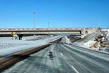
- Highways 401, 407, and 418
| |||||||||||
| |||||||||||
| |||||||||||
| |||||||||||

