Nurney, County Kildare
Nurney (Irish: An Urnaí, meaning "Oratory/prayer house/chapel") is a village in County Kildare, Ireland, on the Tully Stream.
Nurney An Urnaí | |
|---|---|
Town | |
 Nurney, County Kildare | |
 Nurney Location in Ireland | |
| Coordinates: 53°05′42″N 6°56′52″W | |
| Country | Ireland |
| Province | Leinster |
| County | County Kildare |
| Elevation | 71 m (233 ft) |
| Population (2016)[1] | 456 |
| Time zone | UTC+0 (WET) |
| • Summer (DST) | UTC-1 (IST (WEST)) |
| Irish Grid Reference | N704056 |
Location
Nurney lies on the R415 regional road 8 km south of Kildare and is signposted from the M7 motorway at junction 13.
Transport
South Kildare Community Transport's Newbridge-Kildare-Athy bus route serves Nurney on Mondays to Fridays with two services each way a day. The bus also serves Kildare railway station, the nearest station to Nurney, enabling journeys to/from many parts of Ireland.[2]
Amenities
The village has a church, a pub, a school, a shop and two graveyards. A petrol station opened in the village in recent times.
Skerries Irish Figure Dancing Class has been teaching Irish Figure dancing for over 40 years and classes are held weekly in the local GAA hall.
Demographics
In 2006, Nurney's population was recorded at 354, an increase of 48% from 2002 owing to an influx of settlers from Dublin, which lies approximately 60 km away. By the time of the 2016 census, the population had increased to 456 people.[1]
Sport
- Nurney GAA is the local Gaelic Athletic Association club.
References
- http://www.cso.ie/census/documents/census2006_Table_7_and_12.pdf
- http://www.irelands-directory.com/Carlow/Nurney/Entertainment/Pubs.html
- "Sapmap Area - Settlements - Nurney". Census 2016. CSO. April 2016. Retrieved 23 October 2019.
- "Archived copy" (PDF). Archived from the original (PDF) on 2014-05-18. Retrieved 2014-05-17.CS1 maint: archived copy as title (link)
Places in County Kildare | ||
|---|---|---|
| Towns | 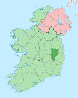 | |
| Villages and Townlands |
| |
| Landforms | ||
| Topics |
| |