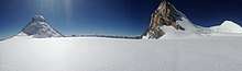
Nun Kun
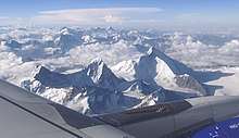
The Nun Kun mountain massif consists of a pair of Himalayan peaks: Nun, 7,135 m (23,409 ft) and its neighbor peak Kun Peak, 7,077 m (23,218 ft).[3] Nun is one of the highest peaks in the part of the Himalayan range lying on the Indian side of the Line of Control in Ladakh. The massif is located near the Suru valley, Kargil district about 250 km (160 mi) east of Srinagar, the capital of neighbouring Jammu and Kashmir. The Nun Kun massif is bounded to the north by the Suru valley and the Zanskar range. To the east, it is flanked by the Suru valley and the Pensila(4400m), a pass which separates Suru from the Zanskar Valley. To the South lies the Kishtwar National Park and the Krash Nai river. While to the southwest and to the south lie a maze of glaciers, peaks and rivers giving access to Kashmir, Kishtwar and Doda regions of the union territory of Jammu and Kashmir. The rocks predominantly are stratified sedimentary rocks composed of shale and sandstone. Metamorphic rocks and granite formations are also seen at places. The area is rich in minerals especially garnets.[4]
| Nun | |
|---|---|
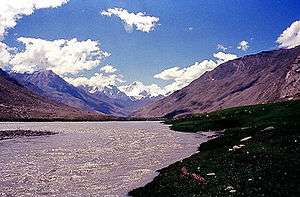 Nun and Kun in the distance | |
| Highest point | |
| Elevation | 7,135 m (23,409 ft) [1] |
| Prominence | 2,404 m (7,887 ft) [1] |
| Listing | Ultra List of Indian states and territories by highest point |
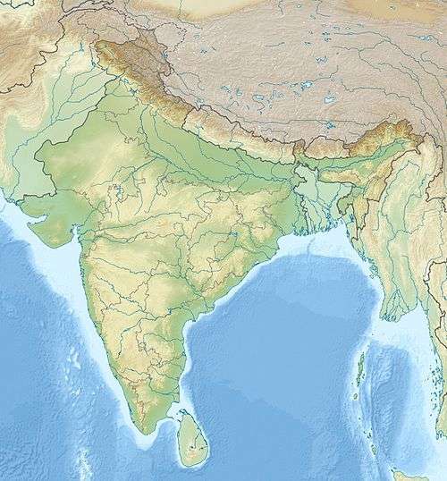
| Coordinates | 33°58′48″N 76°01′18″E [1] |
| Geography | |
| Parent range | Himalaya |
| Climbing | |
| First ascent | 1953 by Pierre Vittoz, Claude Kogan |
| Easiest route | West Ridge: glacier/snow/ice climb |

Kun Peak is located north of Nun and is separated from it by a snowy plateau of about 4 km (2.5 mi) in length. Pinnacle Peak, 6,930 m (22,736 ft), is the third highest summit of the group.
Mountaineering
Early exploration of the massif included a visit in 1898 and three visits by Arthur Neve, in 1902, 1904, and 1910. In 1903, Dutch mountaineer Dr. H. Sillem investigated the massif and discovered the high plateau between the peaks; he reached an altitude of 6,400 m (21,000 ft) on Nun. In 1906, noted explorer couple Fanny Bullock Workman and her husband William Hunter Workman, claimed an ascent of Pinnacle Peak. They also toured extensively through the massif and produced a map; however, controversy surrounded the Workmans' claims, and few trigonometrical points were given for the region, so that the map they produced was not usable.[5]
After unsuccessful attempts to climb the mountain in 1934, 1937, and 1946 the first ascent of Nun was in 1953 by a French-Swiss-Indian-Sherpa team led by Bernard Pierre and Pierre Vittoz, via the west ridge. The summit pair comprised Vittoz, a Moravian missionary to the Tibetans and an experienced alpinist, and Claude Kogan, a pioneering female mountaineer.[6] Since then, other routes have been pioneered.[5][7] The north-west face was first ascended on 27 October. and 28., 1976 by seven climbers from a Czech expedition, led by F. Čejka.[8] The first British ascent was made by Steve Berry and friends via the east ridge in 1981 (his father had attempted Nun in 1946).
Italian mountaineer Mario Piacenza made the first ascent of Kun in 1913, via the north-east ridge. Fifty-eight years passed before the second recorded attempt on the peak, which resulted in a successful ascent by an expedition from the Indian Army. [5]
A comprehensive geographic and topographical description along with a history of climbing Mt Nun can be found in the 2018 issue of the Himalayan Journal.[4]
The massif is most conveniently accessed from the road connecting Kargil and Leh. The roadhead from the West is Tangol, approximately a 2 hr drive from Kargil. The route goes through the villages of Sankoo and Panikhar.
The mountain has the North ridge, the longest that splits into North West and North East ridge at around 500m below the summit. the Northwest Ridge splits the Kangriz Glacier into West and East. The South ridge drops from the mountain after 500m giving way to the formidable South wall. The West ridge, is more direct and accessible by climbing the snow wall on the West face. This is reached by traversing the snow field of the Kangriz glacier after climbing the ice wall of the Kangriz Glacier West reached from the base camp (4600m) typically established in the upper Sentik Valley.[4]
References
- "High Asia I: The Karakoram, Pakistan Himalaya and India Himalaya (north of Nepal)". Peaklist.org. Retrieved 28 May 2014.
- This region is disputed and controlled by India; the whole region is claimed by Pakistan. See e.g. The Future of Kashmir on the BBC website.
- Figures for Kun's elevation vary between 7,035 m and 7,086 m.
- Abbey, Brigadier Ashok (2018). "Nun- Mountain King of the Suru Valley". The Himalayan Journal. 73: 88–99.
- High Asia: An Illustrated History of the 7000 Metre Peaks by Jill Neate, ISBN 0-89886-238-8
- Pierre Vittoz, Ascent of the Nun, in The Mountain World: 1954 (Marcel Kurz, ed.), George Allen & Unwin, Ltd., London, 1954.
- Andy Fanshawe and Stephen Venables, Himalaya Alpine Style, Hodder and Stoughton, 1995
- Petr Rybář, Čelenka Matky Země, Hradec Králové: 1980
External links
- Suru and Zanskar valley
- Topography of Nun Kun ex Geographical Journal 1920