Notre-Dame-de-la-Merci
Notre-Dame-de-la-Merci is a municipality in the Lanaudière region of Quebec, Canada, part of the Matawinie Regional County Municipality.
Notre-Dame-de-la-Merci | |
|---|---|
Municipality | |
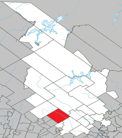 Location within Matawinie RCM. | |
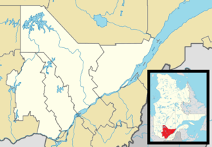 Notre-Dame-de-la-Merci Location in central Quebec. | |
| Coordinates: 46°14′N 74°03′W[1] | |
| Country | |
| Province | |
| Region | Lanaudière |
| RCM | Matawinie |
| Constituted | January 1, 1950 |
| Government | |
| • Mayor | Julien Alarie |
| • Federal riding | Joliette |
| • Prov. riding | Bertrand |
| Area | |
| • Total | 262.40 km2 (101.31 sq mi) |
| • Land | 250.48 km2 (96.71 sq mi) |
| Population (2011)[3] | |
| • Total | 978 |
| • Density | 3.9/km2 (10/sq mi) |
| • Pop 2006-2011 | |
| • Dwellings | 1,159 |
| Time zone | UTC−5 (EST) |
| • Summer (DST) | UTC−4 (EDT) |
| Postal code(s) | J0T 2A0 |
| Area code(s) | 819 |
| Highways | |
| Website | www.municipalite notredamedelamerci.com |
Demographics
Population
| Historical Census Data - Notre-Dame-de-la-Merci, Quebec[4] | ||||||||||||||||||||||||||
|---|---|---|---|---|---|---|---|---|---|---|---|---|---|---|---|---|---|---|---|---|---|---|---|---|---|---|
|
|
| ||||||||||||||||||||||||
Private dwellings occupied by usual residents: 490 (total dwellings: 1159)
Language
Mother tongue:[5]
- English as first language: 3.3%
- French as first language: 93.8%
- English and French as first language: 0%
- Other as first language: 2.9%
Education
Commission scolaire des Samares operates Francophone public schools:
- Notre-Dame-de-la-Merci — Saint-Émile (pavillon Notre-Dame-de-la-Merci)[6]
Sir Wilfrid Laurier School Board operates Anglophone public schools:
- Rawdon Elementary School in Rawdon[7]
- Joliette High School in Joliette[8]
See also
References
- Reference number 44844 of the Commission de toponymie du Québec (in French)
- Geographic code 62055 in the official Répertoire des municipalités (in French)
- Statistics Canada 2011 Census - Notre-Dame-de-la-Merci census profile
- Statistics Canada: 1996, 2001, 2006, 2011 census
- Statistics Canada 2006 Census - Notre-Dame-de-la-Merci community profile
- "Notre-Dame-de-la-Merci — Saint-Émile (pavillon Notre-Dame-de-la-Merci) Archived 2017-09-23 at the Wayback Machine." Commission scolaire des Samares. Retrieved on September 23, 2017.
- "Rawdon Elementary" Zone Map. Sir Wilfrid Laurier School Board. Retrieved on September 17, 2017.
- "Joliette High School Zone Sec 1-5." Sir Wilfrid Laurier School Board. Retrieved on September 5, 2017.
Adjacent Municipal Subdivisions | ||||||||||
|---|---|---|---|---|---|---|---|---|---|---|
| ||||||||||
| Municipalities |
|
|---|---|
| Parishes | |
| Unorganized Territories | |
| |
| Authority control |
|
|---|
This article is issued from Wikipedia. The text is licensed under Creative Commons - Attribution - Sharealike. Additional terms may apply for the media files.